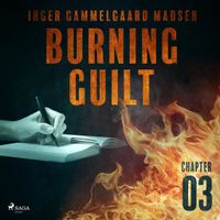
Burning Guilt - Chapter 3

0
Anne Larsen, journalist with TV2 East Jutland, is covering the case of the officer from Silkeborg who was seemingly hit and killed by a colleague in front of his home......

Verkopers met dit product

Verkoper
Bezorging
Prijs

Anderen bekeken ook

Vogelgids Centraal Azie - Birds of Central Asia | Bloomsbury
Birds of Central Asia is the first field guide to include the former Soviet republics of Kazakhstan, Kyrgyzstan, Turkmenistan, Uzbekistan and Tajikistan, along with neighbouring Afghanistan. This vast area includes a diverse variety of habitats, and the avifauna is similarly broad, from sandgrouse, ground jays and larks on the vast steppe and semi-desert to a broad range of raptors, and from woodland species such as warblers and nuthatches to a suite of montane species, such as snowcocks, accentors and snowfinches. Birds of Central Asia includes 141 high-quality plates covering every species (and all distinctive races) that occur in the region, along with concise text focusing on identification and accurate colour maps. Important introductory sections introduce the land and its birds. Birds of Central Asia is a must-read for any birder or traveller visting this remote region.   "For a long time, there's been something of a gap in field-guide coverage across the Palearctic. Europe is w…
50,95
Wegenkaart - landkaart 3 Road Map Britain South East England | AA Publishing
Goede wegenkaart van zuid oost Engeland. Grof geschetst is het een rechthoek tussen Ipswich, Dover, Southampton en Oxford. Britain’s clearest mapping from the experts at the AA, in a handy foldable map. Fully updated, this map of South East England combines clear design and an easy-to-read scale with more road detail to ensure that you never lose your way. The map includes information on toll points, service areas, road numbers, motorways, dual carriageways and wide and narrow local roads. National Parks, and places of interest are also highlighted. Caravan and camping sites pinpointed on the mapping. City and town plans Easy-to-read place index name. Part of a range of 9 regional sheet maps plus 1 map covering the whole of Britain. Map Series - 1 West Country & Wales. 2 Central Southern England. 3 South East England. 4 East Anglia. 5 Midlands & Central England. 6 Wales. 7 Northern England. 8 North England & Scottish Borders. 9 Scotland. 10 Britain.  
10,95
Wegenkaart - landkaart 3 India - Oost | Nelles Verlag
Goede kaart van een deel van India. Aan beide kanten bedrukt. Met veel toeristische aanduidingen als nationale parken en culturele bezienswaardigheden. Prima leesbare kaart. Detailkaart: Kolkata (Calcutta) en Varanasi One of five maps in a series covering India at 1:1 500 000 scale. Folded road and tourist map of eastern India, including Nepal and southern Tibet to the north, Calcutta to the east, Visakhapatnam to the south, and Kanpur and Jabalpur on the western edge of map. Points of interest, national parks and railways are all highlighted and shaded-relief colouring clearly depicts the topography.    The map includes insets showing regional Kolkata (Calcutta) at 1:300 000 and a locator map. The legend is in English, French and German. The other titles in the series are India North, India North East, India South, and India West. Nelles also produces a map of the whole Indian Subcontinent at a scale of 1:4 500 000.   For over 20 years Nelles maps have been renowned throughout the wo…
11,95
Fietsgids Bikeline Iron Curtain Trail 3 - German-German Border Trail | Esterbauer
Praktische fietsgids met detailkaarten, ingetekende route, informatie over overnachten en fietsenmakers, zwaarte en hoogteprofiel. In spiraalbinding, Engelstalig   The Iron Curtain ran for about 7,000 km from the Barents Sea in the north straight through Europe to the Black Sea and divided the continent in East and West. Until the Velvet Revolution in Eastern Europe it was a physical and ideological border between two blocks which conceived each other as enemies. Not only were many neighbouring states divided, but Germany itself was divided into east and west. Today there are hardly any reminders that the wall ever existed.   The border in Germany was 1,400 km long. The former death strip was composed of 3.000 km of fences, car-trenches for 730 km, 830 observation towers, the brightly lit roads, walls and bunkers – most of it is gone. Remaining are the vehicle roads with their perforated paving stones and several observation towers. And in a few years the sparse vegetation will be sup…
17,95

Klanten-reviews van Burning Guilt - Chapter 3

Er zijn nog geen beoordelingen voor dit productBen jij de eerste die een review plaatst?

Meer over Burning Guilt - Chapter 3

Productomschrijving

Anne Larsen, journalist with TV2 East Jutland, is covering the case of the officer from Silkeborg who was seemingly hit and killed by a colleague in front of his home...

Productspecificaties

Artikelnummer(s)
EAN
9788726625479
Webshop.nl maakt gebruik van cookies. Ga je verder op onze website, ga dan akkoord met het plaatsen van cookies en de verwerking van deze data door ons en vermelde partners.