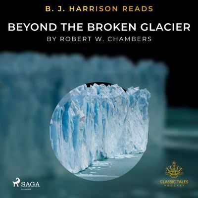
B.J. Harrison Reads Beyond the Broken Glacier

0
We all have heard about the great glaciers. Some may have even seen them......

Verkopers met dit product

Verkoper
Bezorging
Prijs

Anderen bekeken ook

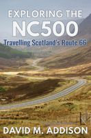
Reisgids Exploring the Nc500 | Extremis Publishing Limited
Travelling anti-clockwise, David M. Addison seeks his kicks on Scotland's equivalent of Route 66. Otherwise known as NC500, the route takes you through five hundred miles of some of Scotland's most spectacular scenery. No wonder it has been voted as one of the world's five most scenic road journeys. There are many mays of exploring the NC500. You can drive it, cycle it, motorbike it or even walk it, even if you are not one of The Proclaimers! And there are as many activities, places of interest and sights to be seen along the way as there are miles. This is a personal account of the author's exploration of the NC500 as well as some detours from it, such as to the Black Isle, Strathpeffer and Dingwall. Whatever your reason or reasons for exploring the NC500 may be, you should read this book before you go, or take it with you as a vade mecum. It will enhance your appreciation of the NC500 as you learn about the history behind the turbulent past of the many castles; hear folk tales, myth…
18,50
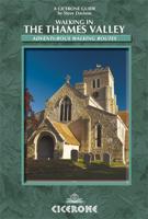
Wandelgids Walking in the Thames Valley | Cicerone
Walking in the Thames Valley offers 25 challenging circular walks around the River Thames and River Kennet in the south of England, taking in the Southern Chilterns, the Berkshire and North Hampshire Downs, Southern Oxfordshire and the eastern edge of Wiltshire. All routes are within easy reach of Reading, Newbury, Abingdon and London. While some walks visit Iron Age hill forts, others pass more modern features such as Wilton Windmill and the Kennet and Avon Canal. Some follow sections of the Ridgeway, while others meander along the banks of the Thames. What they all have in common is that they take the keen rambler to some of the best parts of the Thames Valley – a patchwork of open chalk grassland, broadleaved woodland and farmland and home to two Areas of Outstanding Natural Beauty. • walks from 10 to 18 miles, including one 2-day route • shorter, less strenuous alternatives for many of the walks • detailed route descriptions with information on local points of interest, OS mapping…
18,50
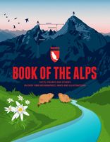
Reisinspiratieboek - Reisboek Book of the Alps | Marmota Maps
The Book of the Alps  the great illustrated book about the Alps.290 pages with over 1000 illustrations, graphics, and maps on geography, sports, history, culture, climate, environment and much more. Understand the Alps like never before.Created in cooperation with the Alpine clubs of Germany, Austria, and South Tyrol. CONTENTS The Book of the Alps has 46 chapters in seven subject areas: Geography   Flora and Fauna   Climate and Environment    Alpinism   Mountain Sports   Society and Economy   Arts and Culture   GEOGRAPHY Geological Formation Ice Age Mountains Valleys Mountain Passes Lakes and Rivers Glaciers The Alps are unique. How did they form and evolve? How do glaciers, passes, valleys, lakes, and rivers shape the landscape? Answers to these and many more questions can be found in the geography chapter.   FLORA AND FAUNA Biodiversity Plants Forests Animals National Parks The Alpine environment is fascinating. Alpine flowers such as the edelweiss and Alpine anima…
44,95
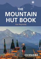
Wandelgids - Reisgids The Mountain Hut Book | Cicerone
This book is a celebration of mountain huts, showcasing the the sheer variety and sometimes quirky nature of these buildings that allow walkers, trekkers and climbers to access remote corners of the mountains. Packed with entertaining stories that bring the places and people to life, it contains descriptions of the author's favourite huts in the Alps, along with suggestions for hut-to-hut tours of 3-13 days duration, including the Tour of Mont Blanc. It also traces the history of huts and how they have evolved from the most primitive of shelters to the often purpose-built, eco-friendly buildings of today. For the uninitiated, it unravels some of the mystery of huts and explains how to use them and what facilities to expect. Above all, it illustrates the way in which mountain huts can be truly sociable places, where like-minded people can spend a night or two in the most magical of locations and share a love of wild places. Reviews: [This book is] practical, interesting, and deserves a…
20,95
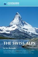
Wandelgids The Swiss Alps | Cicerone
  The Swiss Alps are home to the highest and most spectacular mountains in Western Europe. This stunning guidebook describes each mountain area throughout Switzerland – the peaks, passes, valleys and bases – to help you identify the best destinations to plan your trip.   Questions such as ‘Where to walk, climb or ski?’, ‘What multi-day treks are available’ and ‘Where do they go?’, ‘Where are the mountain huts, what are their facilities, which peaks do they serve?’ And where are the most suitable valley bases?’ – all these and more are addressed in detail in this essential guidebook.   The Swiss Alps does not give detailed route directions but information is given about all the guides and maps available for every region.   The Swiss Alps by Kev Reynolds is the third book in Cicerone’s World Mountain Ranges series, which include The Pyrenees and Scotland.   descriptions of all the Swiss Alps, area-by-area from the Chablais Alps in the south west to the Silvretta in the north east classi…
34,95
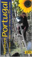
Wandelgids North Portugal - Noord Portugal | Sunflower books
Wandelgids: vele dagtochten worden degelijk beschreven met openbaar vervoer informatie, goede routebeschrijvingen en kaartmateriaal. Tevens enkele autotochten. (Engelstalig) 3 car tours, 30 long and short walks If you explore with us, we can set your feet wandering over the hills into breathtaking scenic beauty. History still lives here, too, written millennia ago in the permanence of granite. Our walks follow some of the delightful old trails, built from huge granite slabs, which lead high into the mountains. You can only marvel at the effort and energy invested in their building, and wonder about the people who once lived in these mountains. Many people in the Minho still live in isolated villages only recently connected to the modern road system, and some are still only accessible by foot; these villages are a delight to visit. It is like going back in time. The villagers vigorously pursue farming techniques developed four centuries ago and still largely unchanged. Long-horned oxen…
20,95
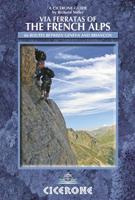
Wandelgids - Klimgids - Klettersteiggids Via Ferratas of the French Alps | Cicerone
This guidebook covers 66 varied via ferratas in the French Alps. The routes are spread over six areas: Geneva and the Northern Alps, Chambéry, Tarentaise and Maurienne valleys, Grenoble and Briançon, amid the Mont Blanc, Vanoise and Queyras ranges. Difficulty ranges from easy, protected routes through to exposed, technical challenges. With some of the most beautiful scenery in the world, the French Alps have long been a popular destination for a wide range of outdoor activities. In recent years, the region has seen the arrival of a growing number of via ferrata routes.   Via ferrata climbing – using fixed cables, bridges and ladders to explore terrain that is normally only accessible to experienced rock climbers – combines elements of scrambling, mountaineering and rock climbing, yet is a very distinct pursuit. Increasingly popular, recent years have seen a surge in the number of routes being established in these iconic mountains.   The routes in this guidebook range from straightforw…
25,95
Fietskaart 10 Cycling guides North York Moors | Goldeneye
Scheur- en watervast foetskaart van de North York Moors  met ingetekende fietsroutes.   Our maps are double-sided, printed on an A2 sheet with a concertina fold. This allows for easy folding and folding, and an ease of access to the mapping. The material is rain and tear-resistant. Our early maps were designed at the scale of 2 miles to 1 inch/1:126,720. The later designs along with digitalisation are 1: 100,000. We were encouraged by the Cycle Touring Club to convert our cartography toward the cycle market (to replace the out-of-print Bartholomew series). As time and the series progressed we have added more data: The National Cycle Network routes, Regional Routes, and Traffic-Free Family Routes, as and when they are developed. These routes are in addition to the Circular Routes Goldeneye Commissioned at the outset of our publishing schedule. We are also adding to new editions; bike shops, cycle hire, and tea rooms, along with the tourist attractions already featured. Our plan is to m…
14,95

Klanten-reviews van B.J. Harrison Reads Beyond the Broken Glacier

Er zijn nog geen beoordelingen voor dit productBen jij de eerste die een review plaatst?

Meer over B.J. Harrison Reads Beyond the Broken Glacier

Productomschrijving

We all have heard about the great glaciers. Some may have even seen them...

Productspecificaties

Artikelnummer(s)
EAN
9788726575415
Webshop.nl maakt gebruik van cookies. Ga je verder op onze website, ga dan akkoord met het plaatsen van cookies en de verwerking van deze data door ons en vermelde partners.