webshop.nl

Atlas The Times Mini Atlas of the World | Collins

0
De kleinste uitvoering van de beste atlas ter wereld! Ook deze mini uitvoering is mooi van kleur en uiterlijk: een leuke kado voor een schappelijke prijs. A pocket-sized Times Atlas of the World packed with the essentials. Fully revised and improved to take account of all recent changes from around the world. Complete map coverage of the world is ...

Webshops met dit product

Webshop
Bezorging
Prijs
DeZwerver.nl logo
DeZwerver.nl
niet bekend
13,95

Anderen bekeken ook

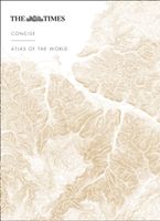
Atlas The Times Concise Atlas of the World | Collins
Het kleinere zusje van de grotere comprehensive atlas, maar nog steeds een imposante dikke verschijning! Gedetailleerde en prachtig uitgevoerde kaarten presenteren de perfecte combinatie van traditie, kennis en stijl. De kaarten zijn ontworpen in de bekroonde Times stijl, hierdoor is er een atlas geproduceerd in een hoogstaande, heldere kwaliteit. Prachtige satelietfoto's gecombineerd met foto's en grafieken geven een helder beeld van de hedendaagse wereld. De atlas is gevat in een elegante slipcase. A fully revised and updated fourteenth edition of this major world atlas in the authoritative and prestigious Times Atlas range. This beautifully designed atlas has all the information you need, whether planning a trip, keeping in touch with world news, solving quizzes and crosswords or just exploring the world from your armchair. Comprehensive reference mapping with 155,000 place names providing an amazingly detailed view of the world, and the illustrated thematic content covers the mos…
89,95
Atlas The Times Comprehensive Atlas of the World | Collins
De moeder aller atlassen in een nieuwe druk. Als je al een atlas wilt kopen, bezuinig dan niet en doe deze: veruit de beste meest complete atlas in een prachtige uitvoering met beschermdoos.   Now in its 16th edition, the world's most authoritative atlas has been extensively updated.   Detailing our world as it is today, it includes more than 200,000 place names. At 45 cm high, this impressive world atlas will become a treasured possession.   In addition to 263 pages of continuous mapping, there are a further 223 pages of extensive indexing, alongside a preliminary section containing essays from trusted academics who discuss topics ranging from global population, to climate change, and the composition of our solar system, to the water in our oceans.   It is a benchmark of cartographic excellence, trusted by governments, media and international organisations, as well as households around the world.   Updates include: New country names for Eswatini (formerly Swaziland) and North Macedon…
226,50
Atlas The Phantom Atlas | Simon & Schuster
Een fascinerend boekwerk met de grootste mythes, leugens en blunders die ooit op kaart zijn verschenen. In een luxe hardcover uitgave met mooie stofomslag. The Phantom Atlas is an atlas of the world not as it ever existed, but as it was thought to be. These marvellous and mysterious phantoms - non-existent islands, invented mountain ranges, mythical civilisations and other fictitious geography - were all at various times presented as facts on maps and atlases. This book is a collection of striking antique maps that display the most erroneous cartography, with each illustration accompanied by the story behind it. Exploration, map-making and mythology are all brought together to create a colourful tapestry of monsters, heroes and volcanoes; swindlers, mirages and murderers. Sometimes the stories are almost impossible to believe, and remarkably, some of the errors were still on display in maps published in the 21st century. Throughout much of the 19th century more than 40 different mapma…
34,95
Atlas Atlas of Forgotten Places | White Lion Publishing
Explore the places that time forgot. Abandoned, mysterious, sleeping monuments around the world have been relegated to the margins of history, pushed off the map and out of sight. From ancient ruins and crumbling castles to more recent relics – an art deco New York subway station, a Soviet ghost town in the Arctic Circle, a flooded Thai mall teeming with aquatic life – Travis Elborough takes you on a journey into these strange, overlooked and disappearing worlds and immortalises their fates. Original maps and stunning colour photography accompany Travis Elborough’s moving historic and geographic accounts of each site. The featured locations are a stark reminder of what was, and the accounts in this investigative book help to bring their stories back to life, telling us what happened, when and why, and to whom. The book features 40 sites, including: Santa Claus, Arizona, USA: A festive tourist resort turned ghost town deep in the desert where once you could meet Santa Claus any day…
21,95
Natuurgids Mammals of Ethiopia, Eritrea, Djibouti and Somalia | Meru Publishing
This long awaited Field Guide to the Larger Mammals of the Horn of Africa depicts some of the world's rarest mammals. All of the larger mammals of Ethiopia, Eritrea, Djibouti and Somalia are described together with identification notes. In full colour, all of the endemic species, and distinctive sub-species, are covered by up to two pages of text with a distribution map and four images, showing the main characters of the mammal and its habitat. Almost all of the other species each occupy a full page with two images and a distribution map. Each species carries details of its distribution, IUCN status, typical localities, local or alternative name, size, description, habitat, similar species and behaviour. The descriptions of the specialties and endemic mammals, including many endangered and little known species, carry additional information including history, threats, status, future outlook and more behavioural details. Experts around the world, who are specialists in their field, have…
24,95
Vogelgids Birds of the Indonesian Archipelago - Indonesië | Lynx
Prachtige vogelgids met harde kaft. The first ornithological field guide covering the vast chain of the Indonesian archipelago has been completely revised following years of meticulous research. This second edition now encompasses over 2,800 illustrations, including 325 entirely new figures and nearly 500 alterations to the original artwork, supplemented by 1,350 maps of all regularly occurring species. The species are mapped with improved accuracy by including three magnified geographical regions, or by a larger archipelago-wide map frame. The book describes all 1,456 bird species known to occur in the region, including 628 endemics, 106 vagrants, 4 introduced species and 10 species yet to be formally described. Together these represent over 13% of global bird diversity. Importantly, all subspecies are described in detail. The guide fully covers the biogeographic regions of the Greater Sundas (Sumatra, Borneo, Java and Bali) and Wallacea (Sulawesi, the Moluccas and the Lesser Sundas)…
45,-
Wegenatlas Japan Traveler's Atlas | Tuttle Publishing
Finding your way around the various regions of Japan is a breeze with this handy Tuttle Japan Traveler's Atlas. Designed for the adventurous traveler and containing all the maps you'll need on your explorations, this atlas includes many views that are not available anywhere else.   The atlas is conveniently divided into the major regions of Japan: Tokyo Mt. Fuji & Around Tokyo Central Honshu Kyoto Kansai Hiroshima & Western Honshu Northern Honshu Hokkaido Shikoku Kyushu Okinawa & the Southwest Islands   Each of the 148 maps in this atlas is presented in a logical, easy-to-follow manner, with emphasis on the most frequently-visited areas. All cities, towns, villages, places of interest including nature reserves are indexed for quick reference.   Comprehensive: detailed insets are given for all the major cities, travel destinations and business hubs in Japan. Informative: Precise locations are indicated for all popular sights, hotels, restaurants, temples, shopping malls an…
19,95
Wegenatlas Great Britain and Northern Ireland Road Atlas 2024 | A-Z Map Company
A full-colour, paperback road atlas of Great Britain, now fully revised and updated. Clear detailed road mapping at a scale of 3.5 miles to 1 inch. Presented in a large, easy to read A3 format. This essential road atlas includes the following; 11 pages of main route mapping covering Greater London, Birmingham and Manchester Mileage chart with average journey times Information on motorway junctions with limited interchanges 70 city and town centre street plans 16 port and airport plans Channel Tunnel terminus maps Map reference information also in French and German Also included is a full index to cities, towns, villages, hamlets, major destinations and selected places of interest with postcodes for sat-nav use. Instantly recognisable and easy to use, the road mapping has been specifically tailored for the smaller scale featuring: clear standard road classification colours for easy identification, motorway junction symbols, under construction and proposed roads, primary route de…
18,95
Wegenatlas Glovebox Atlas Scotland - Schotland | AA Publishing
This handy road atlas fits the glovebox of your car, perfect for quick referencing on the move. Including information on route planning, car ferry routes and operators, restricted motorway junctions, county map, and a mileage chart, this is the perfect glovebox companion for traveling through Scotland. New features on the mapping include award winning beaches, soccer stadiums, lighthouses, and waterfalls. The 4th edition of this AA glovebox atlas for Scotland has been fully revised and updated for November 2017. This handy, flexibound A5 road atlas is designed specifically for the motorist in Scotland. There is a distance and journey time chart between 40 destinations. The atlas legend is in English, French, Spanish, Italian, German and Dutch. 1:250 000 (1 inch=4 miles, 1cm=2.5km) Symbols indicating: places of interest, motorways, dual carriageways, toll areas, prohibited roads, rail lines, road numbers and boundaries Multilingual key to the symbols Distance matrix which shows distanc…
9,95
Fietsgids Cycling South Dublin & Wicklow | The Collins Press
From the doorstep of Dublin city, there is easy access to a different world of deep glens, forested mountains and wild scenery, including the Wicklow Mountains, the largest continuous upland region in Ireland. This guide journeys through some of the country's best-known tourist attractions, such as Glendalough, as well as revealing lesser-known points of interest like the Lemass Monument, where the body of Noel Lemass, older brother of the later Taoiseach Sean, was found in 1923. Information is provided on the many natural landmarks and historical sites en route. The graded routes suit all abilities, and are illustrated with colour maps, photos, gradient graphs, and key facts and statistics. The charm of the historic Military Road is central to many of the cycles. Constructed in the aftermath of the 1798 Rebellion, it runs from Rathfarnham in south Dublin to Aughavannagh in south-west Wicklow, with a side arm from Enniskerry to Glencree, and also from the Sally Gap to Roundwood. Reade…
22,50

Klanten-reviews van Atlas The Times Mini Atlas of the World | Collins

Er zijn nog geen beoordelingen voor dit productBen jij de eerste die een review plaatst?

Meer over Atlas The Times Mini Atlas of the World | Collins

Productomschrijving

De kleinste uitvoering van de beste atlas ter wereld! Ook deze mini uitvoering is mooi van kleur en uiterlijk: een leuke kado voor een schappelijke prijs.

A pocket-sized Times Atlas of the World packed with the essentials. Fully revised and improved to take account of all recent changes from around the world. Complete map coverage of the world is provided with the accuracy and authority for which Times atlases are renowned. This new edition of The Times Mini Atlas of the World has been fully revised to bring all the maps and geographical information completely up to date. As with all the atlases in the Times range it offers great authority, outstanding quality and attention to detail. FULLY UPDATED The 117 pages of reference maps have been completely updated to provide accurate, accessible and attractive coverage of the whole world. The introductory section covers major world geographical themes -- from climate and environment to population and urbanization -- giving a global snapshot of our contemporary world. A comprehensive guide to the world's states and territories including flags, capital cities and key facts, make this the ideal reference atlas for home, school or office. MAIN FEATURES * 117 pages of authoritative up-to-date mapping of the whole world including the newly independent country of South Sudan.* Geographical reference section with flags, statistics and facts for the world's states and territories. * Statistics and world maps on major geographical themes, including population, cities, climate and the environment. * Extensive index to over 20,000 place names.

Verken gerelateerde categorieën

Webshop.nl maakt gebruik van cookies. Ga je verder op onze website, ga dan akkoord met het plaatsen van cookies en de verwerking van deze data door ons en vermelde partners.