Atlas The Times Concise Atlas of the World | Collins

0
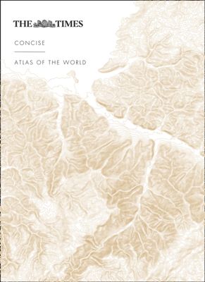
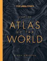
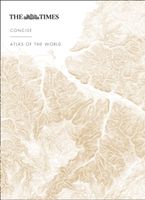
Het kleinere zusje van de grotere comprehensive atlas, maar nog steeds een imposante dikke verschijning! Gedetailleerde en prachtig uitgevoerde kaarten presenteren de perfecte combinatie van traditie, kennis en stijl. De kaarten zijn ontworpen in de bekroonde Times stijl, hierdoor is er een atlas geproduceerd in een hoogstaande, heldere kwaliteit....

Verkopers met dit product

Verkoper
Bezorging
Prijs
DeZwerver.nl logo
DeZwerver.nl
5,95
89,95

Anderen bekeken ook

Atlas The Times Comprehensive Atlas of the World | Collins
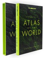
De moeder aller atlassen in een nieuwe druk. Als je al een atlas wilt kopen, bezuinig dan niet en doe deze: veruit de beste meest complete atlas in een prachtige uitvoering met beschermdoos.   Now in its 16th edition, the world's most authoritative atlas has been extensively updated.   Detailing our world as it is today, it includes more than 200,000 place names. At 45 cm high, this impressive world atlas will become a treasured possession.   In addition to 263 pages of continuous mapping, there are a further 223 pages of extensive indexing, alongside a preliminary section containing essays from trusted academics who discuss topics ranging from global population, to climate change, and the composition of our solar system, to the water in our oceans.   It is a benchmark of cartographic excellence, trusted by governments, media and international organisations, as well as households around the world.   Updates include: New country names for Eswatini (formerly Swaziland) and North Macedon…
226,50
Wandelatlas 2 Adventure Atlas South West Coast Path North Cornwall | A-Z Map Company
AZ heeft de meest gedetailleerde wandelkaarten van delen van het South West Coast Path  gebundeld in een atlasje. Daardoor is het heel handig qua formaat. De kaarten zelf zijn perfect voor het wandelen. Schaal 1:25.000 Plan your next adventure along the North Devon & Somerset section of the South West Coast Path with trusted mapping from A-Z The perfect companion for those who love the great outdoors, the A-Z Adventure Series features 1:25000 Ordnance Survey mapping in a convenient book, complete with index. The South West Coast Path is a National Trail along the Somerset, Devon, Cornwall and Dorset coasts. This stunning walk from Minehead, Somerset covers 630 miles to South Haven Point in Poole Harbour, passing through two World Heritage Sites (the Jurassic Coast and the Cornwall and West Devon Mining Landscape), Exmoor National Park, Land's End and many areas of outstanding natural beauty.   This guide to the North Devon and Somerset section features 36 pages of continuous Ordnan…
17,95
Wandelatlas 3 Adventure Atlas South West Coast Path South Cornwall | A-Z Map Company
AZ heeft de meest gedetailleerde wandelkaarten van delen van het South West Coast Path  gebundeld in een atlasje. Daardoor is het heel handig qua formaat. De kaarten zelf zijn perfect voor het wandelen. Schaal 1:25.000 Plan your next adventure along the South Cornwall section of the South West Coast Path with trusted mapping from A-Z The perfect companion for those who love the great outdoors, the A-Z Adventure Series features 1:25000 Ordnance Survey mapping in a convenient book, complete with index. The South West Coast Path is a National Trail along the Somerset, Devon, Cornwall and Dorset coasts. This stunning walk from Minehead, Somerset covers 630 miles to South Haven Point in Poole Harbour, passing through two World Heritage Sites (the Jurassic Coast and the Cornwall and West Devon Mining Landscape), Exmoor National Park, Land's End and many areas of outstanding natural beauty.   A series of five A-Z Adventure Atlases together cover the South West Coast Path: South West Coast…
17,95
Wandelatlas 1 Adventure Atlas South West Coast Path North Devon & Somerset | A-Z Map Company
AZ heeft de meest gedetailleerde wandelkaarten van delen van het South West Coast Path  gebundeld in een atlasje. Daardoor is het heel handig qua formaat. De kaarten zelf zijn perfect voor het wandelen. Schaal 1:25.000 Plan your next adventure along the North Devon & Somerset section of the South West Coast Path with trusted mapping from A-Z The perfect companion for those who love the great outdoors, the A-Z Adventure Series features 1:25000 Ordnance Survey mapping in a convenient book, complete with index. The South West Coast Path is a National Trail along the Somerset, Devon, Cornwall and Dorset coasts. This stunning walk from Minehead, Somerset covers 630 miles to South Haven Point in Poole Harbour, passing through two World Heritage Sites (the Jurassic Coast and the Cornwall and West Devon Mining Landscape), Exmoor National Park, Land's End and many areas of outstanding natural beauty.   This guide to the North Devon and Somerset section features 36 pages of continuous Ordnan…
17,95
Atlas Atlas of Forgotten Places | White Lion Publishing
Explore the places that time forgot. Abandoned, mysterious, sleeping monuments around the world have been relegated to the margins of history, pushed off the map and out of sight. From ancient ruins and crumbling castles to more recent relics – an art deco New York subway station, a Soviet ghost town in the Arctic Circle, a flooded Thai mall teeming with aquatic life – Travis Elborough takes you on a journey into these strange, overlooked and disappearing worlds and immortalises their fates. Original maps and stunning colour photography accompany Travis Elborough’s moving historic and geographic accounts of each site. The featured locations are a stark reminder of what was, and the accounts in this investigative book help to bring their stories back to life, telling us what happened, when and why, and to whom. The book features 40 sites, including: Santa Claus, Arizona, USA: A festive tourist resort turned ghost town deep in the desert where once you could meet Santa Claus any day…
21,95
Atlas The Phantom Atlas | Simon & Schuster
Een fascinerend boekwerk met de grootste mythes, leugens en blunders die ooit op kaart zijn verschenen. In een luxe hardcover uitgave met mooie stofomslag. The Phantom Atlas is an atlas of the world not as it ever existed, but as it was thought to be. These marvellous and mysterious phantoms - non-existent islands, invented mountain ranges, mythical civilisations and other fictitious geography - were all at various times presented as facts on maps and atlases. This book is a collection of striking antique maps that display the most erroneous cartography, with each illustration accompanied by the story behind it. Exploration, map-making and mythology are all brought together to create a colourful tapestry of monsters, heroes and volcanoes; swindlers, mirages and murderers. Sometimes the stories are almost impossible to believe, and remarkably, some of the errors were still on display in maps published in the 21st century. Throughout much of the 19th century more than 40 different mapma…
34,95
Atlas The Travel Atlas | Lonely Planet
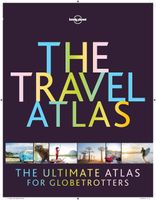
This is the ultimate world atlas for globetrotters. Combining our extensive mapping experience and unrivalled destination insight and knowledge, our first dedicated altas makes it easy for you to plan adventures and discover remarkable places around the planet. With Lonely Planet's The Travel Atlas in your hands, you can explore every part of the world and plan upcoming trips with one simple and easy-to-use resource.   Inside, you'll find detailed maps to every country on Earth, with popular regions and destinations presented at greater scale. Each large page of mapping is accompanied with the area's top sights and activities, while our themed itineraries, ranging from two days to two weeks, will ensure you don't miss the best sights. You'll also find trip planning tools like climate information and transport hubs to help you get there and away.   About Lonely Planet: Lonely Planet is a leading travel media company and the world's number one travel guidebook brand, providing both insp…
64,95
Reisgids - Reisverhaal Pocket Atlas of Remote Islands | Judith Schalansky
'Utterly exquisite.' Robert MacFarlane, Guardian'Gorgeous, lyrical and whimsical.' TimeBorn on the wrong side of the Berlin Wall, as a child Judith Schalansky could travel only through the pages of an atlas. Now she has created her own, taking us across the oceans of the world to fifty remote islands. Perfect maps jostle with cryptic tales from the islands, full of rare animals and lost explorers, marooned slaves and lonely scientists, mutinous sailors and forgotten castaways.'By book's end, I felt that I had travelled to all fifty islands.' Washington Post'Rarely has armchair travel been so farflung and romantic.' Time Out Judith Schalansky was born in 1980 on the wrong side of the Berlin Wall. The Soviets wouldn't let anyone travel so everything she learnt about the world came from her parents' battered old atlas. An acclaimed novelist and award-winning graphic designer, she has spent years creating this, her own imaginative atlas of the world's loneliest places. These islands are s…
20,95
Reisgids Culture Smart! China | Kuperard
De Cultuur Bewust!-gids geeft toeristen en zakenlieden belangrijke informatie met betrekking tot de cultuur van alledag in het land van bestemming. Anders dan in de gebruikelijke reisgidsen wordt de lezer in deze reeks bijgespijkerd op het gebied van omgangsvormen, normen en waarden, hoe zich te gedragen en wat verwacht mag worden op zakelijk en sociaal gebied. Het zijn beknopte zakformaatgidsen met interessante wetenswaardigheden over het dagelijks leven. Een must voor iedereen die naar het buitenland gaat voor vakantie, studie of werk. Culture Smart! China puts the latest dramatic changes into a historical context, explains deep-seated cultural attitudes, and guides the visitor through a maze of unfamiliar social situations. It will enable you to discover for yourself the warmth, intelligence, humor, and humanity of this extraordinary people. For thousands of years, the Chinese believed that they had created a perfect social system. Dynasties came and went, but the essence of being …
14,95
Wandelatlas Adventure Atlas South Downs Way | A-Z Map Company
AZ heeft de meest gedetailleerde wandelkaarten van de South Downs Way  gebundeld in een atlasje. Daardoor is het heel handig qua formaat. De kaarten zelf zijn perfect voor het wandelen. Schaal 1:25.000 The A-Z Adventure Series of maps combines the best of OS and A-Z, creating the perfect companion for walkers, off-road cyclists, horse riders and anyone wishing to explore the great outdoors.   The South Downs Way is a National Trail along the chalk escarpments and ridges of the South Downs. This undulating path begins in Winchester and finishes in Eastbourne covering 100 miles (160km) and lies completely within the South Downs National Park. The route on the map is clearly highlighted in yellow with mileage markers to gauge distances when planning sections of the walk to enjoy.   This official National Trail Map* of the South Downs Way features 44 pages of continuous Ordnance Survey Explorer** mapping providing complete coverage of the South Downs Way. This atlas includes a route plann…
17,95

Klanten-reviews van Atlas The Times Concise Atlas of the World | Collins

Er zijn nog geen beoordelingen voor dit productBen jij de eerste die een review plaatst?

Meer over Atlas The Times Concise Atlas of the World | Collins

Productomschrijving

Het kleinere zusje van de grotere comprehensive atlas, maar nog steeds een imposante dikke verschijning! Gedetailleerde en prachtig uitgevoerde kaarten presenteren de perfecte combinatie van traditie, kennis en stijl. De kaarten zijn ontworpen in de bekroonde Times stijl, hierdoor is er een atlas geproduceerd in een hoogstaande, heldere kwaliteit. Prachtige satelietfoto's gecombineerd met foto's en grafieken geven een helder beeld van de hedendaagse wereld. De atlas is gevat in een elegante slipcase.

A fully revised and updated fourteenth edition of this major world atlas in the authoritative and prestigious Times Atlas range. This beautifully designed atlas has all the information you need, whether planning a trip, keeping in touch with world news, solving quizzes and crosswords or just exploring the world from your armchair. Comprehensive reference mapping with 155,000 place names providing an amazingly detailed view of the world, and the illustrated thematic content covers the most important geographical issues of the day, making this atlas a valuable addition to any reference collection.   Mapping updates include; * Country name changes - Eswatini (formerly Swaziland) and North Macedonia (formerly Macedonia)* Place name changes in New Zealand* Administrative structures in Bangladesh, France, Ghana, India, Norway, Sierra Leone, Tanzania and UK* Changes to capital cities in Burundi, Kazakhstan, Chile and Palau* Airports and other transport infrastructure revisions, new rail and road bridge across Kerch Strait* Aral Sea outline, Polar sea ice extents and Antarctic research bases Produced in a quality finish the world atlas comes in a protective slipcase.  


Productinformatie

    Verken gerelateerde categorieën

    Webshop.nl maakt gebruik van cookies. Ga je verder op onze website, ga dan akkoord met het plaatsen van cookies en de verwerking van deze data door ons en vermelde partners.