webshop.nl
Categorieën
  Sluiten

Meer Particular Books
Meer Particular Books in Literatuur boeken

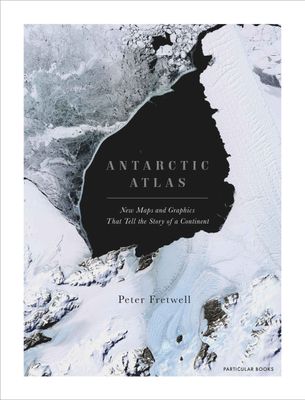
Atlas Antarctic Atlas | Particular Books

One of the least-known places on the planet, the only continent on earth with no indigenous population, Antarctica is a world apart. From a leading cartographer with the British Antarctic Survey, this new collection of maps and data reveals Antarctica as we have never seen it before. This is not just a book of traditional maps.   It measures everyt...
47,50

Webshops met dit product

Webshop
Bezorging
Prijs

Anderen bekeken ook

Atlas Antarctic Atlas | Particular Books
One of the least-known places on the planet, the only continent on earth with no indigenous population, Antarctica is a world apart. From a leading cartographer with the British Antarctic Survey, this new collection of maps and data reveals Antarctica as we have never seen it before. This is not just a book of traditional maps.   It measures everything from the thickness of ice beneath our feet to the direction of ice flows. It maps volcanic lakes, mountain ranges the size of the Alps and gorges longer than the Grand Canyon, all hidden beneath the ice. It shows us how air bubbles trapped in ice tell us what the earth's atmosphere was like 750,000 years ago, proving the effects of greenhouse gases.   Colonies of emperor penguins abound around the coastline, and the journeys of individual seals around the continent and down to the sea bed in search of food have been intricately tracked and mapped. Twenty-nine nations have research stations in Antarctica and their unique architecture is l…
47,50
Fotoboek Antarctica | Amber Books
Presented in a landscape format and with captions explaining the story behind each entry, Antarctica is a stunning collection of images celebrating this hostile yet striking continent. On the southernmost tip of the Earth lies one of the world's biggest and most unfriendly landmasses. From the waters of the Southern Ocean to the ice shelves, glaciers, volcanoes, and mountains, Antarctica is one of the most mysterious yet intriguing continents in existence. It is the windiest, driest, and coldest place on Earth, making it uninhabitable for humans; however, the snow, ice, water, and rocks make it simply stunning. Did you know that if you throw boiling water into the air in Antarctica, it will instantly vaporize? Despite these unimaginably harsh conditions, this unique continent is home to a vast array of wildlife; penguins, seals, and whales are among the animals that brave this frozen planet. From the Ross ice shelf, the largest in Antarctica, to Mount Erebus, currently the most active…
27,95
Wandkaart - Prikbord Antarctica - Zuidpool 120 x 100 cm | Maps Interna
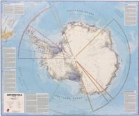
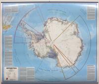
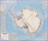
Fraaie kaart van het continent waarbij zowel de natuurkundige als de politieke aspecten zichtbaar zijn. Alle bezettingsstations, berggebieden en landingsplaatsen staan er op.   De wandkaarten op prikbord worden geleverd met een aluminium lijst en een eenvoudig te monteren ophangsysteem. Zij zijn geschikt voor allerhande markeringsystemen als vlaggetjes en prikkers.   Maps International's collection of continental maps would not be complete without this political Antarctica map.    The Antarctica map includes information from the British Antarctic Survey on scientific research. Information on Antarctica's climate and resources is included and as you would expect with a political map, the territory divisions are shown. Shown also are the major expedition routes, camps and weather stations on Antarctica. Map features hill shading, also contains information on the flora and fauna of Antarctica.   The map provides a great opportunity to learn more about a continent that many of us will neve…
185,-
Wandkaart Antarctica - Zuidpool, 120 x 100 cm | Maps International
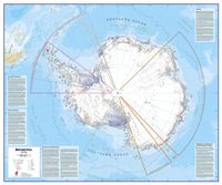
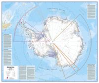
Fraaie kaart van het continent waarbij zowel de natuurkundige als de politieke aspecten zichtbaar zijn. Alle bezettingsstations, berggebieden en landingsplaatsen staan er op. Maps International's collection of continental maps would not be complete without this political Antarctica map.  The Antarctica map includes information from the British Antarctic Survey on scientific research. Information on Antarctica's climate and resources is included and as you would expect with a political map, the territory divisions are shown. Shown also are the major expedition routes, camps and weather stations on Antarctica. Map features hill shading, also contains information on the flora and fauna of Antarctica.   The map provides a great opportunity to learn more about a continent that many of us will never visit. Maps International's Antarctica map is available either plain or laminated making it ideal for classrooms or those with an interest in the South Pole and surrounding areas.
27,95
Wandkaart Antarctica - Zuidpool, 120 x 100 cm | Maps International
Fraaie kaart van het continent waarbij zowel de natuurkundige als de politieke aspecten zichtbaar zijn. Alle bezettingsstations, berggebieden en landingsplaatsen staan er op. Dit is een geplastificeerde versie. Maps International's collection of continental maps would not be complete without this political Antarctica map.  The Antarctica map includes information from the British Antarctic Survey on scientific research. Information on Antarctica's climate and resources is included and as you would expect with a political map, the territory divisions are shown. Shown also are the major expedition routes, camps and weather stations on Antarctica. Map features hill shading, also contains information on the flora and fauna of Antarctica.   The map provides a great opportunity to learn more about a continent that many of us will never visit. Maps International's Antarctica map is available either plain or laminated making it ideal for classrooms or those with an interest in the South Pole an…
37,95
Wandkaart Antarctica - Zuidpool, 120 x 100 cm | Maps International
Fraaie kaart van het continent waarbij zowel de natuurkundige als de politieke aspecten zichtbaar zijn. Alle bezettingsstations, berggebieden en landingsplaatsen staan er op. Dit is een geplastificeerde versie met metalen strips boven en onder de kaart waardoor deze eenvoudig is op te hangen. Maps International's collection of continental maps would not be complete without this political Antarctica map.  The Antarctica map includes information from the British Antarctic Survey on scientific research. Information on Antarctica's climate and resources is included and as you would expect with a political map, the territory divisions are shown. Shown also are the major expedition routes, camps and weather stations on Antarctica. Map features hill shading, also contains information on the flora and fauna of Antarctica.   The map provides a great opportunity to learn more about a continent that many of us will never visit. Maps International's Antarctica map is available either plain or lami…
49,95
Wandkaart Antarctica - Zuidpool, 120 x 100 cm | Maps International
Fraaie kaart van het continent waarbij zowel de natuurkundige als de politieke aspecten zichtbaar zijn. Alle bezettingsstations, berggebieden en landingsplaatsen staan er op. Maps International's collection of continental maps would not be complete without this political Antarctica map.  The Antarctica map includes information from the British Antarctic Survey on scientific research. Information on Antarctica's climate and resources is included and as you would expect with a political map, the territory divisions are shown. Shown also are the major expedition routes, camps and weather stations on Antarctica. Map features hill shading, also contains information on the flora and fauna of Antarctica.   The map provides a great opportunity to learn more about a continent that many of us will never visit. Maps International's Antarctica map is available either plain or laminated making it ideal for classrooms or those with an interest in the South Pole and surrounding areas.
27,95
Natuurgids A Complete Guide to Antarctic Wildlife | Bloomsbury
Prachtig naslagwerk over alle aspecten van de wildlife op de Zuidpool en Antarctica. Zeer gedegen vakwerk met prachtige soortbeschrijvingen en verspreidingskaarten. Harde kaft. This spectacularly illustrated book is the only complete guide to the wildlife and natural history of the vast and beautiful Antarctic region. Covering the Antarctic continent, the southern ocean, and the subantarctic islands, this guide illustrates all of the region's breeding birds and marine mammals with stunning colour photographs. In addition to the colour plates, it features distribution maps and up-to-date species accounts expertly detailing abundance, seasonal status, and conservation prospects. The volume also covers numerous nonbreeding species, migrants, and vagrants. Regional chapters describe all of the subantarctic islands, in addition to most regularly visited sites in Antarctica, and are accompanied by maps of each area and photographs of each locale. These chapters present detailed information o…
61,95

Klanten-reviews van Atlas Antarctic Atlas | Particular Books

Er zijn nog geen beoordelingen voor dit productBen jij de eerste die een review plaatst?

Meer over Atlas Antarctic Atlas | Particular Books

Productomschrijving

One of the least-known places on the planet, the only continent on earth with no indigenous population, Antarctica is a world apart. From a leading cartographer with the British Antarctic Survey, this new collection of maps and data reveals Antarctica as we have never seen it before. This is not just a book of traditional maps.   It measures everything from the thickness of ice beneath our feet to the direction of ice flows. It maps volcanic lakes, mountain ranges the size of the Alps and gorges longer than the Grand Canyon, all hidden beneath the ice. It shows us how air bubbles trapped in ice tell us what the earth's atmosphere was like 750,000 years ago, proving the effects of greenhouse gases.   Colonies of emperor penguins abound around the coastline, and the journeys of individual seals around the continent and down to the sea bed in search of food have been intricately tracked and mapped. Twenty-nine nations have research stations in Antarctica and their unique architecture is laid out here, along with the challenges of surviving in Antarctica'sunforgiving environment. Antarctica is also the frontier of our fight against climate change.   If its ice melts, it will swamp almost every coastal city in the world. Antarctic Atlas illustrates the harsh beauty and magic of this mysterious continent, and shows how, far from being abstract, it has direct relevance to us all.

Productspecificaties

Artikelnummer(s)
Brand
Particular Books

Verken gerelateerde categorieën

Webshop.nl maakt gebruik van cookies. Ga je verder op onze website, ga dan akkoord met het plaatsen van cookies en de verwerking van deze data door ons en vermelde partners.