Meer Sidestone Press
Meer Sidestone Press in EBooks

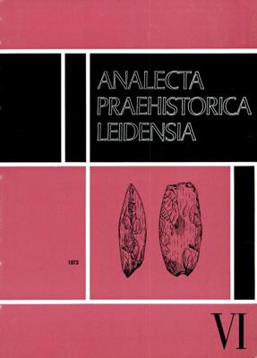
Analecta praehistorica leidensia (Paperback)

0
Analecta Praehistorica Leidensia is the annual journal of the Faculty of Archaeology (formerly the Institute of Prehistory), Leiden University. It was first published in 1964 to present the results of the faculty's archaeological investigations. As such it has become an important source of information for those interested in Neolithic, Bronze and I...

Verkopers met dit product

Verkoper
Bezorging
Prijs

Anderen bekeken ook

Analecta praehistorica leidensia (Paperback)
Analecta Praehistorica Leidensia is the annual journal of the Faculty of Archaeology (formerly the Institute of Prehistory), Leiden University. It was first published in 1964 to present the results of the faculty's archaeological investigations. As such it has become an important source of information for those interested in Neolithic, Bronze and Iron Age studies in northwestern Europe. Sidestone Press acts as the distribution partner responsible for both direct sales to customers as well as bookstores around the world. Contents J. Buurman & P.J.R. Modderman: Ein Grab der Becherkultur aus Hienheim, Ldkr. Kelheim, Bayern, mit einem Beitrag van C.C. Bakels P.J.R. Modderman: Bodemvorming in grafheuvels G.J. Verwers: Urnenveld en nederzetting te Laag Spul, gem. Hilvarenbeek, prov. Noord-Brabant, met een bijdrage van C. C. Bakels C.C. Bakels: Pollenspectra from the Late Bronze Age Urnfield at Hilvarenbeek-Laag Spul, Prov. Noord-Brabant, Netherlands H.Brunsting & G.J. Verwers: Het urnenveld
12,50
Nieuw
Stadsplattegrond Istanbul | Borch
Borch Istanbul is een duidelijke, geplastificeerde plattegrond van het centrum met informatie over openbaar vervoer en bezienswaardigheden. Inclusief straatnamenregister.   Our soft-laminated folded map of Istanbul shows: Istanbul 1:11 000, Topkapi Palace 1:4 000, Grand Bazaar 1:3 000, Üsküdar 1:13 000, Greater Istanbul 1:150 000, Northwestern Turkey 1:2 000 000, Public Transport Istanbul, Turkey administrative & time zones, Top 30 sights. Borch Maps are easy to fold, durable and water-repellent with a wipeable surface. Borch Maps show hotels, museums, monuments, markets, public transport, top sights and points of interest, useful statistics, conversion charts for temperatures, weights and measurements, climate charts showing temperatures, sunshine hours, precipitation and humidity, overview maps, time zones, and much more...   Istanbul (formerly known as Byzantium and Constantinople) is Europe's most populous city (circa 13 million inhabitants) and is located on the Bosphorus Strait.…
9,95
Reisgids Isle of Skye Guide Book | Charles Tait
The Isle of Skye is one of the most popular visitor destinations in Scotland and it was voted the fourth best island in the world by National Geographic. Being a relitavely small island, this guidebook has everything you'll need to experience the wonders of Skye. It covers all the main sites of interest, monuments, details of all of the best places to visit, walks and visitor attractions. It also includes a selection of 11 suggested day itineraries.   Charles does an excellent job at leaving nothing untouched when delving into the beauty that Skye has to offer. Some of the different sections covered range from Nature and Enviroment, Birds, Flora, Fauna, History, Archaeology and Culture. All sections are supported with Charles' own photography, with nearly 800 mostly new and unpublished photographs.   Charles Tait guide books   The Charles Tait guides for Scotland are chock full of information, which will both inspire you before your trip and enhance your experience whilst you're there…
24,95
Hexa Gear Plastic Model Kit 1/24 Abysscrawler Night Stalkers Ver. 15 cm
Combat preparation complete. Start your engines.Model Information:ABYSS CRAWLER is a third-gen HEXA GEAR developed by the Liberty Alliance.It was developed to explore and control blocked terrain such as culverts. Unlike other third-gen HEXA GEAR, it has two Zoatex modes and is characterized by its continuous use of Zoatex.At the beginning of the war, cities were raided by unmanned HEXA GEAR called HIDESTORMs. Further investigations uncovered numerous ginormous underground tunnels and facilities from the past that were used to carry out these attacks. As such, the Liberty Alliance urgently required a full-scale survey. However, all information about the geological patterns of these underground structures barring simple outlines, was lost, and to make matters worse, the areas had already fallen into enemy hands, with MSG Valiant Force HEXA GEARS and droids roaming the tunnels.Hidestorms, with their capabilities in electronic warfare thanks to their VIC Blades and other weapons, greatly t…
91,50
Nieuw
Wegenkaart - landkaart 3013 Adventure Map India Northwest - Noordwest | National Geographic
Wegenkaart van Noordwest India met vermelding van veel bezienswaardigheden, nationale parken en attrakties. Watervast en scheurvast. National Geographic's India Northwest Adventure Map is designed to meet the unique needs of adventure travelers with its durability and detailed, accurate information. The map includes the locations of thousands of cities and towns with a user-friendly index, as well as a clearly marked road network complete with distances and designations for highways, major routes and secondary roads.   The India Northwest Adventure Map differs from a traditional road map for it includes hundreds of points of interest that highlight diverse and unique destinations in the region. The map features UNESCO World Heritage sites, national parks, archaeological sites, wildlife sanctuaries, Hindu, Buddhist and Sikh temples, forts, palaces and other points of interest, making it an invaluable resource to travelers hoping to experience all the history and culture India has to of…
17,50
European Archaeology - Identities & Migrations (Paperback)
As it appears in diverse guises - and notably as a founding narrative - the past is at the core of every functioning human society. The idea that the past can be known through scientific research has long been a fundamental challenge for western societies and for European researchers, from all disciplines concerned. Through more than four decades of outward-looking archaeological practice, the scholar, teacher and intellectual Jean-Paul Demoule has elaborated a truly global approach to European cultures and their transformations, spanning from the social inequality in Neolithic times to Indo European research to contemporary links between heritage and politics. His colleagues - British, Bulgarians, Czechs, Danes, Dutch, French, Germans, North-Americans, Spaniards, Swiss and Russians - seek to extend and enrich his vision. With contributions (written in French and in English) spanning from prehistory to the modern world, they bring in this volume new insights and data to such issues as
65,-
Reisgids Slow Travel Cornwall and the Islands of Scilly | Bradt Travel Guides
Een bijzondere serie van Bradt guides, waarin een gedeelte van Engeland of Schotland uitgebreid beschreven wordt. Met veel aandacht voor kleine details die je niet al gauw elders zult vinden. Naast de beschrijvende informatie vind je ook een schat aan praktische informatie als accommodatie-adressen of leuke pubs. Een aanrader! Thoroughly updated and significantly expanded in this new fourth edition, Bradt’s Cornwall & The Isles of Scilly (Slow Travel) is the most well-established guide to a perennially popular British county. Offering in-depth exploration of both frequently visited and less-well-known destinations that will interest locals as much as newcomers, it is written in a friendly, engaging style and includes up-to-date listings of the best (and sometimes least obvious) places to eat, drink and sleep, appealing to all budgets.   Long popular with discerning travellers and foodies, the boom in staycations and coverage in TV dramas such as Poldark mean that Cornwall enjoys ev…
22,50
Reisgids Scottish Island Bagging | Vertebrate Publishing
Erg mooie gids met aandacht voor 154 Schotse eilanden die de moeite waard zijn om te bezoeken.   Scottish Island Bagging by Helen and Paul Webster, founders of Walkhighlands, is a guide to the magical islands of Scotland.   Focusing on the ninety-nine islands that have regular trips or means of access for visitors, plus fifty-five other islands which have no regular transport but are still of significant size or interest, the authors have described the best ways to experience each one. Of the islands featured, many are household names – Skye, Lewis, Bute – while some, such as the isolated St Kilda archipelago and the remote Sula Sgeir, will be unknown to all but a hardcore few.   When it comes to things to see and do, the islands of Scotland have it all. Wildlife enthusiasts can watch out for otters, orcas and basking sharks, while birdwatchers in particular are spoilt: look out for the rare corncrake on Islay, sea eagles on Mull, or sight puffins, gannets, storm petrels and many othe…
26,95
Nieuw
Wegenkaart - landkaart Western Canada | ITMB
Een degelijke kaart met aanduidingen van o.a. nationale parken, vliegveld, benzinepomp, dirt-roads. Als overzichtskaart goed te gebruiken. This is actually our second attempt at mapping the western portion of Canada; the first covered everything from northwestern Ontario to the Pacific Ocean and, while it was an excellent map, the scale that such a huge area covered necessitated severe problems. In this version, all of British Columbia, Alberta, and the Yukon have been mapped from fresh digital data and presented at 1:1.4T scale. This would have been impossible when we prepared the first map. The Northwest Territories portion had to be compressed in two ways; first, the scale is 1:2M; second, only the portion with roads is shown. This is still an extremely large area. One has to consider the actual size of Canada when designing a map. Most countries in Europe would fit into this area, which only covers 20% of Canada. The Fort McMurray forest fire of a year ago covered an area larger t…
13,95
Nieuw
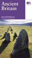
Wegenkaart - landkaart Ancient Britain | Ordnance Survey
The Ordnance Survey Ancient Britain map is a comprehensive guide to the most important archaeological sites of early English, Welsh and Scottish history. Ordnance Survey's Ancient Britain map shows Neolithic, Bronze Age, Iron Age, Roman and early Medieval sites – against a backdrop of modern mapping. This extract shows some of the ancient sites of Wiltshire marked on the map. The secrets of Ancient Britain are to be revealed in a revised Historical map and guide from Ordnance Survey. Aimed at anyone with an interest in the early history of Britain – from schoolchildren through to archaeologists and tourists – the map helps bring the past to life. Information on the map includes ancient roads and place names – as well as comprehensive features and illustrations on many aspects of life in the period, including land use and settlement sites. Photographs, showing how many of the sites look today, are also used to give context. The map is created in conjunction with The National Monuments …
13,50

Klanten-reviews van Analecta praehistorica leidensia (Paperback)

Er zijn nog geen beoordelingen voor dit productBen jij de eerste die een review plaatst?

Meer over Analecta praehistorica leidensia (Paperback)

Productomschrijving

Analecta Praehistorica Leidensia is the annual journal of the Faculty of Archaeology (formerly the Institute of Prehistory), Leiden University. It was first published in 1964 to present the results of the faculty's archaeological investigations. As such it has become an important source of information for those interested in Neolithic, Bronze and Iron Age studies in northwestern Europe. Sidestone Press acts as the distribution partner responsible for both direct sales to customers as well as bookstores around the world. Contents H.M.E. van Haaren & P.J.R. Modderman: Ein mittelneolithischer Fundort unter Koningsbosch, Prov. Limburg P. van de Velde: Rituals, Skins and Homer: the Danubian 'Tan-Pits' P. van de Velde: A Note on a Provisional Factor Analysis of Linear Pottery Ware

Productspecificaties

Artikelnummer(s)
Brand
Sidestone Press

Verken gerelateerde categorieën

Webshop.nl maakt gebruik van cookies. Ga je verder op onze website, ga dan akkoord met het plaatsen van cookies en de verwerking van deze data door ons en vermelde partners.