Meer Sidestone Press
Meer Sidestone Press in EBooks

Analecta praehistorica leidensia (Paperback)

0
Analecta Praehistorica Leidensia is the annual journal of the Faculty of Archaeology (formerly the Institute of Prehistory), Leiden University. It was first published in 1964 to present the results of the faculty's archaeological investigations. As such it has become an important source of information for those interested in Neolithic, Bronze and I...

Verkopers met dit product

Verkoper
Bezorging
Prijs

Anderen bekeken ook

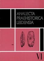
Analecta praehistorica leidensia (Paperback)
Analecta Praehistorica Leidensia is the annual journal of the Faculty of Archaeology (formerly the Institute of Prehistory), Leiden University. It was first published in 1964 to present the results of the faculty's archaeological investigations. As such it has become an important source of information for those interested in Neolithic, Bronze and Iron Age studies in northwestern Europe. Sidestone Press acts as the distribution partner responsible for both direct sales to customers as well as bookstores around the world. Contents H.M.E. van Haaren & P.J.R. Modderman: Ein mittelneolithischer Fundort unter Koningsbosch, Prov. Limburg P. van de Velde: Rituals, Skins and Homer: the Danubian 'Tan-Pits' P. van de Velde: A Note on a Provisional Factor Analysis of Linear Pottery Ware
12,50
Nieuw
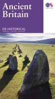
Wegenkaart - landkaart Ancient Britain | Ordnance Survey
The Ordnance Survey Ancient Britain map is a comprehensive guide to the most important archaeological sites of early English, Welsh and Scottish history. Ordnance Survey's Ancient Britain map shows Neolithic, Bronze Age, Iron Age, Roman and early Medieval sites – against a backdrop of modern mapping. This extract shows some of the ancient sites of Wiltshire marked on the map. The secrets of Ancient Britain are to be revealed in a revised Historical map and guide from Ordnance Survey. Aimed at anyone with an interest in the early history of Britain – from schoolchildren through to archaeologists and tourists – the map helps bring the past to life. Information on the map includes ancient roads and place names – as well as comprehensive features and illustrations on many aspects of life in the period, including land use and settlement sites. Photographs, showing how many of the sites look today, are also used to give context. The map is created in conjunction with The National Monuments …
13,50
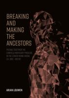
Breaking and making the ancestors (Paperback)
Towards the capstone of the European Bronze Age, in an area stretching from the Carpathians in the East to the North Sea in the West, vast cremation grave cemeteries occur that are perhaps better known as 'urnfields.' Today some 700 of these burial sites have come to light in the Netherlands alone. In this corner of Europe, also known as the 'Lower-Rhine-Basin,' these cemeteries are often characterised by vast collections of small burial mounds under which the cremated remains of decedents were buried in small shaft-like pits. In many a case the cremated remains had been put in urns first, providing these cemeteries with their very name. Though rich in numbers, urnfield graves are often described as 'poor' and 'simple' as only in rare occasions decedents were provided with grave gifts. However, when close attention is paid to the actions involved in the creation of these seemingly simple graves, they in fact reveal a richness in funerary practices that on their turn hint a complex and
40,-
Nieuw
Wandelkaart - Topografische kaart 170 OS Explorer Map | Active Abingdon / Wantage / Vale | Ordnance Survey
Discover the Vale of White Horse, rolling hills dominated by the extraordinary, eponymous White Horse, an enigmatic Bronze Age chalk carving which can be seen for miles leaping across the hillside. Explore the historic market towns of Abingdon-on-Thames, dating back to Saxon times; Wantage, birthplace of King Alfred the Great; Wallingford and Faringdon, known for its 100-foot high folly tower.     Visit the iconic White Horse and the ancient landscape that surrounds it, including Uffington Castle and Dragon Hill, where St George slew the dragon  Follow streams flowing through the chalk uplands and discover unique locations like the Manger and its Giant Steps, remnants of the Ice Age  Walk, hike or cycle along the ancient Ridgeway through the wold or a number of other popular recreational paths including sections of the Thames Path, Lambourn Valley Way and Chiltern Way    Met zijn 4cm voor 1 km (2 ½ cm voor 1 mijl) schaal, is de OS Explorer kaartenserie de ideale en meest gedetailleerd…
25,95
Wandelkaart - Topografische kaart 170 OS Explorer Map Abingdon, Wantage & Vale of White Horse | Ordnance Survey
Discover the Vale of White Horse, rolling hills dominated by the extraordinary, eponymous White Horse, an enigmatic Bronze Age chalk carving which can be seen for miles leaping across the hillside. Explore the historic market towns of Abingdon-on-Thames, dating back to Saxon times; Wantage, birthplace of King Alfred the Great; Wallingford and Faringdon, known for its 100-foot high folly tower.     Visit the iconic White Horse and the ancient landscape that surrounds it, including Uffington Castle and Dragon Hill, where St George slew the dragon  Follow streams flowing through the chalk uplands and discover unique locations like the Manger and its Giant Steps, remnants of the Ice Age  Walk, hike or cycle along the ancient Ridgeway through the wold or a number of other popular recreational paths including sections of the Thames Path, Lambourn Valley Way and Chiltern Way    Met zijn 4cm voor 1 km (2 ½ cm voor 1 mijl) schaal, is de OS Explorer kaartenserie de ideale en meest gedetaille…
19,50
Nieuw
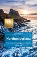
Reisgids Slow Travel Northumberland | Bradt Travel Guides
Een bijzondere serie van Bradt guides, waarin een gedeelte van Engeland of Schotland uitgebreid beschreven wordt. Met veel aandacht voor kleine details die je niet al gauw elders zult vinden. Naast de beschrijvende informatie vind je ook een schat aan praktische informatie als accommodatie-adressen of leuke pubs. Een aanrader! Part of Bradt’s distinctive, award-winning series of ‘Slow’ travel guides to UK regions, this new, thoroughly updated, third edition of the best-selling Northumberland (Slow Travel) provides a reliable, wide-ranging, detailed and accessible font of inspiration and information for discovering the unexpected, varied and increasingly popular riches of northeasternmost England.   Northumberland is much loved for its beaches, wildlife, islands and desolate upland scenery, but despite all the attention and accolades (‘most tranquil county’, ‘darkest night skies in England’, ‘best beaches’), most of the county remains wonderfully crowd-free. Getting away from it all…
24,95
DC Comis Art Print 90 Years Limited Edition 42 x 30 cm
Comics have gone through various eras over the years. The Golden Age, The Silver Age, The Bronze Age, and The Modern Age, and this limited edition art print celebrating 90 years of DC Comics represents them, with versions of their three most iconic heroes. Superman, Batman, and Wonder Woman.Produced at one of the oldest commercial printers in the UK, the print is A3 in size (297 x 420mm) and is hand-numbered as one of 995 worldwide.- Limited to 995- Officially licensed- Individually numbered to reverse- 297 x 420mm
24,50
Reisgids Shetland Guide Book | Charles Tait
The Shetland Guide Book offers unrivalled detail on the more than 100 islands that make up the Shetland Isles. The islands have a wealth of archaeological history, from viking farms to bronze age burial mounds, but the natural wonders are just as impressive and this guide will tell you where you can catch a glimpse of everything from puffins to ponies.   Charles Tait Guidebooks   Charles Tait Guidebooks are photographed, researched, designed and written by the author. Being an Orcadian photographer and travel writer, Charles Tait has been publishing guidebooks based on the natural and cultural history of the Highlands and Islands since 1991. The aim is to create authoritative, readable, informative, easily assimilated handbooks to each area. Each book is extensively illustrated with photographs by Charles Tait, as well as Ordnance Survey maps, old photographs and prints. The guides include introductions covering natural history, archaeology, history and the economy. The Gazetteer cove…
24,95
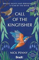
Reisverhaal Call of the Kingfisher | Nick Penny
Call of the Kingfisher is the enchanting debut from composer and wildlife recordist, Nick Penny. This love letter to a short stretch of Northamptonshire's River Nene celebrates all the wild things that live there, especially the kingfishers. Uniquely, it comes with bonus audio content to complement the text, accessed via QR codes. For four decades, Penny has walked beside the river at Oundle - a lovely but little-known part of England where where Clark Gable and thousands of American airmen were stationed during World War II, and where bandleader Glenn Miller performed his final airfield concert before going missing in action. For a whole year, Penny gave the waterway all the time it asked for. The more attention he gave, the more he saw the kingfishers and heard their high whistling calls. Call of the Kingfisher relates a year by the river, the author's experiences there and the people he meets. Other strands weave around the feathered protagonist: explorations of history and landsca…
14,95
Nieuw
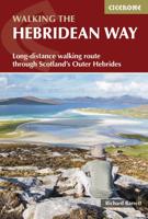
Wandelgids The Hebridean Way | Cicerone
Uitstekende wandelgids van de Hebridean Way, waarbij naast alle noodzakelijke informatie ook gebruik gemaakt wordt van de echte topografische kaart. Officially launched in 2017, the Hebridean Way offers walkers the opportunity to experience the magic of Scotland's Outer Hebrides in one inspirational journey. The waymarked route stretches 247km (155 miles) from Vatersay to Stornaway, linking ten major islands of the archipelago by means of causeways and two ferry crossings: Vatersay, Barra, Eriskay, South Uist, Benbecula, Grimsay, North Uist, Berneray, Harris and Lewis. Suitable for most walkers with a moderate level of fitness, it can be completed in 8-14 days and is rich in natural, historical and cultural interest.   This guidebook presents the Hebridean Way in 10 stages of 16-35km (10-22 miles), plus two additional stages to extend the route to the Butt of Lewis in line with future plans. Detailed route description is accompanied by 1:50,000 OS mapping, stunning photography to w…
20,95

Klanten-reviews van Analecta praehistorica leidensia (Paperback)

Er zijn nog geen beoordelingen voor dit productBen jij de eerste die een review plaatst?

Meer over Analecta praehistorica leidensia (Paperback)

Productomschrijving

Analecta Praehistorica Leidensia is the annual journal of the Faculty of Archaeology (formerly the Institute of Prehistory), Leiden University. It was first published in 1964 to present the results of the faculty's archaeological investigations. As such it has become an important source of information for those interested in Neolithic, Bronze and Iron Age studies in northwestern Europe. Sidestone Press acts as the distribution partner responsible for both direct sales to customers as well as bookstores around the world. Contents J. Buurman & P.J.R. Modderman: Ein Grab der Becherkultur aus Hienheim, Ldkr. Kelheim, Bayern, mit einem Beitrag van C.C. Bakels P.J.R. Modderman: Bodemvorming in grafheuvels G.J. Verwers: Urnenveld en nederzetting te Laag Spul, gem. Hilvarenbeek, prov. Noord-Brabant, met een bijdrage van C. C. Bakels C.C. Bakels: Pollenspectra from the Late Bronze Age Urnfield at Hilvarenbeek-Laag Spul, Prov. Noord-Brabant, Netherlands H.Brunsting & G.J. Verwers: Het urnenveld

Productspecificaties

Artikelnummer(s)
Brand
Sidestone Press

Verken gerelateerde categorieën

Webshop.nl maakt gebruik van cookies. Ga je verder op onze website, ga dan akkoord met het plaatsen van cookies en de verwerking van deze data door ons en vermelde partners.