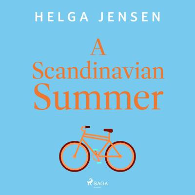
A Scandinavian Summer

0
It's the right time for love, but is it the right place? Following her husband's untimely passing, Martha's life revolves around their daughter, Rosie. But with Rosie leaving the nest and Martha's......

Verkopers met dit product

Verkoper
Bezorging
Prijs
Luisterrijk.nl logo
Luisterrijk.nl
0
gratis
14,99

Anderen bekeken ook

Wandelgids Thames Path | Trailblazer Guides
This book follows the Thames Path National Trail from the river's source in Gloucestershire to the Thames Barrier in London. Officially 184 miles (294km) in length (although the actual distance you walk will depend on a number of decisions you make en route), the path meanders, accompanied by its watery muse, through pristine and tranquil countryside, past historic sites and buildings, via pub, lock, weir, and the occasional scattering of waterfowl, to a city, once the fulcrum of an empire, and now the heart of modern day England. The river, responsible for the metropolis' very being, tells tales, inspires artists, accommodates swans, geese, and water voles, reflects the silhouettes of red kites and kingfishers, provides employment, entices adventure, and allows time for carefree pilgrims to procrastinate and think. Following its banks is a grand way to go for a ramble. The path begins, as the river does, in a meadow in the Cotswolds; its upper reaches lonely and wild, the meadows and…
19,95
Fietskaart 14 Cycling guides Suffolk | Goldeneye
To be confronted with the variety and complexity of the cycling routes, trails and paths in Suffolk can be a bewildering experience.  For it appears that the Suffolk County Council and the three District Councils are all trying hard to promote their areas. This is indeed encouraging for the growth of cycling, but it can be confusing.  Our purpose is to provide clear, easy to use and easy to follow, cycling maps, and to illustrate these in a comprehensive form.    Suffolk must be one of the most charming of counties to explore by bicycle. When Al Churcher delivered his routes to us at Goldeneye we couldn’t keep him quiet, such was his enthusiasm and wonder at Suffolk’s country lanes and byways. He has cycled all over the UK, Canada, Mallorca, New Zealand and Sicily, but Suffolk remained a firm favourite.    The inland scenery is not spectacular for the county’s main glory lies with its attractive villages; the local architecture jealously preserved from modern depredation. There is an …
15,95
Stadsplattegrond Vancouver & Greater Vancouver | ITMB
Stadsplattegrond van Vancouver met een extra inzet op kleinere schaal van het centrum. Met register. Waterproof! ITMB first published our own map of Vancouver six editions and twenty years ago. Each time we update, we're surprised at how much change has taken place. This is a double-sided map, with the city on one side and the metropolitan area on the other side. Like many North American cities, Vancouver consists of several separate urban areas that have merged together physically but not politically. Greater Vancouver's population is 2,500,000, most of which consists of residential areas. The 'regional' side is where the growth in population is taking place (about 100,000 people move to Vancouver each year) and this is where noticeable developments are taking place - the new South Perimeter Road following the Fraser River eastwards, the new Port Mann toll bridge, the new toll Golden Ears toll bridge across the Fraser. None of this will make sense to non-locals, but since most of our…
13,95
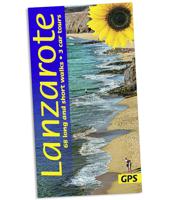
Wandelgids Lanzarote | Sunflower books
Wandelgids: vele dagtochten worden degelijk beschreven met openbaar vervoer informatie, goede routebeschrijvingen en kaartmateriaal. Tevens enkele autotochten. Deze gids staat goed bekend! Engelstalig. (De Nederlandse versie is geheel uitverkocht en wordt niet meer gedrukt) 3 car tours, 68 long and short walks, 15 picnic suggestions Few holidaymakers realise that Lanzarote has more to offer than just beaches and sunshine. This fascinating island is truly extraordinary. Its fate was decided some two and one-half centuries ago, when the largest volcanic eruption in recorded history took place, leaving a strange and alluring countryside in its wake a landscape littered with volcanoes and dark streams of jagged lava. This is the backdrop to nearly every scene on the island, and intriguing sights abound none more so than the 'Fire Mountains'. There is no better place in the Canary Islands for just strolling. No doubt 'serious' walkers will find other islands more challenging, but ramblers …
23,50
Wegenkaart - landkaart Nunavut - Northwest Territories | ITMB
The far north of Canada, north of 60 degrees, consists of three territories; the Yukon, the Northwest Territories, and Nunavut. Until now, there has never been a proper map of the territory that was carved off from the NWT a quarter century ago. With only 30,000 people and a scattering of settlements, Nunavut is larger than western Europe in area. This map took us years to prepare, using 1:250,000 government topo maps as a base and tracing thousands of little lakes. The traditional passageway of the fabled Northwest Passage is also shown. The most northerly civilian community in the world is on the map – Grise Bay, as well as Alert, the most remote place on earth. Originally, the NWT covered all of northwestern North America west of the Louisiana Purchase and the Loyalist colonies, and north of the Spanish provinces (essentially north of current day Sactamento). Political changes have reduced its size over the past century and a half to the region of Canada north of the 60th parallel …
13,95
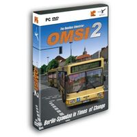
OMSI 2, The Omnibus Simulator
Experience a new omnibus simulator with OMSI 2 and start discovering Spandau . OMSI 2 is the successor of the well-known and awarded omnibus simulator "OMSI - The Bus Simulator". OMSI 2 not only offers the routes and buses available in the original OMSI, but adds lots of exciting new features. In OMSI 2 you can drive the first ever articulated bus in the OMSI history, the MAN NG272. Explore the new omnibus line 5 covering a total distance of 12 km from the subway station Ruhleben to the psychiatric clinic Spandau. Thanks to the newly added chronology function you are not only able to drive through Spandau in 1986, but also to relive the changes taking place in Spandau between 1986 and 1994.Enjoy the charm of the 80s and 90s and experience the period after the fall of the Berlin Wall - all at the wheel of a double-decker or articulated bus.New features in OMSI 2:- The articulated bus MAN NG272 with the exact physical and visual recreation of the joint kinematics as well as corresponding…
28,95
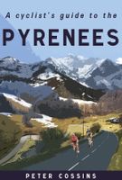
Fietsgids A Cyclist's Guide to the Pyrenees | Great Northern Books
Where do you turn when you want to ride in the mountains, to follow in the wheeltracks of professional racers by climbing the famous passes of the Tour de France? There are several books and websites that highlight these renowned ascents, detailing their location, length and every little change in gradient. But how do you go about finding a route that links these passes together, that describes not only where they are and what they're like to ride, but highlights which is the best side to tackle them from and which roads to avoid?Award-winning author Peter Cossins's new series of guides to riding in the Western Europe's high mountains will provide these details - and much more. Inspired by Alfred Wainwright's walking guides to the Lake District, they are intended as the bible for any cyclist riding in Europe's most stunning terrain.   The first in the series is The Roads, Cols and Passes of the Pyrenees, which is duefor publication by Great Northern Books in June 2020. Featuring 120 r…
23,95
Reisgids Zanzibar, Pemba en Mafia | Bradt Travel Guides
Zeer goede gids voor Zanzibar en betrouwbaar alternatief voor de Lonely Planet. Zo mogelijk nog completer! Zelfde soort informatie als de Lonely Planet: vol met praktische feiten en achtergronden. Engels. A new, thoroughly updated ninth edition of the most comprehensive guide to Zanzibar available, with a complete review of accommodation listings to cover new options in all price brackets on all three main islands (over 300 properties visited personally). Also included is more detailed coverage of Zanzibar's cultural, historic and environmental status than in any other travel guide to the area, while many of the city/town/village maps have been redrawn and accurately updated, with every property, major attraction, eatery and road recorded to provide a detailed level of guidance. The authors aim to direct readers to the more ethically minded hotels, tour operators and activities, from a focus on fair-trade shopping opportunities to marine awareness guidelines. Bradt's Zanzibar is the m…
24,95
Wegenkaart - landkaart Spitsbergen Svalbard | ITMB
North of Norway exists one of the northernmost communities in the world, an archipelago of islands called Svalbard in Norwegian, and better known as Spitsbergen in English. Until now, it has only been available in map format from the Norwegian Arctic Institute, and then only with difficulty. Side one shows the various islands as an entity. There is only one town of any size in the islands, called Longyearbyen, although there is a more northerly town called Pyramiden and an isolated community on the west coast called Alesund. This is true high Arctic adventure travel; one does not come here unprepared! Most of the islands are uninhabited and largely ice-covered. Edge Island, for example, is a large nature reserve, and Prins Karl Forland is a national park. We have translated land area names into English and placed the Norwegian names in brackets, but have tried leaving the Norwegian names in place wherever possible to assist with local usage. This is one of those ‘off the beaten path’ …
13,95
Fietskaart 09 Cycling guides Norfolk | Goldeneye
Norfolk is the fourth largest county in England and one of the most rural. It is also one of the flattest and our circular routes have been chosen to explore the quiet lanes linking the isolated and picturesque villages and places of interest. This is ideal cycling territory and fortunately, the Norfolk County Council (and its District Councils) are seriously committed in providing and developing cycling routes and in promoting a cycling culture that is sustainable and family friendly. Some of their routes are illustrated, hitherto.   The County has been described as flat (rather gentle undulations) and does not in fact rise much over 300 feet, but it offers great scenic interest; the dark forests of Breckland, the rolling chalk lands of the northwest, the unique watery patch of the Broads, and a coastline of great variety. Ancient churches and picturesque villages are there in abundance, the latter often decorated with the attractive signs designed by Harry Carter in the 1950’s.   Re…
14,95

Klanten-reviews van A Scandinavian Summer

Er zijn nog geen beoordelingen voor dit productBen jij de eerste die een review plaatst?

Meer over A Scandinavian Summer

Productomschrijving

It's the right time for love, but is it the right place? Following her husband's untimely passing, Martha's life revolves around their daughter, Rosie. But with Rosie leaving the nest and Martha's...

Productinformatie

    Productspecificaties

    Artikelnummer(s)
    EAN
    9788727043883
    Webshop.nl maakt gebruik van cookies. Ga je verder op onze website, ga dan akkoord met het plaatsen van cookies en de verwerking van deze data door ons en vermelde partners.