A Girl Called Eilinora

0
It is 1846, famine is gripping Ireland and nowhere is it crueller than in Mayo on the west coast......

Verkopers met dit product

Verkoper
Bezorging
Prijs

Anderen bekeken ook

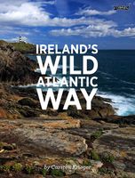
Fotoboek Ireland's Wild Atlantic Way | O'Brien Press
Take a photographic journey down Ireland's Atlantic coast from Donegal in the north to Cork in the south. This beautiful book showcases the west coast in all its wild beauty: dramatic views, abundant nature and wildlife, lighthouses, harbours and quaint seaside villages, as well as heritage, history and people. The Wild Atlantic Way is a fully-signposted route along the west coast of Ireland that brings the visitor to some of Ireland's most spectacular scenery and liveliest towns: from surfing in Rossknowlagh to birdwatching at the magnificent cliffs of Moher, from the boats in Galway Bay to traditional music in Doolin, from dolphins in Kerry to castles in Cork there's something for everyone on the wild west coast. Over 200 wonderful photographs. Maps showing each section of the Wild Atlantic Way: Donegal-Mayo, Mayo-Clare, Clare-Kerry, Kerry to Cork. 'a sumptuous book in which the magnificent colour photographs speak for themselves' Books Ireland on Ireland's Coast
15,95
Wegenkaart - landkaart Ierland | ITMB
As technology improves, we are able to produce more detailed maps than was previously possible. Such is the case with Ireland, a part of the world consisting of two countries divided by religion and history. Preparing a map of Ireland as a double-sided map means cutting the island into two geographic portions. Side 1 covers the northern half. This includes the portion known as Northern Ireland, or Ulster, and a fair portion of the Republic of Ireland, or Eire; essentially everything north of Dublin and west to Counties Mayo and Galway. Side 2 covers the southern half of the island from just north of Dublin to the outer tips of County Kerry. It also includes a nice inset map of central Dublin. Naturally, all motorways and roads are included, as are touristic attractions, camping/caravan sites, ferry terminals, and Top Attractions. This is a very detailed travel map of the island, printed on waterproof paper for durability. We had great fun driving around Ireland researching this map. I…
14,95
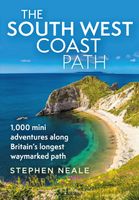
Reisgids The South West Coast Path | Bloomsbury
Often featuring in lists of the world's best walks, the South West Coast Path is 630 miles long, and passes through two World Heritage Sites. This guide to the path is a modern take on the traditional (turn right at the stile, and follow the footpath to the bridge) guidebook: instead of telling readers where to go step by step, Stephen gives fantastic ideas for what to do as they travel along the path. There are so many amazing adventures and places to visit (some 'secret' and some well known) and this guide highlights 1,000 of them, all situated along the route.   After an Introduction giving a history of the path and the stories of the people who made it (Why is this path the most popular National Trail? Why is it so closely associated with tales of King Arthur? When is the best time to visit?) the bulk of the book focuses on all the amazing things you can do along the path itself. It is divided into regions, with over 70 adventures/highlights per region: West Somerset, North Devon,…
27,95
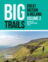
Wandelgids Big Trails Great Britain & Ireland Volume 2 | Vertebrate Publishing
Big Trails: Great Britain and Ireland Volume 2 is the second volume of this inspirational guide to the most iconic long-distance trails in England, Scotland, Wales, Ireland and the Channel Islands.   The twenty-five routes featured in this book comprise more of the best trails in Great Britain and Ireland. From some of Wales’ best views on the Pembrokeshire Coast Path and the magnificent moorlands of the Two Moors Way (Devon Coast to Coast) in South-West England, to Scotland’s wild moors on the Southern Upland Way and over high cliffs on Ireland’s Burren Way. In the shadows of Lakeland peaks on the Cumbria Way and around five islands on the Channel Island Way, the book incorporates the highlights of Great Britain and Ireland, from its centre to its outermost edges.   Big Trails books are designed to inspire big adventures. Rather than being carried along the route, this guide provides everything you need to plan and explore further, including a general overview of the trails, specific…
27,95
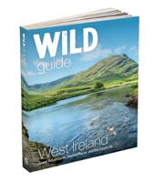
Reisgids Wild Guide West Ireland | Wild Things Publishing
The ultimate adventure guide to exploring Ireland's rugged west coast, this new guide reveals the region's 1,000 wildest and most enchanting places. From remote beaches and dramatic cliffs to secret waterfalls and magical woodlands, readers are taken off the beaten path to discover the untamed beauty of Western Ireland - Donegal, Galway, Mayo, Clare, Kerry, Sligo, Roscommon, Leitrim and Limerick. Perfect for adventurers, nature lovers and families, the guide uncovers hidden gems that most tourists never see and charts the best slow food and wild places to stay. From kayaking among hundreds of tiny islands in Mayo to sandwiching secluded coves and rolling mountains with superb food in Connemara, exploring the Burren's otherworldly rock formations and secret lakes in County Clare, and wandering the wild beaches, remote sea cliffs and waterfalls of Kerry, this new guide brims with Atlantic Ocean adventures, journeys around forgotten castles, forts and tombs, and expeditions into lush val…
27,50
Reisgids Rough Guide Pocket Ireland | Rough Guides
This compact, pocket-sized Ireland travel guidebook is ideal for travellers on shorter trips, who want to make sure they experience the destination's highlights. The book includes highly practical, ready-made walks and tours that allow you to organise your short break in Ireland without losing time planning. This Ireland pocket guidebook covers: Dublin, Wicklow, Kilkenny, Waterford, Kilkenny, Cork city, West Cork, the Ring of Kerry, Dingle Peninsula, Limerick, the Shannon, The Cliffs of Moher, The Burren, Westport, Galway, Connemara, Mayo, Sligo and Donegal, Belfast.   Inside this Ireland travel book, you will find:- 16 ready-made walks and tours - easy-to-follow walking and driving tour itineraries featuring the best places to visit, as well as what to do and where to eat along the way- Itinerary details - each walk or tour starts with pointers on the time taken, distance covered and how to connect with other itineraries in the book- Things not to miss in Ireland - Fota Wildlife Park…
13,95
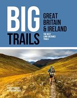
Wandelgids Great Britain & Ireland | Vertebrate Publishing
Big Trails: Great Britain & Ireland is an inspirational guide to the most iconic, spectacular and popular long-distance trails in England, Scotland, Wales, Northern Ireland, Ireland and the Isle of Man.   The twenty-five featured routes will take you across the best of the British Isles. From the South Downs Way in South-East England and across Wales' mountains in the Cambrian Way, the book delves into the heart of Scotland on the West Highland Way, along the Causeway Coast Way on Northern Ireland’s coast, and into southern Ireland on the Beara Way.   The book is designed to inspire big adventures. Rather than being carried along the route, this guide provides everything you need to plan and explore further, including a general overview of the trails, specific technical information, overview mapping, key information and stunning photography. As well as this, each route specifies approximate timings devised using the Jones–Ross formula, which allows for custom itineraries to be generat…
27,95
Wandelgids Coast to Coast the Wainwright Route | Rucksack Readers
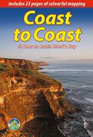
Lange afstandswandelgids van de Coast to Coast wandeling. Wandelgids met kaarten en beschrijving. op waterbestendig papier, in spiraalbinding. This challenging walk of 184 miles (296 km) crosses the north of England from St Bees on the Cumbria coast to Robin Hood’s Bay on the North Sea. It passes through three National Parks – the Lake District, Yorkshire Dales and North York Moors – with splendidly varied scenery. Many walkers complete it within 12 to 16 days, although some divide it into two separate week-long walks.   Devised by the legendary Alfred Wainwright, the Coast to Coast is justly famous as England's most popular walk. It is waymarked, has plenty of accommodation and features welcoming pubs. Both its ends and two midpoints (Kirkby Stephen and Richmond) are accessible by public transport.   The new edition features many photographs by the award-winning landscape photographer Karen Frenkel. It also has freshly commissioned mapping, which appears on 25 of its 126 pages. It co…
22,50
Wegenkaart - landkaart SC5-SC6 George to Kareedouw | Tracks4Africa
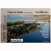
The Cape to Addo map series covers the southern parts of the Western Cape of South Africa in a series of eight highly detailed maps, printed on four sheets of A1 durable paper.   We start in Cape Town in the west and move along the southern coast through the Overberg, Winelands, Garden Route, Klein Karoo R62, Baviaanskloof to eventually arrive in the Addo National Park up to Gqeberha (Port Elizabeth) in the east.   The maps are highly detailed and well researched. Our map scale is 1:200 000 which allows us to show a lot of detail including minor gravel roads, hiking trails, farm boundaries and points of interest which are relevant to self-drive tourists.   The size of the paper is kept small enough to allow this to be the perfect road tripping map. We use Duraflex paper and print two maps per sheet of A1 paper, making this a four-sheet series. Each map sheet is individually packed in a plastic protective sleeve.   The maps are perfect for day drives, overlanding or just doing road tri…
29,95
Reisgids USA West Coast | Insight Guides
Een rijk geillustreerde reisgids met diepgaande teksten: één van de beste reisgidsen die er bestaan. Eerste deel bestaat uit een beschrijving van de unieke aspecten van de regio, daarna een deel echte reisgids en als afsluiting een deel met praktische informatie. De uitstekende informatie wordt vergezeld van prachtige foto's en heldere kaarten. Niet alleen om mee te nemen, maar ook om vooraf en zelfs achteraf weer in de stemming te komen. This Insight Guide is a lavishly illustrated inspirational travel guide to the USA West Coast and a beautiful souvenir of your trip. Perfect for travellers looking for a deeper dive into the destination's history and culture, it's ideal to inspire and help you plan your travels. With its great selection of places to see and colourful magazine-style layout, this USA West Coast guidebook is just the tool you need to accompany you before or during your trip. Whether it's deciding when to go, choosing what to see or creating a travel plan to cover key pl…
24,95

Klanten-reviews van A Girl Called Eilinora

Er zijn nog geen beoordelingen voor dit productBen jij de eerste die een review plaatst?

Meer over A Girl Called Eilinora

Productomschrijving

It is 1846, famine is gripping Ireland and nowhere is it crueller than in Mayo on the west coast...

Productspecificaties

Artikelnummer(s)
EAN
9788728285930
Webshop.nl maakt gebruik van cookies. Ga je verder op onze website, ga dan akkoord met het plaatsen van cookies en de verwerking van deze data door ons en vermelde partners.