A Country Rivalry

0
Life in the beautiful Cotswolds village of Treweham could never be described as boring, but the arrival of a documentary film crew means that things are even busier than normal......

Verkopers met dit product

Verkoper
Bezorging
Prijs
Luisterrijk.nl logo
Luisterrijk.nl
0
gratis
12,99

Anderen bekeken ook

Reisgids Scottish Island Bagging | Vertebrate Publishing
Erg mooie gids met aandacht voor 154 Schotse eilanden die de moeite waard zijn om te bezoeken.   Scottish Island Bagging by Helen and Paul Webster, founders of Walkhighlands, is a guide to the magical islands of Scotland.   Focusing on the ninety-nine islands that have regular trips or means of access for visitors, plus fifty-five other islands which have no regular transport but are still of significant size or interest, the authors have described the best ways to experience each one. Of the islands featured, many are household names – Skye, Lewis, Bute – while some, such as the isolated St Kilda archipelago and the remote Sula Sgeir, will be unknown to all but a hardcore few.   When it comes to things to see and do, the islands of Scotland have it all. Wildlife enthusiasts can watch out for otters, orcas and basking sharks, while birdwatchers in particular are spoilt: look out for the rare corncrake on Islay, sea eagles on Mull, or sight puffins, gannets, storm petrels and many othe…
26,95
Fietsgids London - Land's End Cycle Route | EOS Cycling Holidays Ltd
The guidebook contains routes from both Dover and Harwich ferry ports to London. This makes it possible to cycle around the English Channel, when also using the Plymouth link. The Dover to London route takes you though the fruit orchards of Kent, historic Canterbury and the Medway estuary with its impressive castles.   The Harwich to London route provides pleasant countryside cycling in Essex and takes you through Roman Colchester. Cycling through the heart of London, our route manages to stay away from busy roads, the occasional busy junction crossing excepted. Most of the cycling takes place on towpaths along the River Thames with spectacular views to enjoy.   You will cycle under the Tower Bridge and you'll pass the London Eye, Big Ben, the Houses of Parliament and Buckingham Palace on the way. Greenwich Park, Hyde Park and Richmond Park all provide superb green traffic-free routes. Heading west you'll cycle by Windsor Park and Windsor Castle before making your way to the Aon & Ken…
41,50
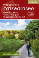
Wandelgids The Cotswold Way | Cicerone
Uitstekende wandelgids van de Cotswolds Way, waarbij naast alle noodzakelijke informatie ook gebruik gemaakt wordt van de echte topografische kaart. inclusief gidsje met routekaarten van 1:25000 (deze is hier ook los te bestellen) Guidebook to walking the 102 mile (163km) Cotswold Way National Trail between Chipping Campden and Bath, across the Cotswolds AONB. The guidebook - which includes both a guide to the route and a separate OS 1:25,000 map booklet - describes the route in both directions.   The route is described over 13 stages, each following the Cotswold escarpment, with dramatic and far-reaching views across the Severn Vale towards the Welsh hills, plunging down to visit honey-coloured villages, old market towns and the elegant and historic city of Bath. The longest of the 13 stages is 10 miles, the shortest 6 miles: these are dictated by the existence of overnight accommodation. For the determined, the trail can be walked in as little as five days.   The Cotswold Way offers…
23,50
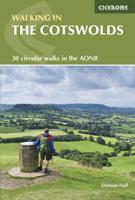
Wandelgids Walking in the Cotswolds | Cicerone
A guidebook to 30 circular walks in the Cotswolds, the largest Area of Outstanding Natural Beauty in England. Ranging from 4 to 12 miles in length, the routes are graded from easy to strenuous, offering something for every walker. Fourteen of the routes described include sections of the Cotswold Way National Trail, a 102-mile walk that winds its way from Chipping Campden to Bath.   Step-by-step route descriptions are accompanied by 1:50,000 mapping. There is plenty of information on the many points of interest passed en route, including Roman ruins, ancient stone circles, Neolithic long barrows and historic villages. Also included is a useful route table summary, information on accommodation, and details on the region’s geology, landscape, plants and wildlife.   Covering 790 square miles, the Cotswolds is home to lush green hills, picturesque valleys and beautiful beech woodlands. The impressive Edge – a remarkable limestone escarpment – offers ethereal views across the Vales of the S…
20,50
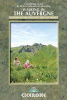
Wandelgids Walking in the Auvergne | Cicerone
Uitgebreide wandelgids van de Auvergne: goede beschrijvingen, veel keuze, kaarten wat minder goed. This handy guidebook offers the finest day walks in five different areas of the Auvergne, an often-forgotten region in central France perfect for accessible day walking in a unique and spectacular landscape. Towns such as Vichy, Clermont-Ferrand and Puy-en-Velay also offer delightful places to base yourself for that perfect walking holiday. The ridges, rocky peaks and verdant valleys of the Cantal supervolcano dominate south-western Auvergne. The centre of the region hosts the unique chain of 'puys' with their pudding bowl forms and the pristine crater lakes of the Sancy massif. In the north, the Montagne Bourbonnaise preserves a pastoral way of life which is quintessentially French while the Haute Loire's rivers and medieval abbeys reward those venturing further off the beaten track. Notes on the geology and history of points of interest passed en route help you to get the most out of y…
19,95
Wandelgids Trekking the Cotswold Way | Knife Edge Outdoor
The definitive two-way guide to the Cotswold Way: both southbound and northbound routes are described in full. Real Maps: Full Ordnance Survey mapping inside (1:25,000). All accommodation is numbered and marked on the maps. 18 different itineraries: schedules of 4, 5, 6, 7, 8, 9, 10, 11 and 12 days for hikers and runners. Includes both southbound and northbound itineraries. Difficult calculations of time, distance and altitude gain/loss are done for you. Also includes: - Detailed information on equipment and travelling light - Everything the trekker needs to know: route, costs, difficulty, weather, travel, and more - Full accommodation listings: the best inns, B&Bs and hotels - Detailed section on camping - What to see in the City of Bath - Essential info for both self-guided and guided trekkers - Information on history, plants and wildlife - Numbered waypoints linking the Real Maps to our clear descriptions The Cotswold Way travels 102 miles through the sublime scenery of the Cots…
22,50
Wandelgids 006 Pathfinder Guides Cotswolds | Ordnance Survey
180 miles of wonderful walking in idyllic, limestone countryside . . .   Take a journey on 28 beautiful walks across the Cotswolds with the OS Pathfinder Guidebooks, graded by length and ranging from 3 to 10 miles.   All walks in this book include written directions, an extract of the OS map for the area and some background on the history and natural environment you see. Most of the walks avoid busy roads and are designed to help you make the most of a holiday or day trips. There are notes on parking, pubs, and things to see en route.   The routes range from extended strolls to longer hikes, something for all levels! Each walk includes a detailed description, an OS map, GPS waypoints and notes of key features and things to see.   This is one of a series of books with great walking routes covering the most popular and scenic areas of Britain. Printed with weather-resistant covers featuring durable rounded corners, they are the perfect companion for country walking throughout Britain.  …
18,50
Wandelgids Walking the John o' Groats Trail | Cicerone
Guide to the John o' Groats Trail, a 233km walking route linking Inverness with John o' Groats on the northeast tip of mainland Britain. Much of the walking is coastal, with the northern half characterised by its spectacular seacliffs; however, there is some inland walking too, and the scenery is varied, ranging from dunes and deserted sandy beaches to beautiful woodland. With rough ground and some exposed clifftop walking, the route is suited to experienced hikers.   It takes around a fortnight to complete. The route is described in 14 stages, each of which includes: an overview map; step-by-step route description illustrated with custom mapping; details of accommodation, facilities and transport links; and information on local points of interest. While the main route description is from south to north, notes are supplied for southbound walkers.   Also included is a bonus route linking the trail with the Great Glen, for the benefit of walkers undertaking the Land's End to John o' Gro…
23,95
Wandelgids - Klimgids - Klettersteiggids Via Ferratas of the French Alps | Cicerone
This guidebook covers 66 varied via ferratas in the French Alps. The routes are spread over six areas: Geneva and the Northern Alps, Chambéry, Tarentaise and Maurienne valleys, Grenoble and Briançon, amid the Mont Blanc, Vanoise and Queyras ranges. Difficulty ranges from easy, protected routes through to exposed, technical challenges. With some of the most beautiful scenery in the world, the French Alps have long been a popular destination for a wide range of outdoor activities. In recent years, the region has seen the arrival of a growing number of via ferrata routes.   Via ferrata climbing – using fixed cables, bridges and ladders to explore terrain that is normally only accessible to experienced rock climbers – combines elements of scrambling, mountaineering and rock climbing, yet is a very distinct pursuit. Increasingly popular, recent years have seen a surge in the number of routes being established in these iconic mountains.   The routes in this guidebook range from straightforw…
25,95

Klanten-reviews van A Country Rivalry

Er zijn nog geen beoordelingen voor dit productBen jij de eerste die een review plaatst?

Meer over A Country Rivalry

Productomschrijving

Life in the beautiful Cotswolds village of Treweham could never be described as boring, but the arrival of a documentary film crew means that things are even busier than normal...

Productspecificaties

Artikelnummer(s)
EAN
9788728286173
Webshop.nl maakt gebruik van cookies. Ga je verder op onze website, ga dan akkoord met het plaatsen van cookies en de verwerking van deze data door ons en vermelde partners.