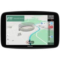



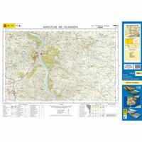
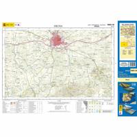
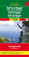


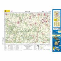

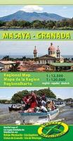
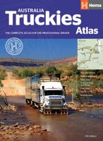
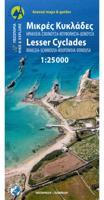
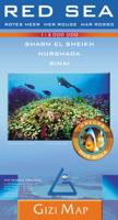
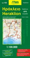


Christoffel Columbus gebruikte een 500 jaar oude kaart, zonder welke zijn reizen en missies onmogelijk zouden zijn geweest. In de wereld van vandaag zijn oude kaarten in de loop der eeuwen geëvolueerd tot GPS-systemen. Met deze systemen kunnen gebruikers interactie hebben met hun omgeving en hun locatie in realtime bepalen. Dus of je nu op straat loopt of in je auto rijdt, navigatiesoftware kan je de weg wijzen en je informeren over de kortste route naar je bestemming.
Navigatie software komt goed van pas als je een plek wilt bezoeken waar je nog nooit bent geweest. Het is altijd goed om de route te plannen voordat je op pad gaat. Deze software kan je reis van punt A naar B opmerkelijk vereenvoudigen door je bij elke stap te begeleiden. Als het gaat om het vinden van de beste software online, heb je een reeks opties om uit te kiezen. De beste fabrikanten op de markt van utility software hebben geavanceerde oplossingen ontwikkeld voor meerdere GPS-doeleinden. Aangezien er veel verschillende types beschikbaar zijn, is hier de gids die je zal helpen om de beste en juiste te kiezen. Aan het eind vind je ook een aantal tips. Dus ga je gang en ontdek het!
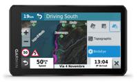
GPS heeft als hoofddoel de locatie van de gebruiker in real-time aan te geven. De meeste mensen zijn vertrouwd met eenvoudige navigatie-apps op hun telefoon en pc. Het is zelfs gemakkelijk om online gratis software te vinden die je op elk apparaat kunt installeren. Maar professionele behoeften vereisen meer functies, waarvoor je misschien een speciaal systeem nodig hebt. De beste GPS-navigatie-apps vertellen je je exacte positie op een kaart en bieden verbeterde functies. Enkele daarvan zijn locatiedeling, verkeersrapporten, ruw terrein en wandelroutes om je mobiliteit te verbeteren. Om een betrouwbaar product te kiezen, moet je overwegen waarom je het product nodig hebt en welke voordelen het product te bieden heeft.
Op aarde bevinden zich GPS-satellieten die door wetenschappers zijn gepositioneerd. Ze zenden radiofrequenties uit naar GPS-apparaten op aarde, die je op hun beurt vertellen waar je je precies bevindt. Met een smartphone of pc kun je je locatie op een kaart aanwijzen. Daarnaast bieden veel producten extra hulp, zoals aanwijzingen naar bestemmingen, spraakopdrachten en nog veel meer. Je kunt investeren in speciale GPS-software of vertrouwen op mobiele apps. Beide opties zijn even functioneel. Ongetwijfeld hebben deze navigatieprogramma's functies die je gemak van topklasse bieden.
De classificatie van de best beoordeelde producten online hangt af van hun plaatsing. Je bent bijvoorbeeld op zoek naar een navigatiesysteem voor je auto, boot, fiets of persoonlijk gebruik. In alle gevallen kun je ervoor kiezen om te investeren in ingebouwde apps of om je mobiele telefoon te gebruiken. Sommige producenten hebben zelfs producten die je op meerdere apparaten kunt aansluiten. Dit betekent dat je de software tegelijkertijd kunt gebruiken op je telefoon, pc en andere mobiele apparaten. Door de jaren heen hebben Google-applicaties de markt gedomineerd. Er zijn echter genoeg opties die je kunt bekijken voordat je er een kiest. Het komt allemaal neer op de navigatie-app met het meeste gemak.
De Google-applicatie staat bovenaan vanwege de betrouwbaarheid en het gebruiksgemak. De app combineert de camera van het apparaat met de straatweergave om de beste resultaten te bieden. Je kunt plaatsen en namen van gebouwen bekijken tijdens het plannen van je route of zelfs tijdens het ontvangen van aanwijzingen in real-time. Bovendien is de app gemakkelijk te gebruiken dankzij de gebruiksvriendelijke interface. De AI-gestuurde virtuele assistent stelt je in staat om meer te doen met behulp van spraakopdrachten. Reizigers houden van de app omdat hij zo snel reageert. Zonder twijfel is Google het toonaangevende product op de markt waarop je kunt vertrouwen. Toch moet je elk detail nauwkeurig onderzoeken voordat je er volledig op vertrouwt.
Waze navigatiesoftware is een ander goed beoordeeld product in zijn categorie vanwege de verkeerswaarschuwingsfuncties en nauwkeurigheid. Het vertrouwt op interactie van de gemeenschap om real-time verkeersgegevens en wegwaarschuwingen te bieden. Waze waarschuwt gebruikers ook voor ongevallen, flitspalen en de verkeerspolitie. Igo voor Android is ook een betrouwbaar product dat je kunt gebruiken. Het heeft 3D oriëntatiepunten en 3D stadskaarten voor meer dan 100 landen. Stel dat je op zoek bent naar een meer gespecialiseerde app, bijvoorbeeld een navigatiesysteem voor je Ipad. In dat geval kun je kijken naar topproducten zoals de Maxsea Timezero met ongelooflijke functies. Er is ook al een product op de markt dat aan je doel beantwoordt. Je hoeft alleen maar te zoeken en de productenlijst te verfijnen.
Een toerist en een vrachtwagenchauffeur kunnen een navigatie-app voor vergelijkbare doeleinden gebruiken, maar ze hebben verschillende verwachtingen. Vanuit dit perspectief moet je kijken naar de belangrijkste functies van de software om te zien of het past bij je behoeften of niet. Je moet de juiste aanpak kiezen om ervoor te zorgen dat het product dat je koopt maximaal gemak biedt. Je kunt de volgende tips toepassen om je zoektocht te begeleiden.
We hopen dat de tips je helpen om een weloverwogen beslissing te nemen. Uiteindelijk zal je doel je vertellen waarom je de software nodig hebt. Als je bijvoorbeeld vrachtwagenchauffeur bent, zullen sommige apps beter bij je passen dan andere. Of misschien ben je op zoek naar een product om je sport-, wandel- of trektochten te begeleiden. Zolang je je doel bepaalt, zul je geen probleem hebben om de beste navigatiesoftware online te vinden.
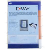
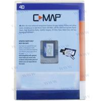
Marinesoftware verwijst naar toepassingsprogramma's die zijn ontworpen om zeelieden te helpen bij het navigeren op zee. In tegenstelling tot de oude gedrukte kaarten en een kompas, gebruiken professionele zeilers tegenwoordig navigatiesystemen om hun cruises te leiden. De navigatievaardigheden van een zeiler zijn essentieel voor het voltooien van een reis. Daarom is het van vitaal belang om maandenlang onderzoek te doen en voorbereidingen te treffen om mogelijke tegenslagen te vermijden. Maar aan de andere kant vereenvoudigt het ook de werklast van een zeiler.
De kaart van je BMW voortdurend bijwerken is cruciaal omdat de wegen elke dag veranderen. Zo kunnen tweerichtingsstraten eenrichtingsstraten worden en kunnen er nieuwe rotondes op je weg komen. Het bijwerken van uw kaart is eenvoudig. Je kunt hiervoor een dvd of USB-apparaat gebruiken. Eerst moet je een bijgewerkte versie van de kaart in de BMW database downloaden. Sluit vervolgens de USB aan of plaats de dvd met de nieuwe kaart in het station. U zult zien dat het scherm automatisch overschakelt naar het tabblad Navigatie-update. Na deze stap verloopt het proces naadloos, maar vergeet niet om je auto te laten draaien tot de update is voltooid. De update duurt ongeveer twintig tot dertig minuten.
De beste GPS is niet ver buiten je bereik. In plaats van sociale media en algemene zoekmachines te gebruiken, kun je alles wat je nodig hebt zoeken op ons speciale online platform. Je vindt er de beste navigatiesoftware voor je auto, topnavigatiesoftware voor Android-apparaten en een brede categorie producten. Het enige wat u hoeft te doen, is onze productzoekmachine verkennen. Hier kun je verkennen, vergelijken, beoordelingen lezen en zonder compromissen de beste producten kiezen.
Reizen geeft smaak aan ons leven omdat we de wonderen kunnen ervaren die de wereld te bieden heeft. Maar het veranderende landschap kan uitdagingen met zich meebrengen als je een plaats bezoekt die je niet kent. Daarom is het essentieel om te vertrouwen op betrouwbare systemen om je de weg te wijzen. Dat is wanneer navigatiesystemen in beeld komen. Verken Webshop.nl vandaag nog om alle variaties te ontdekken en de juiste keuze te maken.