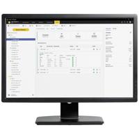
Fluke FLK-TRUTEST-LITE Meetsoftware Geschikt voor merk Fluke
De Fluke TruTest-software vereenvoudigt het gegevensbeheer en de rapportage voor apparaatcontrole ten opzichte van gebruikelijke procedures. Ongeacht of u apparaten in een kantoor controleert,...
Conrad NL 3.5
389,-

Benning 047002 Software BENNING PC-WIN ST 750-760 Software 1 stuk(s)
Conrad NL 3.5
385,-

Siemens 6AV6362-1BA00-0AH0 PLC-software
SIMATIC WinCC/Web Navigator, diagnostische Client-licentie, optie v. WinCC vanaf V7.4 en WinCC Prof. AB V14, runtime-software, licentie voor één cel, licentiesleutel download Ontvanger E-mailadres...
Conrad NL 3.5
4.215,-
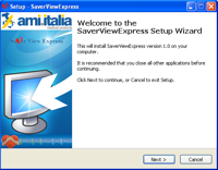
Ami Italia Smarty Saver CD-ROM Saver View Express
Met behulp van de CD-ROM download je de juiste software om de inzetgegevens van de Smarty Saver AED op te kunnen slaan en te kunnen analyseren.
AEDvoordelig.nl
64,31
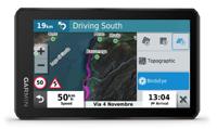
GARMIN Zumo XT, Motor GPS
Zumo XT Ride with team zūmo Het robuuste zūmo XT navigatietoestel voor motoren is gemaakt voor avontuur. Het ultradunne 5,5-inch scherm is handschoenvriendelijk, regenbestendig en laat je op avontuurlijke wegen rijden, zowel op als buiten de gebaande paden. Ultrahelder scherm:...
RAD NL 4.7
409,99
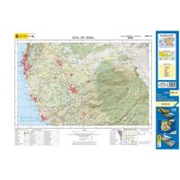
Topografische kaart 1096-I/II Guía de Isora (Tenerife) | CNIG - Instituto Geográfico Nacional1
DeZwerver.nl 4.1
7,95
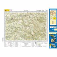
Topografische kaart 124-IV Samos | CNIG - Instituto Geográfico Nacional1
DeZwerver.nl 4.1
7,95
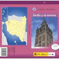
Stadsplattegrond Sevilla y su entorno especial | CNIG - Instituto Geográfico Nacional
DeZwerver.nl 4.1
8,95

Ergens onderweg
Navigatie voor een vloeiend leven
Luisterrijk.nl
12,99
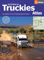
Wegenatlas Australia Truckies Atlas | Hema Maps
DeZwerver.nl 4.1
54,95
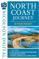
Wegenkaart - landkaart in your pocket North Coast Scotland NSC500 | Nicolson
The North Coast Journey In Your Pocket is the essential guide to driving the 500 miles around the Scottish Coast. The front has a full route overview map with main tourist attractions. Ten detailed routes are shown on the reverse clearly showing petrol stations, EV charging p...
DeZwerver.nl 4.1
7,95

Stadsplattegrond 74 Sevilla | Michelin
Dit is een uitgebreide en heldere stadsplattegrond van Sevilla met compleet straatnamenregister en o.a. parkeergarages en eenrichtingsverkeerpijlen. Zoals gebruikelijk goed leesbaar!
DeZwerver.nl 4.1
9,95
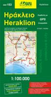
Stadsplattegrond 153 Heraklion | Orama
DeZwerver.nl 4.1
9,95
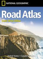
Wegenatlas USA Canada Mexico Road Atlas | A4-Formaat | National Geographic
National Geographic's Road Atlas: Scenic Drives Edition, is the ideal companion for the next time you hit the road for an unforgettable road trip. Includes up-to-date road maps for all 50 U.S. States, plus Canada, Mexico, and Puerto Rico. Major cities and metropolitan areas a...
DeZwerver.nl 4.1
17,95
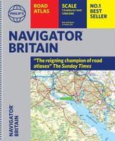
Wegenatlas Navigator Britain - Engeland en Schotland 1:100.000 | Ringband | Philip's Maps
Bijzonder gedetaileerde wegenatlas van Engeland en Schotland op schaal 1:100.000 (met het noorden van Schotland 1:200.000). Alle wegen, bezienswaardigheden, National Trails, campings ... noem maar op en je vindt het in deze atlas. Voorzien van een stevige ringband, iets grot...
DeZwerver.nl 4.1
37,95

Waterkaart Caribbean Cruising | ITMB
The Caribbean Sea is one of the most popular cruising destinations in the world. This colourful double-sided map starts just north of Orlando/Tampa in order to show the northernmost Bahamian islands and south as far as the Panama Canal at Colon and the coast of Venezuela. The...
DeZwerver.nl 4.1
14,95

Wegenkaart - landkaart Deutschland Nord - Noord Duitsland | High 5 Edition
The first water-resistant roadmap with direct access to useful additional information from the Internet Northern Germany in a scale of 1:550,000 shown on a practical map; inclusive of the High 5 Edition app technology for calling up additional travel information and many ot...
DeZwerver.nl 4.1
12,95

Stadsplattegrond Plan de ville - Street Map Napels | Michelin
DeZwerver.nl 4.1
12,95

Wegenkaart - landkaart 584 Southeastern USA - Zuidoost USA | Michelin
Wegenkaart van zuidoostelijk Amerika (zuid vanaf Torreon en Saltillo, west El Paso en Albuquerque, noord in een lijn van Denver naar Washington DC. Primary & secondary road networks are clearly marked out with indications of the number of lanes, intermediate distances and var...
DeZwerver.nl 4.1
12,95
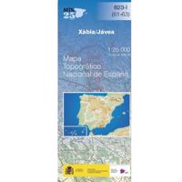
Topografische kaart 823-I Xábia / Jávea | CNIG - Instituto Geográfico Nacional
DeZwerver.nl 4.1
7,95
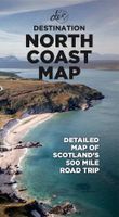
Wegenkaart - landkaart North Coast Road Trip Map | Destination Earth
This North Coast road trip map is the essential tool that will guide you through the breathtaking landscapes, stunning coastal views, and enchanting villages of the North Coast 500 in Scotland. Designed by travel enthusiasts, for travel enthusiasts, our map is more than just ...
DeZwerver.nl 4.1
13,-
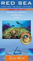
Wegenkaart - landkaart Red Sea Rode Zee (Sharm el Sheikh, Hurghada, Sinai ) | Gizi Map
Red Sea at 1:2,000,000 from Gizi Map with lists of diving sites and wrecks along its shores, an enlargement of southern Sinai and its coastal waters, plus street plans of Sharm el Sheikh and Hurghada with tourist information. Coverage extends from Port Said and the Suez Canal...
DeZwerver.nl 4.1
15,95
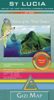
Wegenkaart - landkaart St Lucia | Gizi Map
Lovely indexed road map of St. Lucia, with street plans of central Castries and the holiday complex at Anse Chastanet. Bright altitude colouring and vivid relief shading provide an excellent picture of the islands topography. Mangroves and coral reefs are marked. Road network...
DeZwerver.nl 4.1
15,95
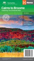
Wegenkaart - landkaart Savannah Way - Cairns to Broome | Hema Maps
Detailkaart van een deel van Australië. Zeer goed leesbaar, met naast de topografische details veel symbolen waarmee allerhande toeristische zaken worden aangeduid als campsites, nationale parken, attracties, wandelmogelijkheden etc. Find out all you need to know about travel...
DeZwerver.nl 4.1
17,50
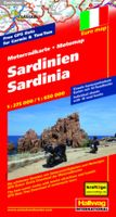
Wegenkaart - landkaart Motomap Motorkaart Sardinië - Sardinie | Hallwag
Die schönsten Strecken mit Sehenswürdigkeiten und Herbergen. GPS-Daten: Gratis Download der Motorradtouren. Einzeln herausnehmbare Karten mit 16 Roadbooks Sardinia Motorbike Map Set from Hallwag with individual waterproof and tear-resistant maps for 16 day tours, plus an over...
DeZwerver.nl 4.1
19,50

Topografische kaart 1058-IV Las Marinas | CNIG - Instituto Geográfico Nacional
DeZwerver.nl 4.1
7,95
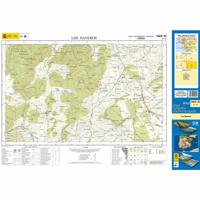
Topografische kaart 1069-IV Los Naveros | CNIG - Instituto Geográfico Nacional1
DeZwerver.nl 4.1
7,95
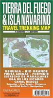
Wegenkaart - landkaart - Wandelkaart trekkingmap Tierra del Fuego & Isla Navarino | Zagier & Urruty
Kaart gebaseerd op satellietfoto's met ingetekende hoogtelijnen, campsites, routes en hutten. Bedenk dat het allemaal wel heel globaal is, het is niet de meest ideale schaal om op te lopen. The Argentine and Chilean sectors of Tierra del Fuego. Satellital relief, winter resor...
DeZwerver.nl 4.1
17,95

Wegenkaart - landkaart South Pacific Cruising & Samoa | ITMB
Een overzichtskaart van de zuidelijke Stille Oceaan met de cruise routes tussen de verschillende eilanden aangegeven. Op de achterzijde een overzichtskaart van Samoa This is a new venture for ITMB. Cruising is a rapidly-growing segment of the travel industry, experiencing dou...
DeZwerver.nl 4.1
13,95
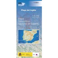
Topografische kaart 1109-I Playa del Inglés (Gran Canaria) | CNIG - Instituto Geográfico Nacional
DeZwerver.nl 4.1
7,95
1 - 30 van 80
