webshop.nl
Categorieën
  Sluiten

Meer ITMB

Wegenkaart - landkaart South America Southern - Zuid Amerika, deel Zui

0
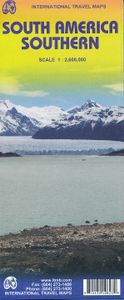
1:2,600,000 scale 6th Edition, double-sided printing. This map shows the southern third of South America in better detail than any other map.gIt starts at northern Chile, southern Paraguay, and central Brasil, and moves south to cover all of Argentina and almost all of Chile. Side 1 is a detailed road map of the region as far south as Buenos Aires....

Webshops met dit product

Webshop
Bezorging
Prijs

Anderen bekeken ook

Wegenkaart - landkaart South America Southern - Zuid Amerika, deel Zui
1:2,600,000 scale 6th Edition, double-sided printing. This map shows the southern third of South America in better detail than any other map.gIt starts at northern Chile, southern Paraguay, and central Brasil, and moves south to cover all of Argentina and almost all of Chile. Side 1 is a detailed road map of the region as far south as Buenos Aires. Side 2 covers Patagonia, the coast of Chile, and Tierra del Fuego. Map size: 27"X39"
13,95
Wegenkaart - landkaart Patagonië en Zuid Chili - Patagonia - Chile sou
Een degelijke wegenkaart met aanduidingen van o.a. nationale parken, vliegveld, benzinepomp, dirt-roads. Als overzichtskaart goed te gebruiken.   Zuid Chili schaal 1:1.770.000 Patagonië schaal 1:2.200.000   This is a brand new map for ITMB and concentrates on the fast-changing southern portion of Chile (known as the Austral) and Patagonia, which technically only exists in southern Argentina, but in reality can't be shown easily on a map without including the same area in Chile. Thus, one side concentrates on Chile south of Los Angeles (yes, there's one there too!) in two long strip maps that go all the way to Cape Horn (or Hoorn, in Dutch) south of Tierra del Fuego. Although it has nothing to do with this part of Chile, we have also included the main portion of touristic Easter Island, an inset of what is popularly referred to as Robinson Crusoe Island (Alexander Selkirk was marooned here for a number of years, and is the real-life model of the fictional Crusoe) and an inset map of Ush…
13,95
Wegenkaart - landkaart 3014 Adventure Map India South - Zuid | Nationa
Wegenkaart van Zuid India met vermelding van veel bezienswaardigheden, nationale parken en attrakties. Watervast en scheurvast. National Geographic's India South Adventure Map is designed to meet the unique needs of adventure travelers with its durability and detailed, accurate information. The map includes the locations of thousands of cities and towns with a user-friendly index, as well as a clearly marked road network complete with distances and designations for highways, major routes and secondary roads.   The India South Adventure Map differs from a traditional road map for it includes hundreds of points of interest that highlight the diverse and unique destinations found in this region. The map features UNESCO World Heritage sites, archaeological sites, wildlife sanctuaries, Hindu and Buddhist temples, sacred sites, forts, palaces, ruins, waterfalls, caves and other points of interest, making it an invaluable resource to travelers hoping to experience all the history and culture …
17,50
Wegenkaart - landkaart Southern Alberta & Southern British Columbia |
ITMB, being based in Vancouver, BC, understandably has a local/regional market for our map line. We have a map of Western Canada, as well as an atlas, a very nice map of BC itself, a map of the south half of BC, and a map of part of BC combined with Washington State. What we did not have, until now, was a map covering the most touristically-visited part of all of Canada – namely, the southern halves of both British Columbia and its neighbour, Alberta, with a small amount of Washington State, Idaho, and Montana (to assist those heading north and needing to know about border crossings). Therefore, ITMB is pleased to announce the release of Southern BC and Alberta. Side One covers BC from the US border (with a carry-on to Seattle) north to Prince George and east to the Alberta border, with a carry-on to Calgary. All of Vancouver Island, the Okanagan Valley, and the Rock Mountain National Parks of Banff and Jasper, are included. The map is rich with wilderness campsite (almost 1,000 are sh…
13,95
Wegenkaart - landkaart South America north- Zuid Amerika noordelijke d
Dekt het noordelijke deel van Zuid Amerika tot aan de grens van Chili - Paraguay - Rio de Janeiro. South America North Travel Reference Map (replacing South America North West) is brand new and is another brilliant cartographic coup for Lan and our production staff. She has come up with a way to preserve the wonderfully detailed artwork of the original version first published in 1980 by Kevin Healey, the co-founder of ITMB, and subsequently published by ITMB in four succeeding updated editions. We retired the artwork several years ago, feeling that the market preferred more detailed country maps, but repeated requests for a map of this nature convinced us to have a look at it again. This map replaces the former map of North West South America at a better scale than was previously thought possible and with the additional benefit of covering ALL of the northern half of South America on a double sided sheet. We have also re-introduced the capsule comments so loved by map aficionados in pa…
13,95
Wegenkaart - landkaart Planning Map South America - Zuid-Amerika | Lon
Durable and waterproof, with a handy slipcase and an easy-fold format, Lonely Planet's South America Planning Map helps you explore with ease. Get more from your map and your trip with images and information about top attractions, itinerary suggestions and themed lists. With this easy-to-use, full-color map in your back pocket, you can truly get to the heart of South America - so begin your journey now! Easy-fold format Handy slipcase Full color and easy to use Beautiful imagery Tailored itineraries Can't-miss highlights Detailed town index Themed lists Covers: Argentina, Bolivia, Brazil, Chile, Colombia, Ecuador, French Guiana, Guyana, Paraguay, Peru, Suriname, Uruguay, Venezuela
10,95

Klanten-reviews van Wegenkaart - landkaart South America Southern - Zuid Amerika, deel Zui

Er zijn nog geen beoordelingen voor dit productBen jij de eerste die een review plaatst?

Meer over Wegenkaart - landkaart South America Southern - Zuid Amerika, deel Zui

Productomschrijving

1:2,600,000 scale 6th Edition, double-sided printing. This map shows the southern third of South America in better detail than any other map.gIt starts at northern Chile, southern Paraguay, and central Brasil, and moves south to cover all of Argentina and almost all of Chile. Side 1 is a detailed road map of the region as far south as Buenos Aires. Side 2 covers Patagonia, the coast of Chile, and Tierra del Fuego. Map size: 27"X39"

Productspecificaties

Artikelnummer(s)
Brand
ITMB
Webshop.nl maakt gebruik van cookies. Ga je verder op onze website, ga dan akkoord met het plaatsen van cookies en de verwerking van deze data door ons en vermelde partners.