webshop.nl
Categorieën
  Sluiten

Meer ITMB

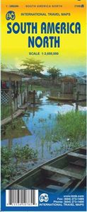
Wegenkaart - landkaart South America north- Zuid Amerika noordelijke d

0
Dekt het noordelijke deel van Zuid Amerika tot aan de grens van Chili - Paraguay - Rio de Janeiro. South America North Travel Reference Map (replacing South America North West) is brand new and is another brilliant cartographic coup for Lan and our production staff. She has come up with a way to preserve the wonderfully detailed artwork of the orig...

Webshops met dit product

Webshop
Bezorging
Prijs

Anderen bekeken ook

Wegenkaart - landkaart South America north- Zuid Amerika noordelijke d
Dekt het noordelijke deel van Zuid Amerika tot aan de grens van Chili - Paraguay - Rio de Janeiro. South America North Travel Reference Map (replacing South America North West) is brand new and is another brilliant cartographic coup for Lan and our production staff. She has come up with a way to preserve the wonderfully detailed artwork of the original version first published in 1980 by Kevin Healey, the co-founder of ITMB, and subsequently published by ITMB in four succeeding updated editions. We retired the artwork several years ago, feeling that the market preferred more detailed country maps, but repeated requests for a map of this nature convinced us to have a look at it again. This map replaces the former map of North West South America at a better scale than was previously thought possible and with the additional benefit of covering ALL of the northern half of South America on a double sided sheet. We have also re-introduced the capsule comments so loved by map aficionados in pa…
13,95
Wegenkaart - landkaart North America - Noord Amerika | National Geogra
• Waterproof • Tear-Resistant • Reference Map   Expertly researched and designed, National Geographic's North America Flags & Facts Map is the authoritative map of North America by which other reference maps are measured. The map side includeds a political map showing countries, cities and other landmarks and a physical map shows the landforms such as mountain ranges and rivers.   Clearly defined boundaries, major cities, and physical features Hundreds of place names carefully placed to maintain legibility in heavily populated areas Includes North America and adjacent regions within Asia and South America Detailed physical map of North America with mountain ranges, plains, lakes, and rivers Flags and facts with detailed information about cultural and physcial attributes Printed in the U.S.A. on extremely durable, waterproof, and tear-resistant material This Reference Map is printed on durable synthetic paper, making it waterproof, tear-resistant and tough — capable of withstanding the …
17,50
Wegenkaart - landkaart South America - Zuid Amerika | ITMB
Een degelijke kaart met aanduidingen van o.a. nationale parken, vliegveld, benzinepomp, dirt-roads en kleine plattegrond van hoofdstad. Als overzichtskaart goed te gebruiken. ITMB is very pleased to release a new, digitally-prepared, double-sided map of South America. It covers the entire continent in great detail and has been able to capture the information on the 'old' map, while using the expanded scale of the new map to add and enhance countless details that were crammed on to the earlier editions or for which there was inadequate room to include. This is the most detailed continental map of this part of the world ever published. Legend Includes: Railways, ferry routes, roads by classification, international and domestic airports, rivers, lakes, points of interest, archaeological sites, beaches, lighthouses, mines, glaciers, volcanoes, national parks and other information.
13,95
Wegenkaart - landkaart Korea, North & South | ITMB
Een degelijke kaart met aanduidingen van o.a. nationale parken, vliegveld, benzinepomp en dirt-roads. Als overzichtskaart goed te gebruiken. Met Noord Korea, schaal 1:830.000, aan een kant en op de andere zijde Zuid Korea, schaal 1:550.000. This is a brand new title for ITMB, combining North and South Korea into one double-sided map focusing on the entire Korean Peninsula rather than its political components. The peninsula is undergoing a lot of change at the moment, and no one knows the ultimate outcome. North Korea seems interested in opening itself somewhat to South Koreans, and even if steps to date seem like baby ones, tensions between north and south seem cordial at the moment. For the time being, this map replaces our separate map of North Korea, as changing conditions makes it too risky for us to re-do our North Korea title until its future path is clearer. However, although this map also shows South Korea in good detail, we will continue marketing our Seoul and South Korea map…
13,95
Wegenkaart - landkaart South America - Zuid Amerika | ITMB
Een degelijke kaart met aanduidingen van o.a. nationale parken, vliegveld, benzinepomp, dirt-roads en kleine plattegrond van hoofdstad. Als overzichtskaart goed te gebruiken. ITMB is very pleased to release a new, digitally-prepared, double-sided map of South America. It covers the entire continent in great detail and has been able to capture the information on the 'old' map, while using the expanded scale of the new map to add and enhance countless details that were crammed on to the earlier editions or for which there was inadequate room to include. This is the most detailed continental map of this part of the world ever published. Legend Includes: Railways, ferry routes, roads by classification, international and domestic airports, rivers, lakes, points of interest, archaeological sites, beaches, lighthouses, mines, glaciers, volcanoes, national parks and other information.
13,95
Wegenkaart - landkaart South America and Antarctica | National Geograp
• Waterproof • Tear-Resistant • Reference Map   Expertly researched and designed, National Geographic's South America and Antarctica Flags & Facts Map is the authoritative map of South America by which other reference maps are measured. The map side includeds a political map showing countries, cities and other landmarks and a physical map shows the landforms such as mountain ranges and rivers. The Flags & Facts side includes a combined political and physical map of Antarctica.   Clearly defined boundaries, major cities, and physical features Hundreds of place names carefully placed to maintain legibility in heavily populated areas Includes South America and Antarctica and adjacent regions within North America Detailed physical map of South America with mountain ranges, plains, lakes, and rivers Flags and facts with detailed information about cultural and physcial attributes Printed in the U.S.A. on extremely durable, waterproof, and tear-resistant material This Reference Map is printed…
17,50
Wandkaart - Magneetbord Zuid Amerika - South America political, 120 x
Fraaie politieke kaart van het continent, waarbij vooral de politieke aspecten heel duidelijk te lezen zijn. Alle landen hebben verschillende kleuren, steden en belangrijke verbindingen zijn goed te vinden.   De kaart wordt in deze versie gelijmd op een plaat, voorzien van een mooie aluminium lijst en een ophangsysteem wordt meegeleverd. Daarnaast krijgt u een bakje bijgeleverd dat u er aan kunt bevestigen voor pennen, stiften of magneetjes.   Maps International's South America political wall map shows all countries in South America from Venezuela and the Grenadine Islands down to Argentina and the most Southerly points of Chile and the Falkland Islands.    This political wall map of South America features countries marked in different colours, with international borders clearly shown. The map's key shows the flags from the countries displayed in this map. This South American political wall map also contains city population detail, capital cities and all the major towns and cities in t…
269,-

Klanten-reviews van Wegenkaart - landkaart South America north- Zuid Amerika noordelijke d

Er zijn nog geen beoordelingen voor dit productBen jij de eerste die een review plaatst?

Meer over Wegenkaart - landkaart South America north- Zuid Amerika noordelijke d

Productomschrijving

Dekt het noordelijke deel van Zuid Amerika tot aan de grens van Chili - Paraguay - Rio de Janeiro. South America North Travel Reference Map (replacing South America North West) is brand new and is another brilliant cartographic coup for Lan and our production staff. She has come up with a way to preserve the wonderfully detailed artwork of the original version first published in 1980 by Kevin Healey, the co-founder of ITMB, and subsequently published by ITMB in four succeeding updated editions. We retired the artwork several years ago, feeling that the market preferred more detailed country maps, but repeated requests for a map of this nature convinced us to have a look at it again. This map replaces the former map of North West South America at a better scale than was previously thought possible and with the additional benefit of covering ALL of the northern half of South America on a double sided sheet. We have also re-introduced the capsule comments so loved by map aficionados in past years. This map is ideal for travelers concentrating their activities on this part of South America. It is quite clear for a map of this scale, yet it contains a tremendous amount of information. It also graphically shows how few motorway-type roads there are in this part of the world. Legend Includes: Roads by classification, Rivers, Lakes, Glaciers, Airports, Ferries, Point of Interests, Beaches, Ruins, Parks, Forests, Mines, and more.

Productspecificaties

Artikelnummer(s)
Brand
ITMB
Webshop.nl maakt gebruik van cookies. Ga je verder op onze website, ga dan akkoord met het plaatsen van cookies en de verwerking van deze data door ons en vermelde partners.