webshop.nl
Categorieën
  Sluiten

Wegenkaart - landkaart Scotland - Schotland | Collins

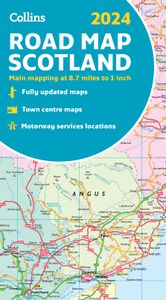
Full-colour map of Scotland at 8.7 miles to 1 inch, with clear road network and administrative areas shown in colour. The map covers the whole of Scotland and part of Northern England conveniently on one side, and is ideal for reference or route planning. The map shows the road network in detail for easy route planning.   It is ideal for business u...
11,50

Webshops met dit product

Webshop
Bezorging
Prijs

Klanten-reviews van Wegenkaart - landkaart Scotland - Schotland | Collins

Er zijn nog geen beoordelingen voor dit productBen jij de eerste die een review plaatst?

Meer over Wegenkaart - landkaart Scotland - Schotland | Collins

Productomschrijving

Full-colour map of Scotland at 8.7 miles to 1 inch, with clear road network and administrative areas shown in colour. The map covers the whole of Scotland and part of Northern England conveniently on one side, and is ideal for reference or route planning. The map shows the road network in detail for easy route planning.   It is ideal for business users also, with its political colouring of local council areas. Main features: Fully updatedAdministrative areas shown in colourClear, detailed road network and road distancesTown and city names, rivers, railway lines and canals are clearly shown7 city/town centre street plans showing places of interestIndex to place namesMileage chartCar ferry routesKey in English, French and German
Webshop.nl maakt gebruik van cookies. Ga je verder op onze website, ga dan akkoord met het plaatsen van cookies en de verwerking van deze data door ons en vermelde partners.