webshop.nl
Categorieën
  Sluiten

Meer ITMB

Wegenkaart - landkaart Russia west & St. Petersburg | ITMB

0
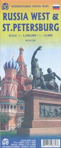
Overzichtskaart van West Rusland tot aan de Oeral op schaal 1:3,2m - Moskou in het midden van de kaart met stadsplattegrond van Sint Petersburg, schaal 1:14.000, en een centrumskaartje van Moskou. Wegenkaart met veel plaatsen en wegen, spoorlijnen en rivieren, hoogten, lengte- en breedtegraden.   Russia West Travel Reference Map 1:3,200,000 - ITMB ...

Webshops met dit product

Webshop
Bezorging
Prijs

Anderen bekeken ook

Wegenkaart - landkaart Russia west & St. Petersburg | ITMB
Overzichtskaart van West Rusland tot aan de Oeral op schaal 1:3,2m - Moskou in het midden van de kaart met stadsplattegrond van Sint Petersburg, schaal 1:14.000, en een centrumskaartje van Moskou. Wegenkaart met veel plaatsen en wegen, spoorlijnen en rivieren, hoogten, lengte- en breedtegraden.   Russia West Travel Reference Map 1:3,200,000 - ITMB ITMB has prepared a map that is centred on Moscow and radiates outwards. Due to the projection necessary for a map close to the North Pole, St. Petersburg and Murmansk are at the top of the map, Rostov and the Black Sea are in the southwest corner, and the Ural Mountains bless the southeast portion of the map. The front side has an excellent inset of Moscow and the reverse a city centre map of St. Petersburg, along with the remaining portion of western Russia and the place names index.   Legend includes: Roads by classification, Boundaries, Highways, Major Roads, Secondary and other Roads,Volcanic Cultural Centres, Restaurants, Museums, Citie…
13,95
Wegenkaart - landkaart Kamchatka Peninsula & Russia Far east | ITMB
Een degelijke kaart met aanduidingen van o.a. nationale parken, vliegveld, benzinepomp, dirt-roads en kleine plattegrond van hoofdstad. Als overzichtskaart goed te gebruiken. Schaal: Kamchatka 1 : 1,700.000 & Eastern Siberia 1 : 3.600.000 This is the most recently released title in our Russia series. In this revised edition, we have expanded the area of coverage to include the portion of Russia known as the Far East Republic and the eastern portions of Siberia (in January, we released Siberia itself). Lets start with the Kamchatka peninsula itself. This is a very interesting adventure travel destination, famous for its geothermal geysers and its isolation from the rest of Russia. There is only one city of any size, Petropavlovsk Kamchatsky (which I genuinely hope is colloquially known as PK), the capital and location of the peninsula only significant airport. We have included an inset map of the city. We also include a map of the famous Valley of Geysers (south of Klyuchi). Interesting…
13,95
Wegenkaart - landkaart Cuba West | ITMB
Een degelijke wegenkaart met aanduidingen van o.a. nationale parken, vliegveld. Als overzichtskaart goed te gebruiken. his is a brand new title for ITMB and reflects the growing interest in travel to Cuba resulting from improved relations with the USA. Licenses to fly into the country from a dozen cities have already been approved; 60 more are awaiting approval. All are for flights into Havana and Varadero airports – in other words, the western half of the country. ITMB already has an exceptionally good map of the entire country. We also have a separate map of Havana. This map expands the scale and opens the information for the western half of the island nation as a double-sided map, with the portion west of Havana (La Habana) to Pinar del Rio province in the far west and south to the Isla de la Juventud (better known, but mis-named, as the Bay of Pigs Invasion Site). This side also has an excellent map of the Varadero beach resort area as an inset, and a map of greater Havana. The oth…
13,95
Wegenkaart - landkaart Egypt & Cairo | ITMB
Following the so-called Arab spring of a few years ago, northern Africa experienced much turbulence. Egypt experienced the overthrow of the government, the installation of a radical religious-oriented replacement, and the installation of military governance. Tourism plummeted. Most map publishers discontinued their maps of the country. Five years later, Egypt has stabilized and tourism is growing. We feel that the time is right to re-introduce our ITMB map of Egypt. This version focuses on the portions of the country that have been re-opened for tourism, which means from the Mediterranean coastline south to the Aswan Dam. The portion further south remains closed for the moment, as is the border crossing with Sudan. We have also been forced to leave off the Great Sand Sea and the Western Desert portions for the same reason of unrest, as the border areas with Libya remain very unstable. However, we have provided a large inset map of Egypt, covering everything, in the area of desert. We h…
13,95
Wegenkaart - landkaart Japan North & Hokkaido | ITMB
Een degelijke kaart met aanduidingen van o.a. nationale parken, vliegveld, benzinepomp, dirt-roads en kleine plattegrond van hoofdstad. Als overzichtskaart goed te gebruiken. In one sense, this is a brand new map, in that the artwork is all brand new. In another sense, it is our map of Hokkaid re-worked into a more marketable format. In any case, it is a very much-needed sectional map of that portion of Japan from Tokyo northwards. Hokkaido is actually one of the most interesting parts of Japan to visit. The island was opened to settlement only after the Ameicans forced Japan to allow contacts with foreign countries in 1868, thanks to Admiral Peary and Gunboat Diplomacy. Hokkaido has been relatively untouched by Japan’s rush to economic dominance, so is the country’s skiing capital in winter and the part of Japan most similar to America. An inset map of Sapporo is included. The other side shows the main island of the country from Nagoya and Toyama (which are considerably west of Tokyo)…
13,95
Wegenkaart - landkaart Australia South & Northern Territory | ITMB
Australia was one of the first countries ITMB published, back in the 1980s, albeit a licensed version. Our own original artwork was completed in the mid-1990s, but until recently, we have not focused on sectional maps of the country based on individual states. In 2019, we published Brisbane and Queensland, and Sydney and New South Wales. Now, we are issuing the ‘middle’ states of South Australia and Northern Territory to provide better coverage of these important parts of Australia at a better scale than a country map could provide. South Australia can be thought of as having two parts; the fertile farming economy surrounding Adelaide in the south and the much more arid northern portion. The road network in the south tends to be well developed, with paved roads going more or less east-west to NSW and WA. Northerly roads tend to be gravel or dirt, such as the Birdville Track, and the north-westerly roads tend to pass through land ceded to aboriginals and require permits. Northern Territ…
13,95

Klanten-reviews van Wegenkaart - landkaart Russia west & St. Petersburg | ITMB

Er zijn nog geen beoordelingen voor dit productBen jij de eerste die een review plaatst?

Meer over Wegenkaart - landkaart Russia west & St. Petersburg | ITMB

Productomschrijving

Overzichtskaart van West Rusland tot aan de Oeral op schaal 1:3,2m - Moskou in het midden van de kaart met stadsplattegrond van Sint Petersburg, schaal 1:14.000, en een centrumskaartje van Moskou. Wegenkaart met veel plaatsen en wegen, spoorlijnen en rivieren, hoogten, lengte- en breedtegraden.   Russia West Travel Reference Map 1:3,200,000 - ITMB ITMB has prepared a map that is centred on Moscow and radiates outwards. Due to the projection necessary for a map close to the North Pole, St. Petersburg and Murmansk are at the top of the map, Rostov and the Black Sea are in the southwest corner, and the Ural Mountains bless the southeast portion of the map. The front side has an excellent inset of Moscow and the reverse a city centre map of St. Petersburg, along with the remaining portion of western Russia and the place names index.   Legend includes: Roads by classification, Boundaries, Highways, Major Roads, Secondary and other Roads,Volcanic Cultural Centres, Restaurants, Museums, Cities, Natural World Heritages,International and Domestic Airports, Point of Interests, Medical Facilities,View points, Banks, Hotels, Border Crossing,Hospitals and much more

Productspecificaties

Artikelnummer(s)
Brand
ITMB
Webshop.nl maakt gebruik van cookies. Ga je verder op onze website, ga dan akkoord met het plaatsen van cookies en de verwerking van deze data door ons en vermelde partners.