webshop.nl
Categorieën
  Sluiten

Meer Hema Maps

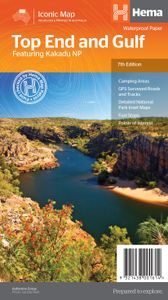
Wegenkaart - landkaart Iconic Map Top End and Gulf | Hema Maps

0
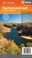
This regional waterproof map of the Top End and Gulf is ideal for discovering the northern parts of Australia's NT by 4WD. It includes a main map of the Darwin region, Judbarra / Gregory National Park, Nhulunbuy, Keep River National Park and Boodjamulla (Lawn Hill) National Park.   There is additional tourist information for Arnhem Land, the Roper ...

Webshops met dit product

Webshop
Bezorging
Prijs

Anderen bekeken ook

Wegenkaart - landkaart Iconic Map Top End and Gulf | Hema Maps
This regional waterproof map of the Top End and Gulf is ideal for discovering the northern parts of Australia's NT by 4WD. It includes a main map of the Darwin region, Judbarra / Gregory National Park, Nhulunbuy, Keep River National Park and Boodjamulla (Lawn Hill) National Park.   There is additional tourist information for Arnhem Land, the Roper River trek, Darwin region, Douglas-Daly district, Nature’s Way, Victoria Highway, Katherine Region and the Stuart Highway Region.   PRODUCT FEATURES   GPS surveyed roads and tracks Fuel stops Self-drive 4WD tracks Camping areas Historic sites Detailed National Park inset maps WHAT'S NEW IN THIS EDITION:   New edition, new layout New cartographic map specifications All inset maps are now provided in a better scale
15,95
Wegenkaart - landkaart South West Western Australia | Hema Maps
Hema's South West Western Australia Map features unequalled road and track information for this picturesque corner in Australia's largest state. A regional map for discovering South West Western Australia (WA). On the reverse side of the map are detailed inset maps of Nambung National Park, Avon Valley National Park, Lane Poole Reservation, the South West Corner, Stirling Range National Park, D, Entrecastreaux National Park and Albany Coast. Also included is tourist information for the Coral Coast, Perth, Avon Valley, the Great Southern Region, Peel, Blackwood River Valley, the Southern Forests, the Margaret River region and the Southern Coast.   The southwestern portion of Western Australia has a spectacular coastline, great surfing beaches, flowing rivers, tall forests, wineries, farms, quaint towns, bustling cities and numerous other attractions. While forest communities remain quiet, the coastal area from Bunbury to Margaret River and Augusta bursts at the seams on long weekends…
15,95
Wegenkaart - landkaart Explorer Map Top End National Parks Kakadu, Lit
Mooie, duidelijke kaart van een aantal prachtige natuurparken in het Noorden van Australië. A regional map that features Litchfield (1:160,000), Katherine Gorge and Kakadu (1:350,000) national parks. A Darwin region map is included (1:850,000) along with extensive tourist information for Darwin and the surrounding region, Arnhem Highway to Kakadu, Mary River, Stuart Highway to Katherine, Litchfield National Park, Katherine Gorge (Nitmiluk) National Park and Kakadu National Park. Also included are national park facility listings in addition to contact details for accommodation and visitor centres in the region.       Key Features  National Parks facility listing Popular tourist routes Campsites & rest areas Tourist information  Key Specifications Edition: 2nd   Publication Date: 01/11/14   Scale: 1:850,000 & 1:160,000   Folded size (WxHxD): 140mm x 250mm x 3mm   Flat size (WxH): 700mm x 1000mm   Weight: 0.09kgs
15,95
Wegenkaart - landkaart Explorer Map Mid West Western Australia - West
Mapping of Mid West Western Australia that has camping areas, national parks, fuel supplies and facility symbols marked on the map. On the reverse is region-specific touring information for Wildflower country, Goldfields, Batavia Coast, Geraldton to Kalbarri, Gascoyne and the Outback Coast, Carnarvon and the Blowhole Coast as well as the Great Eastern Highway, with detailed inset maps for Cape Range National Park, Kalbarri National Park, Francois Peron National Park, Kennedy Range National Park and Mount Augustus National Park also included.    Also featured are the Top 10 4WD Tracks, which include the Holland Track, Cave Hill Circuit, Jaurdi Station, Mount Elvire, Mundaring Powerlines Track, Stockyard Gully & Leseur National Park, Greenough River, Steep Point, Peron Peninsula and Kennedy Range National Park. Each track has a grading, map reference, permits and fees, distances, contact details, things to do and warnings.   Top 10 4WD Tracks Inset maps National parks Camping areas Fuel …
13,95
Wegenkaart - landkaart Iconic Map Cape York - Australia | Hema Maps
Detailkaart van een deel van Australië. Zeer goed leesbaar, met naast de topografische details veel symbolen waarmee allerhande toeristische zaken worden aangeduid als campsites, nationale parken, attracties, wandelmogelijkheden etc. Hema’s latest edition of its iconic Cape York map, on durable waterproof paper, combines Hema’s entire database of roads and 4WD tracks with touring points of interest and topographic information. Also included are camping areas, national parks, accommodation and distances.   It now features new inset maps for the CREB Track and Rinyirru (Lakefield) National Park as well as covering the full Old Telegraph Track.     Key Features Detailed 4WD tracks National parks Camping areas GPS surveyed roads & tracks New inset maps for the CREB Track and Rinyirru (Lakefield) National Park Waterproof paper
15,95
Wegenkaart - landkaart Iconic Map Flinders Range | Hema Maps
Detailkaart van een deel van Australië. Zeer goed leesbaar, met naast de topografische details veel symbolen waarmee allerhande toeristische zaken worden aangeduid als campsites, nationale parken, attracties, wandelmogelijkheden etc.   Flinders Ranges Map (6th edition) This waterproof map of South Australia's Flinders Ranges includes inset national park maps and visitor information on the spectacular Flinders Ranges and Vulkathunha-Gammon Ranges, including information on the history and traditions of the Adnyamathanha people — making trip planning and navigation simple. Accompanying tourist information includes self-drive 4WD treks, historic sites and contact details listed for national parks and reserves.       Key Features • GPS surveyed roads and tracks   • Self-drive 4WD tracks   • Camping, bush camping, walking tracks   • Historic sites   • Detailed National Park inset maps
15,95

Klanten-reviews van Wegenkaart - landkaart Iconic Map Top End and Gulf | Hema Maps

Er zijn nog geen beoordelingen voor dit productBen jij de eerste die een review plaatst?

Meer over Wegenkaart - landkaart Iconic Map Top End and Gulf | Hema Maps

Productomschrijving

This regional waterproof map of the Top End and Gulf is ideal for discovering the northern parts of Australia's NT by 4WD. It includes a main map of the Darwin region, Judbarra / Gregory National Park, Nhulunbuy, Keep River National Park and Boodjamulla (Lawn Hill) National Park.   There is additional tourist information for Arnhem Land, the Roper River trek, Darwin region, Douglas-Daly district, Nature’s Way, Victoria Highway, Katherine Region and the Stuart Highway Region.   PRODUCT FEATURES   GPS surveyed roads and tracks Fuel stops Self-drive 4WD tracks Camping areas Historic sites Detailed National Park inset maps WHAT'S NEW IN THIS EDITION:   New edition, new layout New cartographic map specifications All inset maps are now provided in a better scale

Productspecificaties

Artikelnummer(s)
Brand
Hema Maps
Webshop.nl maakt gebruik van cookies. Ga je verder op onze website, ga dan akkoord met het plaatsen van cookies en de verwerking van deze data door ons en vermelde partners.