webshop.nl
Categorieën
  Sluiten

Meer ITMB

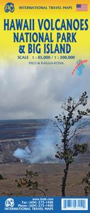
Wegenkaart - landkaart Hawaii Volcanoes National Park & Big Island | I

0
Een degelijke kaart met aanduidingen van o.a. nationale parken, vliegveld, benzinepomp, dirt-roads. Als overzichtskaart goed te gebruiken. We didn't suspect, when we started developing this title, that Mauna Loa Volcano would erupt as soon as our map of the national park was printed, but it did! It is on the news every night, and a marvelous touris...

Webshops met dit product

Webshop
Bezorging
Prijs

Anderen bekeken ook

Wegenkaart - landkaart Hawaii Volcanoes National Park & Big Island | I
Een degelijke kaart met aanduidingen van o.a. nationale parken, vliegveld, benzinepomp, dirt-roads. Als overzichtskaart goed te gebruiken. We didn't suspect, when we started developing this title, that Mauna Loa Volcano would erupt as soon as our map of the national park was printed, but it did! It is on the news every night, and a marvelous touristic attraction. How many of us can ever see a massive eruption of molten lava? Now, we can! (at least, from a safe distance). The national park occupies one side of the map and is the latest in ITMB's series of national parks. By the nature of such parks, we show all the features and elevations, but in this case, we'll add the proviso that heights and lava flows are changing the landscape on a daily basis. Volcanoes are sort of like elephants-they go where they please! The reverse side of the sheet is a map of Big Island, where the park is located. Its name comes from being the largest island in area of all the Hawaiian archipelago. The map i…
13,95
Wegenkaart - landkaart Yellowstone National Park and Wyoming | ITMB
The USA is a vast and wonderful land to explore. ITMB is steadily increasing our coverage of this important travel destination and this month concentrates on the State of Wyoming, with a detailed travel map on one side, including small portions of adjacent states of Utah, Colorado, Nebraska, South Dakota, Montana, and Idaho. The state is lightly populated, with Cheyanne as its capital and main city. Interstates 80 and 90 both traverse the state, with Interstate 25 being the only north-south motorway. Yellowstone National Park occupies the northwest corner of the state and also occupies the second side of the sheet with an extremely detailed map. Yellowstone is the first area in the world to be proclaimed as a national protected area (Banff was second), and Yellowstone remains the paramount preserved wilderness environment in the world. There are several small urban areas within the park for accommodations and servicing, such as West Thumb, Canyon City, and Mammoth Hot Springs. The main…
13,95
Wegenkaart - landkaart Botswana | Infomap
Goede betrouwbare kaart van Botswana. Met GPS coordinaten. Easy to read in a vehicle Practical, user-friendly scale Extensive countrywide accommodation listing and contact details Experienced-based tips and route comments Includes many off-road tracks GPS co-ordinates of intersections Border post information Many points of interest Distances, fuel points, airports Booking details for national parks Roads and tracks in the national park and reserves Inset of Tuli Block A classic. Our Botswana map, now in its 14th edition, is one of our top sellers. From more frequented destinations such as the country’s famous game parks to other lesser known ones like Tsodilo Hills – Botswana’s World Heritage site with over 4000 rock paintings – this map is a one-stop resource for both self-drive travellers and fly-in tourists alike. Use it to navigate your way from Gaborone to Maun, from Kasane down the Hunters Road to Khubu Island, from Twee Rivieren to the Kalahari, or simply use it as a…
15,95
Wegenkaart - landkaart 01 Banff National Park | Gem Trek Maps
Handige uitvouwbare folder met goede kaart van schaal 1:250.000. Op de achterzijde staat heel veel info over geschiedenis, bezienswaardigheden, natuur en geologie. This user-friendly map-guide includes a 1:250,000-scale poster-quality map of Canada's most popular national park, as well as useful and entertaining information about everything from mountain building to Banff Park wildlife.   The map covers Banff National Park as well as Yoho and Kootenay national parks. It shows roads, viewpoints, attractions, lodges and glaciers, and gives the name and elevation of mountains.   Contour lines at 200-metre (650-ft) intervals give map-users a good idea of the lay of the land. The map also shows official park trails, although it is not intended as a hiking map.   On the back of the map are photos and descriptions of the highlights of the park, including sights and attractions in Banff townsite and area, Lake Louise, and along the Icefields Parkway. There are also descriptions of the park's g…
16,95
Wegenkaart - landkaart Jasper National Park & Northern Alberta | ITMB
Jasper National Park kaart, zeer gedetailleerd (schaal 1:250.000) plus op de anderekant van de kaart staat Noord Alberta, schaal 1:1.000.000. Natuurkundige overzichtskaart met veel plaatsen en wegen, spoorlijnen en rivieren, hoogten, lengte- en breedtegraden.   Two words immediately come to my mind if I were to describe Northern Alberta: Oil and Cold. Oil sands could be found relatively easily within the Northern Alberta region. This pushes the Canadian economy forward as gasoline and other petroleum products are becoming higher in demand. Northern Alberta is also about the subzero temperature. The region of Northern Alberta mostly contains very cold, long winters and warm, short summers. Fort McMurray, for example, one of the famous urban communities located in the Wood buffalo municipality, has only a yearly mean temperature of 0.7 degrees Celsius. Nonetheless, Northern Alberta is also a land of recreation activities and wild adventures. On the other side of the Northern Alberta map…
13,95
Wegenkaart - landkaart Richtersveld National Park and Northern Namaqua
Wegenkaart met toeristische informatie en geschikt voor gebruik met GPS   The original InfoMap! Now in its 8th edition this map remains as popular as ever. For those who don’t know, the Richtersveld National Park is a 160 000 hectare national park found on the banks of the Orange River in South Africa’s Northern Cape. It is the only mountain desert park in Southern Africa and is one of the few national parks in which you are not confined to your car. Dry, arid with a feeling of isolation, life in the park is influenced by the mist created by the cold Atlantic Ocean. Known to the local Nama people as ‘malmokkie’ it brings moisture to an otherwise parched land. Despite its lack of rainfall the area is rich in flora containing many species, like the Halfmens, which exist nowhere else on earth.   The area has long been a favorite for botanists, photographers, lovers of remote places and 4×4 enthusiasts who flock to this corner of South Africa for its unique character, isolation and feel…
15,95

Klanten-reviews van Wegenkaart - landkaart Hawaii Volcanoes National Park & Big Island | I

Er zijn nog geen beoordelingen voor dit productBen jij de eerste die een review plaatst?

Meer over Wegenkaart - landkaart Hawaii Volcanoes National Park & Big Island | I

Productomschrijving

Een degelijke kaart met aanduidingen van o.a. nationale parken, vliegveld, benzinepomp, dirt-roads. Als overzichtskaart goed te gebruiken. We didn't suspect, when we started developing this title, that Mauna Loa Volcano would erupt as soon as our map of the national park was printed, but it did! It is on the news every night, and a marvelous touristic attraction. How many of us can ever see a massive eruption of molten lava? Now, we can! (at least, from a safe distance). The national park occupies one side of the map and is the latest in ITMB's series of national parks. By the nature of such parks, we show all the features and elevations, but in this case, we'll add the proviso that heights and lava flows are changing the landscape on a daily basis. Volcanoes are sort of like elephants-they go where they please! The reverse side of the sheet is a map of Big Island, where the park is located. Its name comes from being the largest island in area of all the Hawaiian archipelago. The map includes an inset of Hilo, the largest city on the island, located on a calm bay of the east coast, and a separate inset of Kailua-Kona on the west coast, which is also the focal point for surfing and resorts. This pretty much completes our detailed mapping of Hawaii; in addition to this title, we have maps of the complete state and of each major island, as well as a new map of Honolulu/Waikiki. The map is printed on waterproof stone paper, which could prove very useful in tropical Hawaii!   Legend Includes: Roads by classification, Rivers and Lakes, National Park, Airports, Points of Interests, Highways, Main Roads, Zoos, Fishing, and much more...

Productspecificaties

Artikelnummer(s)
Brand
ITMB
Webshop.nl maakt gebruik van cookies. Ga je verder op onze website, ga dan akkoord met het plaatsen van cookies en de verwerking van deze data door ons en vermelde partners.