webshop.nl
Categorieën
  Sluiten

Meer ITMB

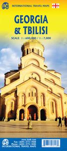
Wegenkaart - landkaart Georgia and Tbilisi - Georgië | ITMB

0
Georgia, the country and not the American state, is a very nice, but threatened country of great historical importance. Bordered on the west by the Black Sea, on the north by Russia, and on the east by Azerbaijan, and with an ill-defined border with Turkey on the west, Georgians must be nimble to retain their independence. Only with neighbouring Ar...

Webshops met dit product

Webshop
Bezorging
Prijs

Anderen bekeken ook

Wegenkaart - landkaart Georgia and Tbilisi - Georgië | ITMB
Georgia, the country and not the American state, is a very nice, but threatened country of great historical importance. Bordered on the west by the Black Sea, on the north by Russia, and on the east by Azerbaijan, and with an ill-defined border with Turkey on the west, Georgians must be nimble to retain their independence. Only with neighbouring Armenia does Georgia enjoy relatively good relations. Historically, Georgia is a Christian enclave that dates back to the earliest days of Christianity, and its many churches are major touristic attraction. This map portrays the country as accurately as is possible, showing the expanding network of motorways, major churches, castles, touristic sites, and regrettably, areas of contention with both Russia and Azerbaijan. The reverse side shows a full-sized city map of Tbilisi, the capital. This is the first time that the city has been portrayed in such detail. Attractions include the Narikala Fortress, the cathedral, the old town centre, and the …
13,95
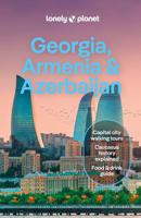
Reisgids Georgia, Armenia & Azerbaijan - Georgië, Armenië & Azerbeidzj
De perfecte reisgids voor zowel de georganiseerde als de zelfstandige reiziger. Naast een algemene inleiding van het land / streek vol met praktische informatie over hoe je er het beste kunt reizen: slapen, eten, vervoer, excursies ... alles kun je er in vinden. Lonely Planet's local travel experts reveal all you need to know to plan the trip of a lifetime to Georgia, Armenia & Azerbaijan.   Discover popular and off the beaten track experiences from visiting Georgia's Truso Valley for a hike past majestic scenery to riding a cable car to the tiny village of Tatev, and seeing Tsminda Sameba Church in the South Caucasus with its extraordinary hilltop location.   Build a trip to remember with Lonely Planet's Georgia, Armenia & Azerbaijan travel guide:   Our classic guidebook format provides you with the most comprehensive level of information for planning multi-week trips Updated with an all new structure and design so you can navigate Georgia, Armenia & Azerbaijan and connect e…
24,95
Wegenkaart - landkaart Georgia & Armenia - Georgië & Armenië | ITMB
Een degelijke kaart met aanduidingen van o.a. nationale parken, vliegveld, benzinepomp, dirt-roads en kleine plattegrond van hoofdstad. De kracht van deze kaart is dat met kleurgebruik het landschap en de hoogtes heel duidelijk zichtbaar zijn, de natuurkundige aspecten van het land worden daardoor benadrukt. Als overzichtskaart goed te gebruiken. Met een stadsplattegrond (klein) van het cdentrum van Tiblisi en Yerevan. Europeans consider Georgia to be in Asia because, by an accident of history, the country ended up on the wrong side of an arbitrary line drawn through some rolling hills called the Caucasus. Regardless, this is a European country, bound by ethnicity, history, and religion to the west, not the east.   The country has been threatened fairly recently by the Russian bear, but the country is recovering and the people are warm and hospitable.   Historically, Georgia has much to offer – ancient cities, churches and monasteries, mountain villages, and everywhere, smiling fa…
13,95
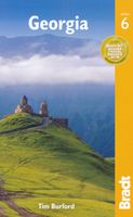
Reisgids Georgia - Georgië | Bradt Travel Guides
Georgië Bradt guide is een Engelstalige, praktische reisgids voor de avontuurlijke reiziger, boordevol informatie over accommodatie van budget tot luxe, vervoer, plaatsbeschrijvingen en natuur - kenmerk : kritisch op toeristische pleisterplekken en de stijl is verhalend. This new sixth edition of Bradt's Georgia, the only dedicated guide to the country, has been thoroughly updated throughout to include all the most recent developments, ranging from greatly expanded coverage of Batumi, Adjara and Svaneti to the addition of new maps for Tbilisi, Mestia and Telavi. Tourism is booming in Georgia: the number of guesthouses has mushroomed, Tbilisi airport has just opened a second terminal and a new terminal and rail link are under construction at Kutaisi airport. New low-cost flights are now available and visa-free travel is the norm for most. With Bradt's Georgia discover both the old and the new. The capital, Tbilisi, has seen huge changes in the past decade with some conspicuous new proje…
24,95
Wegenkaart - landkaart Bahrain & Qatar | ITMB
Een degelijke kaart met aanduidingen van o.a. nationale parken, vliegveld, benzinepomp, dirt-roads en kleine plattegrond van hoofdstad. Als overzichtskaart goed te gebruiken.  Schaal: - Bahrein 1:115.000 - Qatar 1:300.000 The northern portion of the United Arab Emirates consists of a small peninsula (Qatar) and an island (Bahrain). Although these countries are not geographically significant in relation to their neighbours, they are enormously wealthy, thanks to oil, and have aspirations of grandeur. Qatar hosted the FIFA World Cup of soccer in November 2022. This is significant. Qatar, as a destination country, is now 'on the map'. Its capital, Doha, is quite well developed, with three Metro subway lines, motorways, and a sophisticated city centre dominated by superb high-rise architecture. Just to the west, the island of Bahrain is just as wealthy, and just as likely to have ornate architecture, luxurious shopping arcades, and an extravagant lifestyle. Its capital, Manama, is growing …
13,95
Wegenkaart - landkaart Ontario | ITMB
Een degelijke kaart voor Ontario met aanduidingen van o.a. nationale parken, vliegveld, benzinepomp, dirt-roads en kleine plattegrond van Toronto, Sault Ste. Marie. Als overzichtskaart goed te gebruiken. Ontario and Quebec form the portion of Canada known as Central Canada. Ontario is the industrial heartland of the country, and the southern portion is the most densely-populated and urbanized part of Canada. Toronto is a city of 2.8M people and the heartland of an economic region serving 100,000,000 people in two countries. Southern Ontario is also home for six million residents, some of the most historic sites in the country, and major recreational land masses (Algonquin Park, Bruce Trail, Muskoka/Haliburton). Northern Ontario, on the other side of the map, occupies the bulk of the land area of the province, and is dominated by the Canadian Shield (a pre-Cambrian rock formation that is the oldest land on earth, rich in mineral wealth). The North is dominated by recreational activities…
13,95

Klanten-reviews van Wegenkaart - landkaart Georgia and Tbilisi - Georgië | ITMB

Er zijn nog geen beoordelingen voor dit productBen jij de eerste die een review plaatst?

Meer over Wegenkaart - landkaart Georgia and Tbilisi - Georgië | ITMB

Productomschrijving

Georgia, the country and not the American state, is a very nice, but threatened country of great historical importance. Bordered on the west by the Black Sea, on the north by Russia, and on the east by Azerbaijan, and with an ill-defined border with Turkey on the west, Georgians must be nimble to retain their independence. Only with neighbouring Armenia does Georgia enjoy relatively good relations. Historically, Georgia is a Christian enclave that dates back to the earliest days of Christianity, and its many churches are major touristic attraction. This map portrays the country as accurately as is possible, showing the expanding network of motorways, major churches, castles, touristic sites, and regrettably, areas of contention with both Russia and Azerbaijan. The reverse side shows a full-sized city map of Tbilisi, the capital. This is the first time that the city has been portrayed in such detail. Attractions include the Narikala Fortress, the cathedral, the old town centre, and the Dry Bridge Market (now a flea market, but in Soviet times a black market). The city lies beside the Kura River, in a valley enclosed by Mtatsminda Mountain, which has two cable cars to its summit, which is now a recreational theme park. The city’s two metro lines are also a good way to travel around the city. Legend Includes: Roads by classification, Rivers and Lakes, National Park, Airports, Points of Interests, Highways, Main Roads, Zoos, Fishing, and much more...

Productspecificaties

Artikelnummer(s)
Brand
ITMB
Webshop.nl maakt gebruik van cookies. Ga je verder op onze website, ga dan akkoord met het plaatsen van cookies en de verwerking van deze data door ons en vermelde partners.