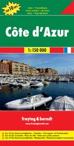
Wegenkaart - landkaart Côte d'Azur- Franse Riviera | Freytag & Berndt
Deze bijzonder gedetailleerde Freytag & Berndt Wegenkaart van de Cote d'Azur is aan één kant geprint en heeft een schaal van 1:150.000. Op deze kaart staan o.a. fietsroutes, lange afstandswandelpaden, toeristische wegen en bezienwaardigheden aangegeven. In de omslag van de kaart is een apart boekje geniet met een korte beschrijving van de TOP 10 van bezienswaardigheden, een uitgebreide index en plattegrondjes van enkele toeristische plaatsen. Explore the French Riviera with this Freytag & Berndt road map. The best way to plan your trip, prepare your itinerary, and to travel independently in this country. As with all Freytag & Berndt maps the cartography is clear and detailed with the topography shown by relief shading with plenty of spot heights. This map includes detailed land information of the French Riviera area, and also insets of major towns including Nice, Toulon, Cannes, Monte Carlo and more. Also included is a booklet of top tips of what to do and see when visiting there. …
14,95

