webshop.nl
Categorieën
  Sluiten

Meer ITMB
Meer ITMB in Literatuur boeken

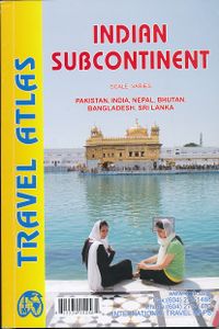
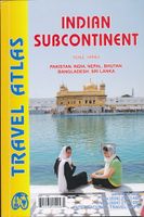
Wegenatlas Travel Atlas Indian Subcontinent | ITMB

0
Handzame wegenatlas op A5 formaat, helaas geen spiraalbinding. Maar voor deze regio is er op dit moment geen andere atlas beschikbaar.   This is our biggest atlas ever, with 152 pages of maps and 51 pages of place names indexing. The Indian Sub-Continent consists of Pakistan, India, Nepal, Bhutan, Bangladesh, Sri Lanka and Kashmir. Each country (Ka...

Webshops met dit product

Webshop
Bezorging
Prijs

Anderen bekeken ook

Wegenatlas Travel Atlas Indian Subcontinent | ITMB
Handzame wegenatlas op A5 formaat, helaas geen spiraalbinding. Maar voor deze regio is er op dit moment geen andere atlas beschikbaar.   This is our biggest atlas ever, with 152 pages of maps and 51 pages of place names indexing. The Indian Sub-Continent consists of Pakistan, India, Nepal, Bhutan, Bangladesh, Sri Lanka and Kashmir. Each country (Kashmir being considered shared) is presented as an entity, so Pakistan occupies 30 pages at 1:1,200,000 scale, and Nepal occupies 32 pages at 1:530,000 scale. In short, each country is shown in detail, but at scales appropriate for each country. The amount of detail on each page is impressive; equal to buying six maps at $12.95 each. The market is the traveller to the region, visiting several of these areas and wanting a compact way to have detailed mapping without having to carry half a dozen maps or spend a large amount of money on maps. Eleven city inset maps are included, as well as basic insets for the Andaman and Nicobar island chains. T…
16,50
Wegenatlas Travel Atlas South America - Zuid Amerika | ITMB
De eerste gedegen wegenatlas van Zuid Amerika: handig boekje met slappe kaft op A5 formaat. This is unique! ALL of the continent of South America is now available in an easy-to-read, easy-to-use, easy-to-store road atlas at a superb scale. In addition to showing each country systematically, logically, and in great detail, physical features, points of interest, beaches, reefs, parks and reserves, major airports, and roads are shown. The atlas is 5 1/2" wide by 8 1/2" high (15cmx22cm), the same size as our Mexico Road Atlas. This atlas is 112 pages in length, is fully indexed, and has a hard card cover, and a spine. The advantage of this book format is that visitors to more than one country can save money and gain ease of use through a conveniently-sized and attractively presented book format. There is nothing equivalent to this in the world!
16,50
Wegenatlas Road Atlas Britain 2025 - A4 | AA Publishing
Wegenatlas, met spiraal,  van Groot-Brittannie, Engeland, Wales en Schotland, met toeristische informatie This top-selling road atlas showcases Britain’s clearest mapping from the experts at the AA at a large 3.2 miles to 1 inch scale. Each page has been titled with its geographical location so you can turn to the page you need more easily. Wide and narrow minor roads, National Trust, English and World Heritage sites and hard-to-find places are shown. There are 112 city, town, port and airport plans, full colour country, unitary and administrative area map and a comprehensive 31,500 entry index with airports, top tourist sites and motorway services listed. Plus, scenic routes, over 1,800 golf courses and the top 300 AA-Inspected caravan and camping sites symbolised on the mapping. Motorway maps, ferry planning information and 5 district maps provide the essential motoring content for travelling the country. 10 pages of central London street mapping with index. District maps of Birmi…
24,95
Wegenatlas Quebec & Ontario | ITMB
Wegenatlas van Quebec en Ontario. Natuurkundig kaartbeeld. Met inzetjes van stadsregio's en centrumkaarten van Montreal en Toronto. Uitgebreide index.   We are blessed in North America with a state of peace unattainable in most other parts of the world. We take for granted freedom to travel over vast distances on good roads, have rail services carrying millions of passengers each year, and have reasonably minimal border formalities to undergo at borders. Quebec is one of the great travel destinations for North Americans; so is Ontario. In fact, it is almost inconceivable that one would visit one without seeing the other. Geographically, each province occupies a huge amount of space far larger than any American state, so combining these areas on a folded paper sheet makes no sense. We have combined the two provinces into one travel atlas which, in Canadian terms, would be called central Canada, a term peculiar to Canadians and unmarketable. We present in a compact atlas format the ideal…
16,50
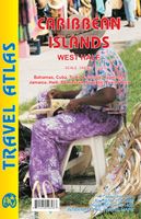
Wegenatlas Travel Atlas Caribbean Island West Half | ITMB
Wegenatlas voor de westelijke Caraïbische eilanden - verschillende schalen : Bahamas, Turks- en Caicoseilanden, Cuba, Kaaimaneilanden, Jamaica, Dominikaanse Republiek, Puerto Rico. Met inzetjes van Freeport, Nassau, Havana, Varadero, Georgetown, Kingston, Port-au-Prince, Santo Domingo, San Juan   The Caribbean is a particularly difficult part of the world to map effectively. It is a combination of larger islands in the west and a string of small islands in the east. Some can be shown as separate maps, but others are too small (or too lacking in market appeal) to be mapped adequately as folded paper maps. This atlas covers the Bahamas and the Turks and Caicos Islands in the north with Cuba, the Cayman Islands, Jamaica, the Dominican Republic, and Puerto Rico in scales ranging from 1:18,000 for Puerto Rico to 1:600,000 for Cuba The atlas is the same size as all ITM atlases (8''x5'' or 21x13.5cm) and has a straight spine edge with title for displaying spine outwards on store shelves, if d…
16,50
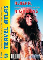
Wegenatlas Travel Atlas Alaska Highway | ITMB
A5 boekvorm   This booklet is the same size as all other ITMB atlases and is designed to fit comfortably in a user's backpack, purse, or car door storage bin. The famous Alaska Highway of WW2 fame has been largely paved and straightened by now, but is still one of the paramount exploration adventures in the world and is far more accessible than the Karakoram or mid-Australia routes. The original highway, from Dawson Creek in northern British Columbia to close to Fairbanks, Alaska, has been supplemented by several off-shoots: the Dempster Highway leading to Inuvik, in Canada's Northwest Territories, the Dalton Highway, leading north to the high Arctic at Prudhoe Bay in Alaska, and the Stewart Highway leading south through the Coastal Mountains to Prince Rupert, BC are all closely integrated with the traditional Alaska Highway. All of these are shown in great detail in this atlas. Road conditions, distances, campgrounds, convenient hiking trails, heights of land, parks, and everything el…
13,95

Klanten-reviews van Wegenatlas Travel Atlas Indian Subcontinent | ITMB

Er zijn nog geen beoordelingen voor dit productBen jij de eerste die een review plaatst?

Meer over Wegenatlas Travel Atlas Indian Subcontinent | ITMB

Productomschrijving

Handzame wegenatlas op A5 formaat, helaas geen spiraalbinding. Maar voor deze regio is er op dit moment geen andere atlas beschikbaar.   This is our biggest atlas ever, with 152 pages of maps and 51 pages of place names indexing. The Indian Sub-Continent consists of Pakistan, India, Nepal, Bhutan, Bangladesh, Sri Lanka and Kashmir. Each country (Kashmir being considered shared) is presented as an entity, so Pakistan occupies 30 pages at 1:1,200,000 scale, and Nepal occupies 32 pages at 1:530,000 scale. In short, each country is shown in detail, but at scales appropriate for each country. The amount of detail on each page is impressive; equal to buying six maps at $12.95 each. The market is the traveller to the region, visiting several of these areas and wanting a compact way to have detailed mapping without having to carry half a dozen maps or spend a large amount of money on maps. Eleven city inset maps are included, as well as basic insets for the Andaman and Nicobar island chains. This completes our network of atlases that started with Japan and China, and now includes South East Asia and the Middle East in a series of detailed travel atlases covering almost all of Asia.   Legend Includes: Road by classification, Motorways, Main Roads, Ferry Routes, Railways, Lakes, Deserts, Swamps, Hospitals, Walterfalls, Motels, Hotels, Beaches and much more...

Productspecificaties

Artikelnummer(s)
Brand
ITMB

Verken gerelateerde categorieën

Webshop.nl maakt gebruik van cookies. Ga je verder op onze website, ga dan akkoord met het plaatsen van cookies en de verwerking van deze data door ons en vermelde partners.