webshop.nl
Categorieën
  Sluiten

Meer ITMB
Meer ITMB in Literatuur boeken

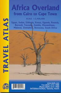
Wegenatlas Travel Atlas Afrika Africa Overland: Cairo to Cape Town | I

0
Handzame wegenatlas, formaat A5, van de hele route van Cairo naar Kaapstad langs de oostelijke kant van Afrika. Naast de wegenkaarten bevat deze atlas ook een aantal centrumkaarten van de belangrijkste steden die je onderweg tegenkomt.  There are three possible routes to traverse Africa top to bottom. From the east, the only route is via Egypt and ...

Webshops met dit product

Webshop
Bezorging
Prijs

Anderen bekeken ook

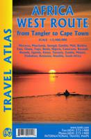
Wegenatlas Travel Atlas Africa West Route: from Tangier to Cape Town |
Handzame wegenatlas, formaat A5, van de hele route van Tanger naar Kaapstad langs de westelijke kant van Afrika. Naast de wegenkaarten bevat deze atlas ook een aantal centrumkaarten van de belangrijkste steden die je onderweg tegenkomt.  There are three routes one can follow on an overland expedition from Europe to Cape Town (or the reverse). Last year, ITMB published the eastern route, via Cairo and Sudan to Ethiopia and Kenya. This year, we are pleased to announce the publication of a more practical route to follow, via Tangier, Morocco, Mauritania, Senegal, Mali and Ghana, through the Congo to Uganda, and then south over a variety of options to Namibia and South Africa. The advantage of this route is that it avoids the conflict-ridden countries closest to infection from the extremist Islam movement. It also avoids the current difficulties of the central route through Algeria (the Hoggar route) and Niger. We do have to caution that all routes through Africa contain risks. Routes are …
16,50
Reisgids Africa Overland - Afrika | Bradt Travel Guides
Bradt's Africa Overland is the result of over 40 years' experience on the roads of Africa, Asia and South America, combining everything you need to know about the Africa with all the practical advice needed for tackling long-distance journeys under often challenging conditions, be it by 4X4 or public transport. A massive amount of background detail is included, from suggested routes for reaching Africa - including via Asia or Saudi Arabia - to selecting and shipping your vehicle, budgeting, equipment and spares, organised tours, public transport, red tape and heaps of information about issues likely to arise on the road: driving and recovery techniques, maintenance, motorbike driving, bureaucracy, borders and police checks. This new, fully updated edition covers over 50 countries, as well as offering a focus on aspects such as geography, vegetation and climate, natural history and conservation, cultural interaction, religion and festivals.   There's lots of guidance about where to find…
27,95
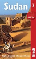
Reisgids Sudan - Soedan | Bradt Travel Guides
Er bestaat geen Lonely Planet van Sudan. Daarom vermelden wij de enige goede gids van Sudan, die van Bradt Guides. Voor Afrikaanse landen net zo goed, zo niet beter dan de Planet. Beduidend soberder uitgevoerd, maar ook met veel informatie voor backpackers en met veel kaartmateriaal. Een aanrader! Bradt: This third edition is the only stand-alone guide to Sudan with practical information on getting around a country where the travelling is rugged but the rewards immense. As the largest country in Africa, Sudan is vast, often described by its people as the whole of Africa in one country. With more pyramids than Egypt, and rock gongs and engravings (petroglyphs) that are 7000 years old, it has one of the richest and least-explored histories in Africa. Improved infrastructure has made the archaeological riches of the Sudanese Nile more accessible. The Red Sea remains one of the world's greatest diving sites and the wildlife of the south will entice visitors to explore. This latest edition …
26,50
Wegenkaart - landkaart Africa north east - noord oost Afrika | ITMB
This is the third ITMB title on Africa to be released using our digital data base material. As with Africa as a continental map and Africa North West, this map covers a large area and tries to do so fairly and in detail. The essential areas of coverage are Libya and Egypt in the north, with Sudan/South Sudan, Ethiopia/Eritrea in the middle, and Kenya/Uganda in the south, with a fair portion of Tanzania and Congo thrown in simply because it fits. Being a regional map, it is useful for the 'big' picture. It is quite detailed, showing roads, towns, and major touristic sites. It is more detailed and at a better scale than the Michelin map of the same name   Legend Includes: Road by classification, Main Road, National Park, Lake, Capital, International Airport, Oasis, Ruins, Hotels and much more...
13,95
Reisgids Africa - Afrika | Lonely Planet
Superdikke gids van alle landen van Afrika: ideale gids voor een trekking door het hele continent, met de jeep door Afrika heen of gewoon als naslagwerk thuis. De perfecte reisgids voor zowel de georganiseerde als de zelfstandige reiziger. Naast een algemene inleiding van het land / streek vol met praktische informatie over hoe je er het beste kunt reizen: slapen, eten, vervoer, excursies ... alles kun je er in vinden. Engelstalig. Lonely Planet This guide covers: North Africa: Algeria, Egypt, Libya, Morocco, Sudan, Tunisia West Africa: Benin, Burkina Faso, Cameroon, Côte D'Ivoire, The Gambia, Ghana, Guinea, Guinea-Bissau, Liberia, Mali, Mauritani, Niger, Nigeria, Senegal, Sierra Leone, Togo Central Africa: Central African Republic, Chad, Congo (Zaire), Democratic Republic of Congo, Equatorial Guinea, Gabon, São Tomé & Príncipe East Africa: Burundi, Djibouti, Eritrea, Ethiopia, Kenya, Rwanda, Tanzania, Uganda, Somaliland, Puntland & Somalia Southern Africa: Angola, Botswana, Lesotho, M…
27,95
Wegenkaart - landkaart Afrika noordwest - Africa northwest | ITMB
Een degelijke kaart met aanduidingen van o.a. nationale parken, vliegveld, benzinepomp, dirt-roads en kleine plattegrond van hoofdstad. Als overzichtskaart goed te gebruiken. This is the detailed map of Africa emanating from our continental data base and, at an scale better than Michelin's famous regional map, we feel that this version is a winner. First, it is printed double-sided with the western coastal segment on one side and the eastern half on the other. Second, we have been able to improve the accuracy of the road information enormously at the better scale, and third we are making progress in developing a new series of travel maps for Africa by publishing the first of what we hope will become a new regional map covering Africa from top to bottom, or from Cape to Cairo, as Uncle Cecil used to say. The coverage of this map is from Morocco in the west to the Libyan/Egyptian border and from Senegal and Liberia in the southwest to the Chad/Sudan border in the southeast. This is also …
13,95

Klanten-reviews van Wegenatlas Travel Atlas Afrika Africa Overland: Cairo to Cape Town | I

Er zijn nog geen beoordelingen voor dit productBen jij de eerste die een review plaatst?

Meer over Wegenatlas Travel Atlas Afrika Africa Overland: Cairo to Cape Town | I

Productomschrijving

Handzame wegenatlas, formaat A5, van de hele route van Cairo naar Kaapstad langs de oostelijke kant van Afrika. Naast de wegenkaarten bevat deze atlas ook een aantal centrumkaarten van de belangrijkste steden die je onderweg tegenkomt.  There are three possible routes to traverse Africa top to bottom. From the east, the only route is via Egypt and Sudan to Ethiopia and East Africa. The route through Algeria, known as the Hoggar (or Haager) route is next, with the route through Morocco to West Africa third. Traversing Africa is one of the great adventure trips in the world. I did it in 1969/70 in an epic journey that took a year and proved to be one of those fundamental acts shaping ones life. None of the routes are completely safe. That applied in the 1960s and it applies equally now, but life consists of determining acceptable risks and doing ones best not to be hit by a Number 10 bus by liking the wrong way when crossing a London street. This atlas portrays the eastern route from Cairo to Cape Town over a hundred pages of maps. It covers 14 countries and gives advice on particularly sensitive travel areas, such as between Egypt and Sudan. We do not show only one recommended route, as there are alternatives once one reaches Kenya, but all are shown. The great advantage of this book is that it is compact and easy to carry, as well as being as accurate as we could make it.

Productspecificaties

Artikelnummer(s)
Brand
ITMB

Verken gerelateerde categorieën

Webshop.nl maakt gebruik van cookies. Ga je verder op onze website, ga dan akkoord met het plaatsen van cookies en de verwerking van deze data door ons en vermelde partners.