webshop.nl
Categorieën
  Sluiten

Meer Maps International

Wandkaart Europa Natuurkundig, 135 x 98 cm | Maps International

0
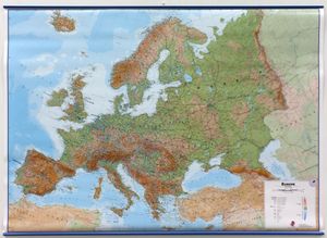
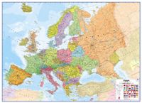
Maps International's large physical wall map of Europe is one of the finest money can buy.   European Map details: Our large physical wall map of Europe features the natural terrain of the land, with countries marked and international borders shown. The map's key helps to identify the land elevation and water depth. This large European physical wal...

Webshops met dit product

Webshop
Bezorging
Prijs

Anderen bekeken ook

Wandkaart Europa Natuurkundig, 135 x 98 cm | Maps International
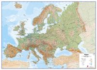
Maps International's large physical wall map of Europe is one of the finest money can buy.   European Map details: Our large physical wall map of Europe features the natural terrain of the land, with countries marked and international borders shown. The map's key helps to identify the land elevation and water depth. This large European physical wall map also contains city population detail, national capitals and all the major towns and cities in Europe.   Map uses: As with most of our maps, the large physical wall map of Europe, is available in a range of finishes making it suitable for a variety of locations. Major motorways and transport lines are shown on this European wall map making it an ideal map for planning and logistics
49,95
Wandkaart Europa Natuurkundig, 135 x 98 cm | Maps International
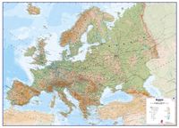
Maps International's large physical wall map of Europe is one of the finest money can buy.   European Map details: Our large physical wall map of Europe features the natural terrain of the land, with countries marked and international borders shown. The map's key helps to identify the land elevation and water depth. This large European physical wall map also contains city population detail, national capitals and all the major towns and cities in Europe.   Map uses: As with most of our maps, the large physical wall map of Europe, is available in a range of finishes making it suitable for a variety of locations. Major motorways and transport lines are shown on this European wall map making it an ideal map for planning and logistics
24,95
Wandkaart Europa Natuurkundig, 135 x 98 cm | Maps International
Maps International's large physical wall map of Europe is one of the finest money can buy.   European Map details: Our large physical wall map of Europe features the natural terrain of the land, with countries marked and international borders shown. The map's key helps to identify the land elevation and water depth. This large European physical wall map also contains city population detail, national capitals and all the major towns and cities in Europe.   Map uses: As with most of our maps, the large physical wall map of Europe, is available in a range of finishes making it suitable for a variety of locations. Major motorways and transport lines are shown on this European wall map making it an ideal map for planning and logistics
37,95
Wandkaart Europa Natuurkundig, 135 x 98 cm | Maps International
Maps International's large physical wall map of Europe is one of the finest money can buy.   European Map details: Our large physical wall map of Europe features the natural terrain of the land, with countries marked and international borders shown. The map's key helps to identify the land elevation and water depth. This large European physical wall map also contains city population detail, national capitals and all the major towns and cities in Europe.   Map uses: As with most of our maps, the large physical wall map of Europe, is available in a range of finishes making it suitable for a variety of locations. Major motorways and transport lines are shown on this European wall map making it an ideal map for planning and logistics
24,95
Wandkaart Europa Natuurkundig, 135 x 98 cm | Maps International
Maps International's large physical wall map of Europe is one of the finest money can buy.   European Map details: Our large physical wall map of Europe features the natural terrain of the land, with countries marked and international borders shown. The map's key helps to identify the land elevation and water depth. This large European physical wall map also contains city population detail, national capitals and all the major towns and cities in Europe.   Map uses: As with most of our maps, the large physical wall map of Europe, is available in a range of finishes making it suitable for a variety of locations. Major motorways and transport lines are shown on this European wall map making it an ideal map for planning and logistics
37,95
Prikbord Europa Natuurkundig, 135 x 98 cm | Maps International
Maps International's large physical wall map of Europe is one of the finest money can buy.   European Map details: Our large physical wall map of Europe features the natural terrain of the land, with countries marked and international borders shown. The map's key helps to identify the land elevation and water depth. This large European physical wall map also contains city population detail, national capitals and all the major towns and cities in Europe.   Map uses: As with most of our maps, the large physical wall map of Europe, is available in a range of finishes making it suitable for a variety of locations. Major motorways and transport lines are shown on this European wall map making it an ideal map for planning and logistics   Prikbord Prikbord, geplastificeerd met een glans folie, beschrijfbaar met drooguitwisbare stiten, omkaderd met een stijlvol aluminium designprofiel en afgewerkt met ronde, grijze kunststof hoekstukjes. Een pennengoot en standaard ophangmateriaal worden bijge…
219,95
Wandkaart Europa - Europe Huge, 170 x 124 cm | Maps International
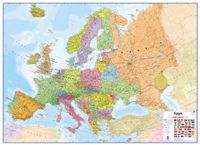
Fraaie politieke kaart van het continent, waarbij vooral de politieke aspecten heel duidelijk te lezen zijn. Alle landen hebben verschillende kleuren, steden en belangrijke verbindingen zijn goed te vinden. Geplastificeerde uitvoering. Let op: deze heeft geen metalen strips, de kaart is simpelweg te groot daarvoor. Wel is er nog een optie met houten stokken    Maps International’s European political wall map is huge! Our European political wall map is the size of a Smart Car and is the largest single sheet map available to buy.    European Map details: Politically coloured wall map of Europe features countries marked in a different colour, with international boundaries shown. All major towns and cities of Europe are featured within our huge map, and the country's capital cities are clearly marked. The map contains hill and sea shading adding to the vibrant overall effect. The wall map also contains a section showing the different flags of countries in Europe.   Map uses: As with most o…
64,95
Wandkaart Europa - Europe Huge, 170 x 124 cm | Maps International
Fraaie politieke kaart van Europa, waarbij vooral de politieke aspecten heel duidelijk te lezen zijn. Alle landen hebben verschillende kleuren, steden en belangrijke verbindingen zijn goed te vinden. Papieren uitvoering. Let op: deze heeft geen versie in metalen strips, de kaart is simpelweg te groot daarvoor. Wel is er nog een optie met houten stokken  Maps International’s European political wall map is huge! Our European political wall map is the size of a Smart Car and is the largest single sheet map available to buy.  European Map details: Politically coloured wall map of Europe features countries marked in a different colour, with international boundaries shown. All major towns and cities of Europe are featured within our huge map, and the country's capital cities are clearly marked. The map contains hill and sea shading adding to the vibrant overall effect. The wall map also contains a section showing the different flags of countries in Europe. Map uses: As with most of our map…
47,95

Klanten-reviews van Wandkaart Europa Natuurkundig, 135 x 98 cm | Maps International

Er zijn nog geen beoordelingen voor dit productBen jij de eerste die een review plaatst?

Meer over Wandkaart Europa Natuurkundig, 135 x 98 cm | Maps International

Productomschrijving

Maps International's large physical wall map of Europe is one of the finest money can buy.   European Map details: Our large physical wall map of Europe features the natural terrain of the land, with countries marked and international borders shown. The map's key helps to identify the land elevation and water depth. This large European physical wall map also contains city population detail, national capitals and all the major towns and cities in Europe.   Map uses: As with most of our maps, the large physical wall map of Europe, is available in a range of finishes making it suitable for a variety of locations. Major motorways and transport lines are shown on this European wall map making it an ideal map for planning and logistics

Productspecificaties

Artikelnummer(s)
Brand
Maps International
Webshop.nl maakt gebruik van cookies. Ga je verder op onze website, ga dan akkoord met het plaatsen van cookies en de verwerking van deze data door ons en vermelde partners.