webshop.nl
Categorieën
  Sluiten

Meer Ordnance Survey

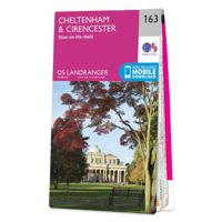
Wandelkaart - Topografische kaart 163 Landranger Cheltenham & Cirences

0
Zeer goede detailkaart met topografische ondergrond. Kleurgebruik is goed over nagedacht: bijzonder goed leesbaar en helder kaartbeeld. Hierop zijn toeristische symbolen van bezienswaardigheden ingetekend, daarnaast staan bijvoorbeeld campings en jeugdherbergen vermeld en - voor wandelaars het belangrijkst - alle right of way paden en Lange afstand...

Webshops met dit product

Webshop
Bezorging
Prijs

Anderen bekeken ook

Wandelkaart - Topografische kaart 163 Landranger Cheltenham & Cirences
Zeer goede detailkaart met topografische ondergrond. Kleurgebruik is goed over nagedacht: bijzonder goed leesbaar en helder kaartbeeld. Hierop zijn toeristische symbolen van bezienswaardigheden ingetekend, daarnaast staan bijvoorbeeld campings en jeugdherbergen vermeld en - voor wandelaars het belangrijkst - alle right of way paden en Lange afstands Wandelpaden zijn er op te vinden. De ideale kaart voor het wandelen in Engeland, Wales of Schotland. De kaarten zijn te gebruiken met GPS (UTM OSGB36), de legenda is in het Engels, Frans en Duits.    Plaatsen op deze kaart: Cheltenham, Cirencester, Stow-on-the-Wold, Northleach, Burford, Carterton, Lechlade on Thames, Fairford, Farringdon, Highworth, Cricklade, Tetbury, Crudwell, Oaksey, Minety, Broad Blunsdon, Longcot, Whelford, South Cerney, Kemble, Tarlton, Rodmarton, Poulton, Bagendon, Barnsley, Quenington, Alvescot, Bibury, Winson, Chedworth, Aldsworth, Great Barrington, Serborne, Chalford, Bisley, Duntisbourne Abbots, Cranham, Colesbou…
19,50
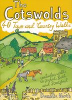
Wandelgids The Cotswolds | Pocket Mountains
Handige compacte wandelgids met 40 dagwandelingen. Deze gids bevat kleine kaartjes en leuke uitgebreide informatie over wat er langs de route te zien is. Goede wandelkaarten zijn echter we noodzakelijk voor deze tochten: de Ordnance Survey explorer maps of Landanger maps zijn zeer geschikt.   From upland outlooks and secret valleys to rolling pastures and honey stone villages, nature and history weave together in the Cotswolds to create a landscape that is the epitome of rural England. In these 40 walks Dominic North unlocks the secrets of the Cotswolds, from the hills and lanes in the north to the languid riverbanks and ancient woods of the south. Along the way discover sleepy villages, grand country houses and architectural curiosities, and then reach out to explore three of England's most celebrated cities, Bath, Oxford and Stratford-upon-Avon. Plaatsen in het boekje Bath, Bathampton, Batsford, Belas Knap, Bibury, Blenheim Park, Blockley, Bourton-on-the-Hill, Bourton-on-the-Water, B…
10,95
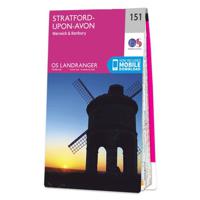
Wandelkaart - Topografische kaart 151 Landranger Stratford-upon-Avon,
Zeer goede detailkaart met topografische ondergrond. Kleurgebruik is goed over nagedacht: bijzonder goed leesbaar en helder kaartbeeld. Hierop zijn toeristische symbolen van bezienswaardigheden ingetekend, daarnaast staan bijvoorbeeld campings en jeugdherbergen vermeld en - voor wandelaars het belangrijkst - alle right of way paden en Lange afstands Wandelpaden zijn er op te vinden. De ideale kaart voor het wandelen in Engeland, Wales of Schotland. De kaarten zijn te gebruiken met GPS (UTM OSGB36), de legenda is in het Engels, Frans en Duits.    Plaatsen op deze kaart: Stratford-upon-Avon, Warwick, Banbury, Royal Leamington Spa, Henley-in-Arden, Norton Lindsey, Willoughby, Southam, Napton on the Hill, Bishop’s Itchington, Harbury, Moreton Morrell, Wellesbourne, Long Marston, Ettington, Kineton, Fenny Compton, Hellidon, Byfield, Chipping Warden, Cropredy, Oxhill, Ilmington, Shenington, Middleton Cheney, Shipston-on-Stour, Chipping Campden, Lower Brailes, Swalcliffe, Bloxham, Hook Norton…
19,50
Wandelgids The Cotswolds | Pocket Mountains
Handige compacte wandelgids met 40 dagwandelingen. Deze gids bevat kleine kaartjes en leuke uitgebreide informatie over wat er langs de route te zien is. Goede wandelkaarten zijn echter we noodzakelijk voor deze tochten: de Ordnance Survey explorer maps of Landanger maps zijn zeer geschikt.   From upland outlooks and secret valleys to rolling pastures and honey stone villages, nature and history weave together in the Cotswolds to create a landscape that is the epitome of rural England. In these 40 walks Dominic North unlocks the secrets of the Cotswolds, from the hills and lanes in the north to the languid riverbanks and ancient woods of the south. Along the way discover sleepy villages, grand country houses and architectural curiosities, and then reach out to explore three of England's most celebrated cities, Bath, Oxford and Stratford-upon-Avon. Plaatsen in het boekje Bath, Bathampton, Batsford, Belas Knap, Bibury, Blenheim Park, Blockley, Bourton-on-the-Hill, Bourton-on-the-Water, B…
10,95
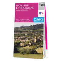
Wandelkaart - Topografische kaart 150 Landranger Worcester & The Malve
Zeer goede detailkaart met topografische ondergrond. Kleurgebruik is goed over nagedacht: bijzonder goed leesbaar en helder kaartbeeld. Hierop zijn toeristische symbolen van bezienswaardigheden ingetekend, daarnaast staan bijvoorbeeld campings en jeugdherbergen vermeld en - voor wandelaars het belangrijkst - alle right of way paden en Lange afstands Wandelpaden zijn er op te vinden. De ideale kaart voor het wandelen in Engeland, Wales of Schotland. De kaarten zijn te gebruiken met GPS (UTM OSGB36), de legenda is in het Engels, Frans en Duits.    Plaatsen op deze kaart: Worcester, Evesham, Tewkesbury, Droitwich Spa, Redditch, Great Malvern, Abberley, Holt Fleet, Stoke Prior, Studley, Martley, Himbelton, Inkberrow, Alcester, Upton Snodsbuty, Church Lench, Bidford-on-Avon, Cradley, Kempsey, Pershore, Harvington, Upton upon Severn, Eckington, Hollybush, Twyning, Beckford, Sedgeberrow, Broadway, Redmarley D’Abitot, Staunton, Gotherington and Winchcombe
19,50
Wandelkaart - Topografische kaart 173 Landranger Swindon & Devizes, Ma
Zeer goede detailkaart met topografische ondergrond. Kleurgebruik is goed over nagedacht: bijzonder goed leesbaar en helder kaartbeeld. Hierop zijn toeristische symbolen van bezienswaardigheden ingetekend, daarnaast staan bijvoorbeeld campings en jeugdherbergen vermeld en - voor wandelaars het belangrijkst - alle right of way paden en Lange afstands Wandelpaden zijn er op te vinden. De ideale kaart voor het wandelen in Engeland, Wales of Schotland. De kaarten zijn te gebruiken met GPS (UTM OSGB36), de legenda is in het Engels, Frans en Duits.    Plaatsen op deze kaart: Swindon, Devizes, Marlborough, Cricklade, Stanton Fitzwarren, Wroughton, Rockley, Uffcott, Clench Commeon, Pewsey, Rushall, Chirton, All Cannings, Bishops Cannongs, Avebury, Cherhill, Winterbourne Bassett, Wotton Bassett, Hook, Purton, Minety, Charlton, Brinkworth, Malmesbury, Hankerton, Oaksey, Tetbury, Leigherton, Didmarton, Sherston, Hullavington, Castle Combe, Dauntsey, Kington Langley, Ford, Chippenham, Colerne, Bre…
19,50
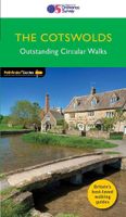
Wandelgids 06 Pathfinder Guides Cotswolds | Ordnance Survey
180 miles of wonderful walking in idyllic, limestone countryside . . .   Take a journey on 28 beautiful walks across the Cotswolds with the OS Pathfinder Guidebooks, graded by length and ranging from 3 to 10 miles.   All walks in this book include written directions, an extract of the OS map for the area and some background on the history and natural environment you see. Most of the walks avoid busy roads and are designed to help you make the most of a holiday or day trips. There are notes on parking, pubs, and things to see en route.   The routes range from extended strolls to longer hikes, something for all levels! Each walk includes a detailed description, an OS map, GPS waypoints and notes of key features and things to see.   This is one of a series of books with great walking routes covering the most popular and scenic areas of Britain. Printed with weather-resistant covers featuring durable rounded corners, they are the perfect companion for country walking throughout Britain.   …
18,50
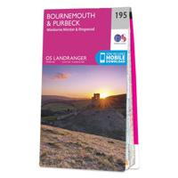
Wandelkaart - Topografische kaart 195 Landranger Bournemouth & Purbeck
Take a walk on the sunny side of life in beautiful south Dorset. Relax on Bournemouth’s sandy beaches or explore the Jurassic Coast peninsula of the Isle of Purbeck, home to the world-famous beaches of Swanage and Lulworth Cove.   Visit the charming riverside town of Wimborne Minster set amidst the Cranborne Chase Area of Outstanding Natural Beauty From the market town of Ringwood, explore the New Forest National Park  Walk, hike and cycle along the South West Coast Path through the Dorset and East Devon Coast World Heritage Site    Zeer goede detailkaart met topografische ondergrond. Kleurgebruik is goed over nagedacht: bijzonder goed leesbaar en helder kaartbeeld. Hierop zijn toeristische symbolen van bezienswaardigheden ingetekend, daarnaast staan bijvoorbeeld campings en jeugdherbergen vermeld en - voor wandelaars het belangrijkst - alle right of way paden en Lange afstands Wandelpaden zijn er op te vinden. De ideale kaart voor het wandelen in Engeland, Wales of Schotland. D…
19,50

Klanten-reviews van Wandelkaart - Topografische kaart 163 Landranger Cheltenham & Cirences

Er zijn nog geen beoordelingen voor dit productBen jij de eerste die een review plaatst?

Meer over Wandelkaart - Topografische kaart 163 Landranger Cheltenham & Cirences

Productomschrijving

Zeer goede detailkaart met topografische ondergrond. Kleurgebruik is goed over nagedacht: bijzonder goed leesbaar en helder kaartbeeld. Hierop zijn toeristische symbolen van bezienswaardigheden ingetekend, daarnaast staan bijvoorbeeld campings en jeugdherbergen vermeld en - voor wandelaars het belangrijkst - alle right of way paden en Lange afstands Wandelpaden zijn er op te vinden. De ideale kaart voor het wandelen in Engeland, Wales of Schotland. De kaarten zijn te gebruiken met GPS (UTM OSGB36), de legenda is in het Engels, Frans en Duits.    Plaatsen op deze kaart: Cheltenham, Cirencester, Stow-on-the-Wold, Northleach, Burford, Carterton, Lechlade on Thames, Fairford, Farringdon, Highworth, Cricklade, Tetbury, Crudwell, Oaksey, Minety, Broad Blunsdon, Longcot, Whelford, South Cerney, Kemble, Tarlton, Rodmarton, Poulton, Bagendon, Barnsley, Quenington, Alvescot, Bibury, Winson, Chedworth, Aldsworth, Great Barrington, Serborne, Chalford, Bisley, Duntisbourne Abbots, Cranham, Colesbourne, Birdlip, Withington, Andoversford, Bourton-on-the-Water, Shurdington, Bishop’s Cleeve, Winchcombe, Charlton Abbots, Naunton, Upper Slaugher, Kineton, Condicote, Bledington and Chastleton, with the Cotswold Hills.

Productspecificaties

Artikelnummer(s)
Brand
Ordnance Survey
Webshop.nl maakt gebruik van cookies. Ga je verder op onze website, ga dan akkoord met het plaatsen van cookies en de verwerking van deze data door ons en vermelde partners.