webshop.nl
Categorieën
  Sluiten

Meer Pocket Mountains

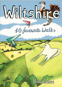
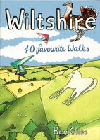
Wandelgids Wiltshire | Pocket Mountains

0
Handige compacte wandelgids met 40 dagwandelingen. Deze gids bevat kleine kaartjes en leuke uitgebreide informatie over wat er langs de route te zien is. Goede wandelkaarten zijn echter we noodzakelijk voor deze tochten: de Ordnance Survey explorer maps of Landanger maps zijn zeer geschikt.   The enigmatic Neolithic standing stones at Stonehenge an...

Webshops met dit product

Webshop
Bezorging
Prijs

Anderen bekeken ook

Wandelgids Wiltshire | Pocket Mountains
Handige compacte wandelgids met 40 dagwandelingen. Deze gids bevat kleine kaartjes en leuke uitgebreide informatie over wat er langs de route te zien is. Goede wandelkaarten zijn echter we noodzakelijk voor deze tochten: de Ordnance Survey explorer maps of Landanger maps zijn zeer geschikt.   The enigmatic Neolithic standing stones at Stonehenge and Avebury first drew footsore pilgrims to this landlocked area of Southern England more than 4000 years ago. Today there are scores of waymarked footpaths, bridleways and byways which connect the rolling downland, verdant valleys, white chalk horses, ancient settlements and vibrant historic towns of the 'great green county' of Wiltshire. This guide contains 40 circular routes which make the most of that network.   Most walks can be completed inside two or three hours, though some will require half a summer's day, with a few full-day routes along the downland ridges.
10,95
Wandelgids Wye Valley | Pocket Mountains
This guide contains forty circular routes, covering an area somewhat broader than the AONB but within similar north-south boundaries. This collection of walks is split into five areas: Hereford Lowlands and the Woolhope Dome; Archenfield and the Monnow and Trothy Valleys; The Wye Gorge; The Forest of Dean; The Trellech to Chepstow Plateau. In part, the areas reflect the diverse geology and ecology of the landscape, but they are in no way essentially distinct or separate. Each has its own particular attractions and character, but there is much that is shared between all five areas.   Most of the routes are intended as comfortable walks or strolls, manageable by all willing to put one foot in front of another, at most requiring half a day to complete. Occasionally, the cumulative ascent may leave unseasoned legs a little stiffer, but in general the walking is on well-worn paths, lanes and tracks, which should require minimal time and effort for route-finding. However, the sketch maps serve an…
10,95
Wandelgids Peru's Cordilleras Blanca & Huayhuash | Trailblazer Guides
The Cordilleras Blanca and Huayhuash boast some of the most spectacular scenery in the Andes, and some of the most accessible high altitude trekking and cycling in the world. Perfect pyramidal peaks, gargantuan ice falls and turquoise alpine lakes are all easily reached from Huaraz, the region's capital and centre of tourist comforts.   This practical guide contains 50 detailed route maps and descriptions covering 20 hiking trails and 30 days of paved and dirt road cycle touring. Trekking – the classic treks: Huayhuash Circuit, Santa Cruz and Alpamayo Basecamp, as well as lesser known, wild walks in valleys which see few visitors. Ranging from easy day hikes to challenging routes of 10 days or more, all can be trekked independently or in guided groups. Cycling – includes the Huascarán Circuit, a loop of Peru's highest mountain, as well as four other multi-day rides and five day-cycles from Huaraz. Covers all the information cyclists need to pedal past glaciers on 6000m peaks or fly dow…
25,50
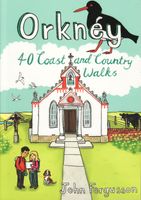
Wandelgids Orkney | Pocket Mountains
Handige compacte wandelgids met 40 dagwandelingen. Deze gids bevat kleine kaartjes en leuke uitgebreide informatie over wat er langs de route te zien is. Goede wandelkaarten zijn echter we noodzakelijk voor deze tochten: de Ordnance Survey explorer maps of Landanger maps zijn zeer geschikt.   The 40 walks in this guide range from a short stroll to hikes of several hours, but most can be completed in half a day or less. The majority are circular, several are lollipop-shaped and some require you to return by the same route. They all, however, end up back where they started, so you will not find yourself miles from your car. Each route is prefaced by an indication of the distance involved and the time it is likely to take. The latter is estimated on the time it took the author to walk the route (averaging around 3.5km per hour) before adding a little for tea, toilet and tourism stops. The timings should be regarded as a rough guide, and if you have to catch a bus or boat at the end of the…
10,95
Wandelgids Peru's Cordilleras Blanca & Huayhuash | Trailblazer Guides
The Cordilleras Blanca and Huayhuash boast some of the most spectacular scenery in the Andes, and some of the most accessible high altitude trekking and cycling in the world. Perfect pyramidal peaks, gargantuan ice falls and turquoise alpine lakes are all easily reached from Huaraz, the region's capital and centre of tourist comforts.   This practical guide contains 50 detailed route maps and descriptions covering 20 hiking trails and 30 days of paved and dirt road cycle touring. Trekking – the classic treks: Huayhuash Circuit, Santa Cruz and Alpamayo Basecamp, as well as lesser known, wild walks in valleys which see few visitors. Ranging from easy day hikes to challenging routes of 10 days or more, all can be trekked independently or in guided groups. Cycling – includes the Huascarán Circuit, a loop of Peru's highest mountain, as well as four other multi-day rides and five day-cycles from Huaraz. Covers all the information cyclists need to pedal past glaciers on 6000m peaks or fly dow…
25,50
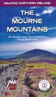
Wandelgids The Mourne Mountains | Knife Edge Outdoor
The only guidebook for the Mourne Mountains written by a County Down local hiker: 30 handpicked routes. The only guidebook for the Mourne Mountains with Real 1:25,000 Maps: this makes navigation easy and saves you money: no need to carry additional maps. Also includes: -Game of Thrones film locations -Numbered waypoints linking maps to text -Quick Reference Route List: enabling you to plan an itinerary to match your ability and schedule. All difficult calculations of time, distance and altitude gain are done for you -Everything the hiker needs to know to plan routes: route descriptions, difficulty, weather, how to get there, and more -Accommodation section -Information on Wildlife, Plants & Geology -History of the Mourne Wall -List of Irish Place Names -Edge to edge colour: the most modern and beautiful Mournes guidebook The Mourne range comprises the highest mountains in Northern Ireland. It is a stunning wilderness which is popular with local walkers but is relatively unknown to thos…
19,50
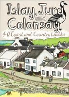
Wandelgids Islay, Jura and Colonsay | Pocket Mountains
Handige compacte wandelgids met 40 dagwandelingen. Deze gids bevat kleine kaartjes en leuke uitgebreide informatie over wat er langs de route te zien is. Goede wandelkaarten zijn echter wel aan te raden voor deze tochten: de Ordnance Survey explorer maps of Landranger maps zijn zeer geschikt. Islay, Jura and Colonsay make up the most southerly Hebridean island group and are famed for their outstanding wildlife, glorious sandy beaches, fascinating historical treasures, rugged hills and dramatic coastlines, and – on Jura, but especially on Islay – legendary distilleries which produce distinctively peaty whisky.   This book aims to help you get the most from your visit to these islands. Most of the 40 walks are a half day or shorter, with many suitable for families, but there are also a few more challenging hillwalks for those who can’t resist the allure of reaching an island summit.
10,95
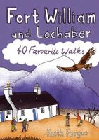
Wandelgids Fort William and Lochaber | Pocket Mountains
Handige compacte wandelgids met 40 dagwandelingen. Deze gids bevat kleine kaartjes en leuke uitgebreide informatie over wat er langs de route te zien is. Goede wandelkaarten zijn echter wel aan te raden voor deze tochten: de Ordnance Survey explorer maps of Landranger maps zijn zeer geschikt. With the historic town of Fort William at its heart, Lochaber boasts some of Scotland's most celebrated mountains and glens, beautiful sea lochs and, on the craggy west coast, dazzling white sandy beaches. Ben Nevis may draw the crowds, but with countless miles of lower-level paths and tracks to explore there is far more than Britain's highest mountain for walkers to enjoy in the region which lays claims to the title of 'The Outdoor Capital of the UK'. This guide features 40 varied walks that take in the very best of Lochaber. From the iconic Glencoe and Glen Nevis to the wild lands of Ardnamurchan and Moidart, there is something for everyone in this diverse selection of routes.
10,95

Klanten-reviews van Wandelgids Wiltshire | Pocket Mountains

Er zijn nog geen beoordelingen voor dit productBen jij de eerste die een review plaatst?

Meer over Wandelgids Wiltshire | Pocket Mountains

Productomschrijving

Handige compacte wandelgids met 40 dagwandelingen. Deze gids bevat kleine kaartjes en leuke uitgebreide informatie over wat er langs de route te zien is. Goede wandelkaarten zijn echter we noodzakelijk voor deze tochten: de Ordnance Survey explorer maps of Landanger maps zijn zeer geschikt.   The enigmatic Neolithic standing stones at Stonehenge and Avebury first drew footsore pilgrims to this landlocked area of Southern England more than 4000 years ago. Today there are scores of waymarked footpaths, bridleways and byways which connect the rolling downland, verdant valleys, white chalk horses, ancient settlements and vibrant historic towns of the 'great green county' of Wiltshire. This guide contains 40 circular routes which make the most of that network.   Most walks can be completed inside two or three hours, though some will require half a summer's day, with a few full-day routes along the downland ridges.

Productspecificaties

Artikelnummer(s)
Brand
Pocket Mountains
Webshop.nl maakt gebruik van cookies. Ga je verder op onze website, ga dan akkoord met het plaatsen van cookies en de verwerking van deze data door ons en vermelde partners.