Productomschrijving
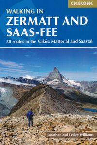
Wandelgids met dagtochten: goed beschreven met veel praktische informatie om de route te kunnen lopen, inclusief redelijke kaarten. Enorm veel keus in een groot gebied! Guidebook describing 50 varied walks in the Valais region in the heart of the Swiss Alps. The graded day walks based around the popular resort towns of Zermatt and Saas-Fee explore the Mattertal and Saastal valleys and the surrounding mountains. Ranging from 4 to 18km, the easily accessible routes make use of the area's extensive network of well-made mountain paths and its lift system. There are walks here to suit all tastes, from low-level lake walks or easy strolls up to mountain restaurants, through to serious mountain outings on steep and rocky trails. Distance, walking time and difficulty are shown for each route, and the detailed route description is accompanied by clear mapping. Dominated by 4000m the giants, the Matterhorn and Monte Rosa, this is a land of contrasts, with snow-capped mountains and glaciers above and meadows and vineyards fringing the valleys below. Good transport infrastructure and plentiful accommodation make it a superb area for a walking holiday. It is divided into three chapters: Zermatt; Grächen, Randa and the Mattertal; and Saas-Fee and the Saastal. The routes are graded from 1 to 4 and range from 4 to 18km. They are best walked between mid June and mid September. Most are on well-made mountain paths, although a few are on steep and rocky trails with exposure. There are routes to suit all tastes, from easy strolls up to mountain restaurants, lakes and viewpoints through to serious mountain challenges. Zermatt and Saas-Fee offer superb walking in the shadow of the Matterhorn. Both villages have a full range of facilities and there is a plenty of accommodation throughout the Mattertal and Saastal. There is ample opportunity to make use of Switzerland's an excellent public transport infrastructure to give access to walks. Distance, walking time, ascent, descent and difficulty are shown for each route, and the route description is supported by clear mapping. An appendix of contacts list sources of information, helpful websites and apps, and there is a useful English-German glossary.
