webshop.nl
Categorieën
  Sluiten

Meer Cicerone
Meer Cicerone in Literatuur boeken

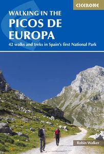
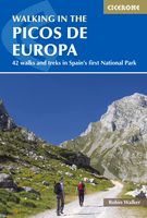
Wandelgids Walking in the Picos de Europa | Cicerone

0
Guidebook to 38 walks and 4 short treks of 3-4 days in the stunning Picos de Europa mountains of northern Spain. The walking routes are between 8 and 24 km in length and are graded by difficulty, ranging from easy valley walks to difficult ascents of the high peaks. The walks cover the areas of Cangas de Onis, Cabrales, Liebana, Valdeon and Sajambr...

Webshops met dit product

Webshop
Bezorging
Prijs

Anderen bekeken ook

Wandelgids Walking in the Picos de Europa | Cicerone
Guidebook to 38 walks and 4 short treks of 3-4 days in the stunning Picos de Europa mountains of northern Spain. The walking routes are between 8 and 24 km in length and are graded by difficulty, ranging from easy valley walks to difficult ascents of the high peaks. The walks cover the areas of Cangas de Onis, Cabrales, Liebana, Valdeon and Sajambre.   Alongside detailed route descriptions and 1:50k mapping, there is plenty of information on potential bases, manned refuges, local transport and facilities along the routes. There are also background notes on the area's rich geology, plants and wildlife. Spain's first national park, the Picos de Europa feature striking karst landscapes of jagged peaks and deeply incised gorges.   However, there are also beech woods and picturesque alpine lakes, and the diverse landscapes support a wide variety of plants, wildlife and birdlife. The walks showcase many of the region's highlights, including its high peaks, the Covadonga lakes and the breatht…
24,95
Wandelgids Walking and trekking in the Sierra Nevada | Cicerone
Uitstekende wandelgids voor de Sierra Nevada. Goed beschreven met veel praktische informatie om de route te kunnen lopen, inclusief redelijke kaarten. Aanbevolen wandelkaarten Wandelkaart NP Sierra Nevada met Alpujarras | Editorial Penibetica 1:40.000 of Wandelkaart Sierra Nevada en Alpujarras | Editorial Alpina - 1:40.000 Wandelkaart Sierra Nevada - la integral de los 3000 | Editorial Piolet 1:25.000   This guidebook presents 33 graded walks and 5 high mountain scrambles in the striking Sierra Nevada, the highest mountain range in mainland Spain and in western Europe outside the Alps. Easily accessible from Granada and Málaga, it is a world of soaring, snow-clad peaks and deep valleys, far removed from the crowded beaches of the Costa del Sol just two hours away. The routes are spread across the national park, with attractive towns and villages such as Trevélez, Lanjarón, Hoya de la Mora and Cumbres Verdes serving as potential bases for a walking holiday.   The walks have been careful…
20,95
Wandelgids Walks and treks in Croatia - Kroatië | Cicerone
Uitstekende wandelgids, sommige meerdaags, voor dit uitdagende wandelgebied. 20 dagwandelingen en 7 korte trekkings. Goede beschrijvingen en praktische informatie, kaartmateriaal is wat summier. This guide describes 20 walks and 7 short treks in beautiful Croatia. Around half the routes focus on the striking limestone ranges of Gorski kotar and Velebit, which form part of the Dinaric Alps, but there are also routes in Dalmatia and on the Istrian peninsula, as well as four walks centred around the capital, Zagreb. They are easily accessible from the coastal resorts and main cities such as Zagreb, Rijeka and Split, and the guide includes advice on the most convenient bases.   Showcasing Croatia's majestic scenery, the routes range from short, easy walks to more challenging treks and mountain traverses. Step-by-step route description is accompanied by clear mapping, and there are notes highlighting where refreshments are available on or near the trails. The treks make use of mountain huts…
23,95
Wandelgids Walking in the Auvergne | Cicerone
Uitgebreide wandelgids van de Auvergne: goede beschrijvingen, veel keuze, kaarten wat minder goed. This handy guidebook offers the finest day walks in five different areas of the Auvergne, an often-forgotten region in central France perfect for accessible day walking in a unique and spectacular landscape. Towns such as Vichy, Clermont-Ferrand and Puy-en-Velay also offer delightful places to base yourself for that perfect walking holiday. The ridges, rocky peaks and verdant valleys of the Cantal supervolcano dominate south-western Auvergne. The centre of the region hosts the unique chain of 'puys' with their pudding bowl forms and the pristine crater lakes of the Sancy massif. In the north, the Montagne Bourbonnaise preserves a pastoral way of life which is quintessentially French while the Haute Loire's rivers and medieval abbeys reward those venturing further off the beaten track. Notes on the geology and history of points of interest passed en route help you to get the most out of yo…
19,95
Wandelgids Walking in the Briançonnais | Cicerone
Handige duidelijke wandelgids van een mooi wandelgebied. De routes zijn accuraat beschreven met praktische informatie erbij. Kaartmateriaal is redelijk, soms wat schetsmatig. In berggebieden zijn wandelkaarten wel belangrijk! Bij de routes worden de juiste kaartnummers gegeven.    This guidebook presents 40 walks exploring the area around Briançon in France. The walks are divided into 6 sections covering the valleys of Clarée, Cerveyrette, Ayes, Durance and Guisane, as well as the area around Vallouise and Montgenèvre. The walks are circular and range in distance from 4 to 21 km. Graded easy to very hard, there is a walk to suit all abilities.    Dominated on all sides by jagged peaks, and perched on a rocky spur at the nucleus of five beautiful valleys, the city of Briançon lies almost at the southernmost tip of the main Alpine range. The Briançonnais, the surrounding region to which it gives its name, is a stunning mountain wilderness packed with everything one would expect from a hi…
23,95
Wandelgids Walking in Andalucia - Andalusië | Cicerone
Mooi en duidelijke wandelgids over bepaalde streken in Andalusië: goed beschreven wandelingen met een redelijke kaart. De tekst is behoorlijk kompleet. Daarnaast ook praktische informatie per route. This guidebook explores six of Andalucía's most beautiful Natural Parks, the Sierra Nevada regions of Aracena, Grazalema, Los Alcornocales and the Gaucín, La Axarquía, the Alpujarras and Cazorla, along the great belt of the Cordillera Bética mountains. The thirty-six half-day and full-day mostly circular walks are evenly split within these six regions, and range in length from 4 to 21km. Walks are graded and some involve steep ascents and descents, all within the capabilities of a reasonably fit walker. The vast mountain range of the Cordillera Bética offers some of the finest year-round walking in Europe. Towering above the Mediterranean, the highest peaks of the Sierra Nevada rise to almost 3500m, mainland Spain's highest mountains. And wrapped within this mighty belt of mountains are so…
22,95

Klanten-reviews van Wandelgids Walking in the Picos de Europa | Cicerone

Er zijn nog geen beoordelingen voor dit productBen jij de eerste die een review plaatst?

Meer over Wandelgids Walking in the Picos de Europa | Cicerone

Productomschrijving

Guidebook to 38 walks and 4 short treks of 3-4 days in the stunning Picos de Europa mountains of northern Spain. The walking routes are between 8 and 24 km in length and are graded by difficulty, ranging from easy valley walks to difficult ascents of the high peaks. The walks cover the areas of Cangas de Onis, Cabrales, Liebana, Valdeon and Sajambre.   Alongside detailed route descriptions and 1:50k mapping, there is plenty of information on potential bases, manned refuges, local transport and facilities along the routes. There are also background notes on the area's rich geology, plants and wildlife. Spain's first national park, the Picos de Europa feature striking karst landscapes of jagged peaks and deeply incised gorges.   However, there are also beech woods and picturesque alpine lakes, and the diverse landscapes support a wide variety of plants, wildlife and birdlife. The walks showcase many of the region's highlights, including its high peaks, the Covadonga lakes and the breathtaking Cares Gorge. The landscape of the Picos is widely considered the jewel in Spain's mountainous crown.

Productspecificaties

Artikelnummer(s)
Brand
Cicerone

Verken gerelateerde categorieën

Webshop.nl maakt gebruik van cookies. Ga je verder op onze website, ga dan akkoord met het plaatsen van cookies en de verwerking van deze data door ons en vermelde partners.