webshop.nl
Categorieën
  Sluiten

Meer Trailblazer Guides

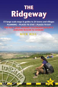
Wandelgids The Ridgeway | Trailblazer Guides

0
Goede wandelgids waarin met veel details alle etappes zijn beschreven. Tevens informatie over overnachtingen en openbaar vervoer. This is an all-in-one hiking guide to The Ridgeway, an 87-mile trail that partly follows England's oldest road which dates from prehistoric times. Easily accessible from London, this is not a difficult walk and the rewar...

Webshops met dit product

Webshop
Bezorging
Prijs

Anderen bekeken ook

Wandelgids The Ridgeway | Trailblazer Guides
Goede wandelgids waarin met veel details alle etappes zijn beschreven. Tevens informatie over overnachtingen en openbaar vervoer. This is an all-in-one hiking guide to The Ridgeway, an 87-mile trail that partly follows England's oldest road which dates from prehistoric times. Easily accessible from London, this is not a difficult walk and the rewards are many: rolling countryside, Iron Age forts, Neolithic burial mounds, white horses carved into the chalk downs and picturesque English villages. The guide includes places to stay, places to eat, sights and comprehensive transport options for day trips. Practical guide to walking the whole of the Ridgeway National Trail. The Ridgeway path begins near Avebury and runs 87 miles across the high chalk downs of Wiltshire, into the Thames Valley and on to the Chiltern Hills of Buckinghamshire, finishing at Ivinghoe Beacon near Aylesbury. Includes: Ridgeway map, 53 large-scale maps (1:20,000), guides to 24 towns and villages. Detailed accommodat…
19,95
Wandelgids South Downs Way | Trailblazer Guides
The South Downs Way is a 100-mile footpath which follows the line of chalk hills stretching from Winchester to Eastbourne. Walking the length of the Downs is the best way to experience this beautiful landscape with its mixture of rolling hills, steep hanging woodland and windswept fields. You'll also pass through picture-postcard villages with welcoming pubs, thatched cottages and country gardens. 1. Unique mapping features - In many walking guides the reader has to read a route description then try to relate it to the map. Our guides are easier to use because walking directions, tricky junctions, places to stay and eat, points of interest and walking times are all written onto the maps themselves in the places to which they apply. With their uncluttered clarity, these are not general-purpose maps but fully-edited maps drawn by walkers for walkers. Downloadable GPS waypoints also included. 2. The largest scale walking maps available - At just under 1:20,000 (8cm or 31/8 inches to 1 mil…
20,95
Wandelgids Walking in the Thames Valley | Cicerone
Walking in the Thames Valley offers 25 challenging circular walks around the River Thames and River Kennet in the south of England, taking in the Southern Chilterns, the Berkshire and North Hampshire Downs, Southern Oxfordshire and the eastern edge of Wiltshire. All routes are within easy reach of Reading, Newbury, Abingdon and London. While some walks visit Iron Age hill forts, others pass more modern features such as Wilton Windmill and the Kennet and Avon Canal. Some follow sections of the Ridgeway, while others meander along the banks of the Thames. What they all have in common is that they take the keen rambler to some of the best parts of the Thames Valley – a patchwork of open chalk grassland, broadleaved woodland and farmland and home to two Areas of Outstanding Natural Beauty. • walks from 10 to 18 miles, including one 2-day route • shorter, less strenuous alternatives for many of the walks • detailed route descriptions with information on local points of interest, OS mapping …
18,50
Wandelgids Cleveland Way | Trailblazer Guides
All the information you need to enjoy your hiking adventure along the Cleveland Way in this fully revised and updated 2nd edition. In the beautiful, wild countryside of the North York Moors National Park in northern England lies this fabulous trail, the Cleveland Way. The 110-mile route runs from Helmsley near Thirsk around the western edge of the park to reach the coast at Saltburn-by-the-Sea.   It then continues along the eastern edge of the park south down the coast through Whitby, Robin Hood's Bay and Scarborough to finish in Filey. Combining moorland and coast there's wonderful scenic variety to this walk, with crumbling castles and idyllic fishing villages to explore. The guide includes:48 large-scale walking maps - at just under 1:20,000 - showing route times, places to stay, places to eat, points of interest, and 8 town plans10 colour stage maps to help plan your walk, including hills and descents, and two colour overview mapsPlaces to stay with reviews - campsites, bunkhouses,…
19,95
Wandelgids The Ridgeway | Cicerone
Uitstekende wandelgids van de Ridgeway, waarbij naast alle noodzakelijke informatie ook gebruik gemaakt wordt van de echte topografische kaart. Inclusief gidsje met routekaarten van 1:25000   This guidebook - which includes both a guide to the route and a separate OS map booklet - describes the Ridgeway National Trail, an 87 mile (139km) route through southern England from Avebury in Wiltshire to Ivinghoe Beacon in Buckinghamshire. Typically walked in 6 or 8 days, this is a low-level waymarked route suitable for all abilities and for year round walking.   The guidebook details the trail in both directions, west to east and east to west. Step-by-step route descriptions are accompanied by 1:100,000 OS mapping and a separate OS 1:25,000 map booklet showing the entire route is included. Packed with details on points of interest and a trek planner giving at-a-glance information about facilities, public transport and accommodation available along the way, this book is an indispensable guide …
23,95
Wandelgids Norfolk Coast Path - Peddars Way | Trailblazer Guides
The Norfolk Coast Path & Peddars Way cover 130-miles of walking trails. The Peddars Way runs through East Anglia from Knettishall Heath on the Norfolk/Suffolk border and follows a Roman road to Holme-next-the-Sea. From here it becomes the Norfolk Coast Path, hugging the beautiful Norfolk coastline through Holkham, Wells, Blakeney and Cley to Cromer before it rounds the shoulder of the county and continues along the superb beaches and crumbling cliffs to Mundesley, Sea Palling and Great Yarmouth, finishing just before the Suffolk border.   Includes: 77 large-scale walking maps - at just under 1: 20,000 (8cm or 3 and one eighth inches to 1 mile) our maps are bigger than even the most detailed walking maps currently available, with walking directions, tricky junctions, places to stay and eat, points of interest and walking times written onto the maps Text and maps in clear TWO-COLOUR style All standards of accommodation with reviews - campsites, B&Bs, hostels, hotels, bunkhouses Where to …
20,95

Klanten-reviews van Wandelgids The Ridgeway | Trailblazer Guides

Er zijn nog geen beoordelingen voor dit productBen jij de eerste die een review plaatst?

Meer over Wandelgids The Ridgeway | Trailblazer Guides

Productomschrijving

Goede wandelgids waarin met veel details alle etappes zijn beschreven. Tevens informatie over overnachtingen en openbaar vervoer. This is an all-in-one hiking guide to The Ridgeway, an 87-mile trail that partly follows England's oldest road which dates from prehistoric times. Easily accessible from London, this is not a difficult walk and the rewards are many: rolling countryside, Iron Age forts, Neolithic burial mounds, white horses carved into the chalk downs and picturesque English villages. The guide includes places to stay, places to eat, sights and comprehensive transport options for day trips. Practical guide to walking the whole of the Ridgeway National Trail. The Ridgeway path begins near Avebury and runs 87 miles across the high chalk downs of Wiltshire, into the Thames Valley and on to the Chiltern Hills of Buckinghamshire, finishing at Ivinghoe Beacon near Aylesbury. Includes: Ridgeway map, 53 large-scale maps (1:20,000), guides to 24 towns and villages. Detailed accommodation: campsites, B&Bs, hotels, hostels and bunkhouses. Places to eat: cafes, teashops, pubs and restaurants. Detailed public transport information. Itineraries for all walkers including day Ridgeway walks. Downloadable GPS waypoints. Colour pictures including 4 paqe flower and butterfly guide.

Productspecificaties

Artikelnummer(s)
Brand
Trailblazer Guides
Webshop.nl maakt gebruik van cookies. Ga je verder op onze website, ga dan akkoord met het plaatsen van cookies en de verwerking van deze data door ons en vermelde partners.