webshop.nl
Categorieën
  Sluiten

Meer Trailblazer Guides
Meer Trailblazer Guides in Literatuur boeken

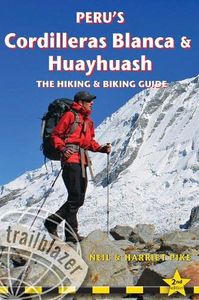
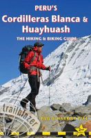
Wandelgids Peru's Cordilleras Blanca & Huayhuash | Trailblazer Guides

0
The Cordilleras Blanca and Huayhuash boast some of the most spectacular scenery in the Andes, and some of the most accessible high altitude trekking and cycling in the world. Perfect pyramidal peaks, gargantuan ice falls and turquoise alpine lakes are all easily reached from Huaraz, the region's capital and centre of tourist comforts.   This practi...

Webshops met dit product

Webshop
Bezorging
Prijs

Anderen bekeken ook

Wandelgids Peru's Cordilleras Blanca & Huayhuash | Trailblazer Guides
The Cordilleras Blanca and Huayhuash boast some of the most spectacular scenery in the Andes, and some of the most accessible high altitude trekking and cycling in the world. Perfect pyramidal peaks, gargantuan ice falls and turquoise alpine lakes are all easily reached from Huaraz, the region's capital and centre of tourist comforts.   This practical guide contains 50 detailed route maps and descriptions covering 20 hiking trails and 30 days of paved and dirt road cycle touring. Trekking – the classic treks: Huayhuash Circuit, Santa Cruz and Alpamayo Basecamp, as well as lesser known, wild walks in valleys which see few visitors. Ranging from easy day hikes to challenging routes of 10 days or more, all can be trekked independently or in guided groups. Cycling – includes the Huascarán Circuit, a loop of Peru's highest mountain, as well as four other multi-day rides and five day-cycles from Huaraz. Covers all the information cyclists need to pedal past glaciers on 6000m peaks or fly dow…
25,50
Wandelgids Peru - Hiking and Biking Peru's Inca Trails | Cicerone
The eastern slope of the Peruvian Andes is one of the most dramatic and diverse places on the planet, dropping from over 6000m (20,000ft) to just 200m above sea level. This dramatic drop in elevation produces a wide range of constantly changing climactic and vegetative zones – it is often possible to hike from the base of a glacier down to the jungle in just a day or two. Combined with the countless Inca sites and ubiquitous Inca roads, this makes the Sacred Valley one of the best trekking and mountain biking destinations in the world.    Machu Picchu is well known as one of the Seven Wonders of the World, and the Inca Trail trek that leads there is nearly as famous. What is less known, however, is the vast choice of other epic adventure trips that exist in the region – treks through soaring Andean glaciers and Incan ruins, bike rides through stunning alpine and jungle scenery. Nearly every route in this book uses an Inca road or visits an Inca ruin – and most do both. The majority of …
22,95
Wandelgids Thames Path | Trailblazer Guides
This book follows the Thames Path National Trail from the river's source in Gloucestershire to the Thames Barrier in London. Officially 184 miles (294km) in length (although the actual distance you walk will depend on a number of decisions you make en route), the path meanders, accompanied by its watery muse, through pristine and tranquil countryside, past historic sites and buildings, via pub, lock, weir, and the occasional scattering of waterfowl, to a city, once the fulcrum of an empire, and now the heart of modern day England. The river, responsible for the metropolis' very being, tells tales, inspires artists, accommodates swans, geese, and water voles, reflects the silhouettes of red kites and kingfishers, provides employment, entices adventure, and allows time for carefree pilgrims to procrastinate and think. Following its banks is a grand way to go for a ramble. The path begins, as the river does, in a meadow in the Cotswolds; its upper reaches lonely and wild, the meadows and …
19,95
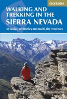
Wandelgids Walking and trekking in the Sierra Nevada | Cicerone
Uitstekende wandelgids voor de Sierra Nevada. Goed beschreven met veel praktische informatie om de route te kunnen lopen, inclusief redelijke kaarten. Aanbevolen wandelkaarten Wandelkaart NP Sierra Nevada met Alpujarras | Editorial Penibetica 1:40.000 of Wandelkaart Sierra Nevada en Alpujarras | Editorial Alpina - 1:40.000 Wandelkaart Sierra Nevada - la integral de los 3000 | Editorial Piolet 1:25.000   This guidebook presents 33 graded walks and 5 high mountain scrambles in the striking Sierra Nevada, the highest mountain range in mainland Spain and in western Europe outside the Alps. Easily accessible from Granada and Málaga, it is a world of soaring, snow-clad peaks and deep valleys, far removed from the crowded beaches of the Costa del Sol just two hours away. The routes are spread across the national park, with attractive towns and villages such as Trevélez, Lanjarón, Hoya de la Mora and Cumbres Verdes serving as potential bases for a walking holiday.   The walks have been careful…
20,95
Wandelgids Walking in Italy's Stelvio National Park | Cicerone
Wandelgids voor de Stelvio Nationaal Park in de Rätische Alpen ( Alpi Retiche ) ten zuiden van de Splügenpas op de grens met het Zwitserse Graubünden. Engelstalige beschrijving van 38 dagwandelingen.   Aanbevolen wandelkaarten 1:25.000 voor deze gids Wandelkaart 008 Ortles - Cevedale - Ortlergebiet | Tabacco Editrice   Wandelkaart 045 Latsch - Martell - Schlanders- Laces - Val Martello - Silandro | Tabacco Editrice   Wandelkaart 048 Val di Peio - Val di Rabbi - Val di Sole | Tabacco Editrice   The wide range of 38 summer day walks in this guide explore the renowned Stelvio National Park in the Italian Rhaetian Alps. Bordering the Dolomites to the east, and Switzerland to the west, the Stelvio is one of the largest protected areas in all of the Alps. Its unspoilt landscape ranges from valley farmland to forested hillsides and alpine meadows, and up to a wilderness of rugged glaciated summits and ridges, the highest of which is Ortler, at 3905m.   The walks, a selection of routes from ea…
20,95
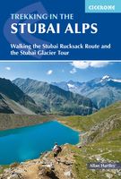
Wandelgids Trekking in the Stubaier Alps | Cicerone
Uitstekende wandelgids van Cicerone over de Stubaier Alpen, waarbij de nadruk ligt op een tweetal meerdaagse routes: Huttentochten voor een gemiddelde en wat meer gevorderde wandelaar. Goede praktische informatie, kaartmateriaal beperkt. Aanbevolen wandelkaarten bij deze gids Schaal 1:25.000 Wandelkaart 31/1 Alpenvereinskarte Stubaier Alpen - Hochstubai Wandelkaart 31/2 Alpenvereinskarte Stubaier Alpen - Sellrain Of schaal 1:50.000 Wandelkaart 83 Stubaier Alpen Kompass Of all the many Alpine areas, few can match the Stubai in the Austrian Tyrol as a venue for a first Alpine season. Shapely peaks, good paths and some of the best huts in the Alps make it ideal for the novice who wants to extend their experience beyond Britain. Of all the many Alpine areas, few can match the Stubai in the Austrian Tyrol as a venue for a first Alpine season. Shapely peaks, good paths and some of the best huts in the Alps make it ideal for the novice who wants to extend their experience beyond Britain. This…
21,95
Wandelgids Sinai Trekking Guide | Trailblazer Guides
Bijzondere gids over fantastische tochten in de Sinai: wandelgids met goede schetskaarten, veel praktische informatie. Onmisbaar voor zo'n tocht! Trek with the Bedouin and their camels and discover one of the most exciting new trekking destinations in the world. Egypt's Sinai peninsula is the small tooth of land between Africa and Asia, and the fabled Biblical setting of The Exodus. It's a region of high mountains and sweeping deserts, home to crumbling Egyptian temples, Byzantine monasteries and more. The millions that visit Sinai each year come mostly for its beaches and reefs but for a true adventure, the best way to see Sinai is to trek with the Bedouin. Walking with their camels gives access to the most remote and waterless parts of the peninsula and no other mode of travel immerses you so fully in your surroundings nor gives such a close feel for the desert - its freedoms and hardships. Trekking is becoming ever-better established and it's perfectly possible to arrive and organis…
21,95
Wandelgids Pilgrim Pathways | Trailblazer Guides
Many people are inspired by the idea of going on a pilgrimage. TV series such as The Road to Rome and The Road to Santiago have shown that even the averagely unfit celeb can hobble through one. However, few of us have time for such long routes.   So what to do?Pilgrim Pathways has the answer: 20 answers in fact. The pilgrimages in this guidebook are achievable for people with limited time and busy lives. The book was inspired by the belief that pilgrimage - variously defined as a journey on foot to a place that is holy, important or special - should be open to all.   There are many ancient pilgrim paths in Britain, some long-forgotten but recently rediscovered, others well-established - but all of them are dauntingly long. Pilgrim Pathways offers routes inspired by the very best of them, distilled into walks that can be accomplished comfortably in two days. There are many one-day options.   In pilgrimage, the journey itself is as important as the destination. Hence, these routes take i…
21,95
Wandelkaart 01 Jasper National Park & Maligne Lake | Gem Trek Maps
Scheur- en Watervast papier Gem Trek’s JASPER AND MALIGNE LAKE MAP map is designed for outdoor enthusiasts looking to explore the section of Jasper National Park near the town and out to Maligne Lake. Whether you are touring along the roads or heading into the backcountry, you’ll find the waterproof and tear-resistant Jasper & Maligne Lake Map to be an invaluable tool.   This map features detailed cartography, accurate hiking trails with distances, and details such as campgrounds, equestrian routes, picnic areas, and fire lookouts. On the back of the map are trail descriptions and photos of 18 recommended day hikes, four overnight or multi-day trips, and six classic mountain bike rides. Each of these described trails is referenced and colour-coded to the map on the front. Also on the back is contact information for Jasper National Park, as well for as the three backcountry lodges located in the Tonquin Valley and on the Skyline Trail.   Jasper & Maligne Lake Map Coverage The Jasp…
16,95

Klanten-reviews van Wandelgids Peru's Cordilleras Blanca & Huayhuash | Trailblazer Guides

Er zijn nog geen beoordelingen voor dit productBen jij de eerste die een review plaatst?

Meer over Wandelgids Peru's Cordilleras Blanca & Huayhuash | Trailblazer Guides

Productomschrijving

The Cordilleras Blanca and Huayhuash boast some of the most spectacular scenery in the Andes, and some of the most accessible high altitude trekking and cycling in the world. Perfect pyramidal peaks, gargantuan ice falls and turquoise alpine lakes are all easily reached from Huaraz, the region's capital and centre of tourist comforts.   This practical guide contains 50 detailed route maps and descriptions covering 20 hiking trails and 30 days of paved and dirt road cycle touring. Trekking – the classic treks: Huayhuash Circuit, Santa Cruz and Alpamayo Basecamp, as well as lesser known, wild walks in valleys which see few visitors. Ranging from easy day hikes to challenging routes of 10 days or more, all can be trekked independently or in guided groups. Cycling – includes the Huascarán Circuit, a loop of Peru's highest mountain, as well as four other multi-day rides and five day-cycles from Huaraz. Covers all the information cyclists need to pedal past glaciers on 6000m peaks or fly down 2500m descents from high passes. Mountain biking – includes two detailed downhill routes and information on organising guides to lead you through the labyrinth of exciting singletrack in the area. South America's top mountain adventure destination As mountain adventure destinations, the Cordilleras Blanca and Huayhuash in northern Peru are unrivalled in South America. The area boasts the most accessible high mountain trekking and biking in the world. Perfect pyramidal peaks, gargantuan ice falls and turquoise alpine lakes are all easily reached from Huaraz, the region's capital and centre of tourist comforts. Trekking 20 hiking trails Includes the classic treks: Huayhuash Circuit, Santa Cruz and Alpamayo Base Camp, as well as lesser known, wild walks in valleys which see few visitors. Ranging from easy day hikes to challenging routes of 10 days or more, all can be trekked independently or in guided groups. Cycling more than 30 days of paved and dirt routes Includes a loop of Peru s highest mountain - the Huascaran Circuit - as well as 6 other multi-day rides and 5 day cycles from Huaraz. Covers all the information cyclists need to pedal past glaciers on 6000m peaks or fly down 2500m descents from high passes. Mountain biking off road routes Includes two detailed downhill routes and information on organising guides to lead you through the labyrinth of exciting singletrack to be found in the area. Practical information planning your trip and getting to Peru City and town guides and maps Lima, Huaraz, Caraz, Carhuaz, Chavin, Chiquian, Pomabamba plus information on Yungay, Yanama, Chacas, Huari, San Marcos Minimum impact hiking and biking how to hike and cycle lightly in a fragile region Flora and fauna Language Spanish words and phrases 60 detailed route maps at 1:50,000 scale for main maps"
Productspecificaties

Artikelnummer(s)
Brand
Trailblazer Guides

Verken gerelateerde categorieën

Webshop.nl maakt gebruik van cookies. Ga je verder op onze website, ga dan akkoord met het plaatsen van cookies en de verwerking van deze data door ons en vermelde partners.