webshop.nl
Categorieën
  Sluiten

Meer Cicerone

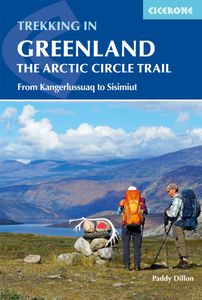
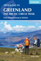
Wandelgids Groenland: Trekking in Greenland The Arctic Circle Trail |

0
Uitstekende wandelgids van dit geweldige gebied. goed beschreven met veel praktische informatie om de route te kunnen lopen, inclusief redelijke kaarten. A comprehensive guidebook for hiking the Arctic Circle Trail, which crosses the largest ice-free area of West Greenland, 25-30 miles north of the Arctic Circle. At just over 100 miles long, and ta...

Webshops met dit product

Webshop
Bezorging
Prijs

Anderen bekeken ook

Wandelgids Groenland: Trekking in Greenland The Arctic Circle Trail |
Uitstekende wandelgids van dit geweldige gebied. goed beschreven met veel praktische informatie om de route te kunnen lopen, inclusief redelijke kaarten. A comprehensive guidebook for hiking the Arctic Circle Trail, which crosses the largest ice-free area of West Greenland, 25-30 miles north of the Arctic Circle. At just over 100 miles long, and taking 7 to 10 days to complete, this splendid backpacking route runs from Kangerlussuaq to Sisimiut - both with airport access. At just over 100 miles long, and taking 7 to 10 days to complete, the Arctic Circle Trail crosses the largest ice-free patch of West Greenland. This splendid trekking route, lying 25-30 miles north of the Arctic Circle runs from Kangerlussuaq to Sisimiut (both of which have airport access).    The trail traverses remote, empty, silent and stunningly scenic arctic tundra, and is mostly gently graded with just a few short, steep and rocky slopes. However, the landscape between the two towns of Kangerlussuaq and Sisimiut…
23,95
Wandelgids Trekking The Kungsleden | Cicerone
Sweden's most famous long-distance trail, the Kungsleden (King's Trail) traverses the land of the Sámi people and the midnight sun, stretching 460km between Abisko and Hemavan. Around half the route lies within the Arctic Circle showcasing an ever-changing landscape of snowy mountains, deep glacial valleys, open fell, expansive lakes and verdant forest. The fully waymarked trail is comprised of five continuous and distinct sections: these can be walked individually or a thru-hike will take around a month. The guide also includes the popular Abisko to Nikkaluokta circuit, which can be completed in a week, and an ascent of Kebnekaise, Sweden's highest peak at 2098m. In addition to clear route description and mapping, you'll find a wealth of practical advice covering accommodation and facilities, equipment and resupply and detailed notes on how to get to and from the section start and finish-points. A Swedish and Fell Sámi glossary can be found in the appendix. Although there are plentif…
24,95
Wandelgids Walking and Trekking in Iceland - IJsland | Cicerone
Wandelgids met beschrijvingen, kaarten en praktische informatie zoals bussen, overnachten, etc. voor meerdaagse wandelroutes en dagwandeltochten op IJsland. A country of extraordinary beauty, Iceland’s incredible variety of volcanic and glacial landscapes makes it a unique destination for walking and trekking holidays. Its three national parks include the mighty Vatnajökull, largest national park in Europe.   The wide range of routes in this book introduce walkers and backpackers to this ‘Land of Ice and Fire’. There are 100 days of walking in this guidebook, stretching over 1722km, split between 49 day walks and 10 multi-stage treks. They climb mountains, cross glaciers, pass lakes and explore coastlines and geothermal areas, and range from easy nature trails to challenging treks. So, there is enough variation to satisfy all kinds of walkers. The routes are spread all around Iceland, grouped into twelve regions. Detailed information is given at the start of each route or trekking stag…
26,95
Wandelgids GR 70: The Robert Louis Stevenson Trail van Le Puy tot St-J
Uitstekende wandelgids van een gerenommeerde Engelse uitgever. De tochten zijn met zorg beschreven en voorzien van allerhande nuttige informatie. Met beperkt kaartmateriaal. Aanbevolen wandelkaarten bij deze gids 1:100.000 Wandelkaart GR 70 The Stevenson Trail | IGN - Institut Géographique National Als overzichtskaart Of Wegenkaart 156 Le Puy en Velay - Privas - Mende | IGN - Institut Géographique National Wegenkaart 163 Avignon - Nimes | IGN - Institut Géographique National  of 1:25.000 1. Wandelkaart - Topografische kaart 2835OT Le Puy-en-Velay | IGN - Institut Géographique National 2. Wandelkaart - Topografische kaart 2836OT Gerbier de Jonc | IGN - Institut Géographique National 3. Wandelkaart - Topografische kaart 2736SB Monistrol d'Allier, Solignac-sur-Loire, Cayres | IGN - Institut Géographique National 4. Wandelkaart - Topografische kaart 2737SB Langogne - Grandrieu | IGN - Institut Géographique National 5. Wandelkaart - Topografische kaart 2738SB Le Bleymard | IGN - Institut Gé…
23,95
Wandelgids Walking and Trekking in Iceland - IJsland | Cicerone
Wandelgids met beschrijvingen, kaarten en praktische informatie zoals bussen, overnachten, etc. voor meerdaagse wandelroutes en dagwandeltochten op IJsland. A country of extraordinary beauty, Iceland’s incredible variety of volcanic and glacial landscapes makes it a unique destination for walking and trekking holidays. Its three national parks include the mighty Vatnajökull, largest national park in Europe.   The wide range of routes in this book introduce walkers and backpackers to this ‘Land of Ice and Fire’. There are 100 days of walking in this guidebook, stretching over 1722km, split between 49 day walks and 10 multi-stage treks. They climb mountains, cross glaciers, pass lakes and explore coastlines and geothermal areas, and range from easy nature trails to challenging treks. So, there is enough variation to satisfy all kinds of walkers. The routes are spread all around Iceland, grouped into twelve regions. Detailed information is given at the start of each route or trekking stag…
26,95
Wandelgids Epic Hikes of the Americas | Lonely Planet
Lace up your hiking boots for the next in Lonely Planet's highly successful Epic Hikes series, this time exploring 50 of the Americas' most rewarding treks and trails. From Canada's longest hut-to-hut hike, the Sunshine Coast Trail, to a descent through Havasu Canyon in the USA, and the Santa Cruz Trail of northern Peru, we cover a huge variety of themes and experiences across routes that range from one-day walks to multi-day treks. Each of the featured hikes includes: First-person accounts from writers who have completed the hike Challenge level grading: easy / harder / epic Inspirational photography, maps and practical information to follow in the writer's footsteps Orientation toolkit: when is the best time of year to hike, how to get there, special equipment required Expert travel advice: where to stay, recommended tours, the best places to eat Suggestions for similar hikes 50 epic hikes across the Americas, including: The Chilkoot Trail, Alaska (USA) Joshua Tree Trail, C…
34,95
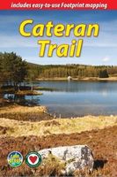
Wandelgids The Cateran Trail | Rucksack Readers
Uitgevoerd in de vorm van een klapper, met ringband geeft deze gids een goede beschrijving van de lange afstands route. De kaarten zijn schetsmatig maar wel duidelijk. The Cateran Trail is a circular walk of 64 miles (103 km) starting in Blairgowrie, near Perth, following in the footsteps of cattle-rustlers (caterans). This waymarked Trail follows ancient paths through glens, mountains and farmland of Highland Perthshire, with fine scenery, heritage and wildlife. The nearest village is never more than 7 miles (11 km) away, and gradients are easy to moderate. The Trail can be completed comfortably within 4-5 days, and there are options to link with the Rob Roy Way, and for a weekend Minitrail. This guidebook contains all a walker needs: - drop-down route map (scale 1:100,000) - detailed description of the official Trail - concise directions for related walks, including a weekend Minitrail - side-trips including Mount Blair (744 m/2440 ft) - planning information for transport and accommo…
20,95

Klanten-reviews van Wandelgids Groenland: Trekking in Greenland The Arctic Circle Trail |

Er zijn nog geen beoordelingen voor dit productBen jij de eerste die een review plaatst?

Meer over Wandelgids Groenland: Trekking in Greenland The Arctic Circle Trail |

Productomschrijving

Uitstekende wandelgids van dit geweldige gebied. goed beschreven met veel praktische informatie om de route te kunnen lopen, inclusief redelijke kaarten. A comprehensive guidebook for hiking the Arctic Circle Trail, which crosses the largest ice-free area of West Greenland, 25-30 miles north of the Arctic Circle. At just over 100 miles long, and taking 7 to 10 days to complete, this splendid backpacking route runs from Kangerlussuaq to Sisimiut - both with airport access. At just over 100 miles long, and taking 7 to 10 days to complete, the Arctic Circle Trail crosses the largest ice-free patch of West Greenland. This splendid trekking route, lying 25-30 miles north of the Arctic Circle runs from Kangerlussuaq to Sisimiut (both of which have airport access).    The trail traverses remote, empty, silent and stunningly scenic arctic tundra, and is mostly gently graded with just a few short, steep and rocky slopes. However, the landscape between the two towns of Kangerlussuaq and Sisimiut is extremely remote and those who choose to take on this route must be competely self-sufficient. The book includes plenty of practical information on what to take with you and when to go, as well as on safety, travel and accommodation.   Fully illustrated with a variety of photographs and its route is highlighted on continuous trekking maps. The guide also includes an optional extension to the Greenlandic ice cap.

Productspecificaties

Artikelnummer(s)
Brand
Cicerone
Webshop.nl maakt gebruik van cookies. Ga je verder op onze website, ga dan akkoord met het plaatsen van cookies en de verwerking van deze data door ons en vermelde partners.