webshop.nl
Categorieën
  Sluiten

Meer Cicerone
Meer Cicerone in Reisgidsen & talen boeken

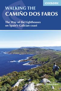
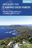
Wandelgids Camino dos Faros | Cicerone

0
Handzaam boekje met de routebeschrijving inclusief een heleboel praktische informatie. Uitstekende beschrijving en redelijke kaarten. This guidebook explores the Camiño dos Faros (the Way of the Lighthouses), a 200km hike around the remote northwest corner of Spain. Starting in the old whaling town of Malpica and ending in Fisterra (Spain's Land's ...

Webshops met dit product

Webshop
Bezorging
Prijs

Anderen bekeken ook

Wandelgids Camino dos Faros | Cicerone
Handzaam boekje met de routebeschrijving inclusief een heleboel praktische informatie. Uitstekende beschrijving en redelijke kaarten. This guidebook explores the Camiño dos Faros (the Way of the Lighthouses), a 200km hike around the remote northwest corner of Spain. Starting in the old whaling town of Malpica and ending in Fisterra (Spain's Land's End), the eight day hike along the Costa da Morte follows a path that sticks limpet-like to the Atlantic coast. It's a spectacular walk along dramatic cliffs and around deep, verdant river estuaries, exploring the rich Galician culture and history. With stages between 18 and 29km per day, this is a hike suitable for walkers willing to undertake reasonably long days and the occasional scramble up and down beach paths.   The guide provides in-depth descriptions of the route alongside clear mapping to aid navigation. It includes practical information for both before and during your trip, and details about wildlife and historic sites along the wa…
20,95
Wandelgids Portugal's Rota Vicentina | Cicerone
This guidebook follows the Rota Vicentina, a 224km walking route along the marvellous Atlantic coastline in the Alentejo and Algarve regions of Portugal. The 12-stage trek combines two well-marked routes, the Caminho Histórico (the Historical Way) and the Trilho dos Pescadores (the Fishermen's Trail), to create a hike starting in Santiago do Cacém and ending at Cabo de São Vicente. The guide also describes an alternative circular route for those who would prefer an 11-stage loop, moving inland from Odeceixe and back up to Santiago de Cacém. Whichever route is chosen, the Rota Vicentina is ideal for a two-week holiday in spring or late summer to autumn, offering walkers a remarkable range of landscapes from coastal fishing villages to wooded river valleys. The guidebook includes advice about accommodation options along the route, information about the surrounding area, and a glossary of Portuguese terms to aid with reading signs and maps. Along the Rota Vicentina are many delights for…
26,50
Wandelgids Wales: The Ceredigion and Snowdonia Coast Paths | Cicerone
As part of the Wales Coast Path, the Ceredigion Coast Path and Snowdonia Coast Path trace a curve of 233km (145 miles) of coastal and inland walking down Cardigan Bay. This guidebook describes a 16-stage guide to the walk from Porthmadog to St Dogmaels covering the trail between the Llyn Peninsula and the Pembrokeshire Coast Path. .In 16 day stages from Porthmadog to St Dogmaels, this guidebook offers all the information walkers need to complete the 233km (145 miles) section of the Wales Coast Path that curve down Cardigan Bay, passing through a range of contrasting landscapes.   Six days are spent on the Snowdonia Coast Path, two around the Dyfi Estuary, seven on the Ceredigion Coast Path and one from Cardigan to St Dogmaels.   Linking the Llyn Peninsula Coast Path with that of the Pembrokeshire Coastal Path, this section takes in Snowdonia National Park’s splendid coastal plains, leads inland through beautiful hill country around the Dyfi Estuary and follows some of the finest coastl…
18,50
Wandelgids The Peddars Way and Norfolk Coast Path | Cicerone
Uitstekende wandelgids van de Peddars Way en de Norfolk Coast Path, waarbij naast alle noodzakelijke informatie ook gebruik gemaakt wordt van de echte topografische kaart. The Peddars Way and Norfolk Coast Path National Trail is an easy-to-follow 130-mile trail that combines the best of inland and coastal walking in Norfolk, and one that, being well waymarked, largely flat and within easy reach of public transport for most of its length, is ideal for people new to long-distance walks.   Described here in 11 stages, the route can be walked in just over a week but also easily split into day walks or over a series of weekends, with full information about access to start and finish points for each stage by public transport. This handy guidebook is illustrated throughout with extracts of OS 1:50,000 mapping and stunning photographs depicting the Trail in all seasons and describes points of interest along the way, including the Nofolk Songlines sculptures, and also facilities available in th…
18,50
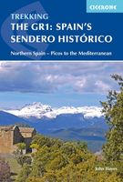
Wandelgids Spain's Sendero Historico: the GR1 | Cicerone
A step by step guide to walking the 1250km long Sendero Historico (the GR1) across northern Spain. Travelling from west to east, the GR1 starts at the Puerto de Tarna, on the border of Asturias and Castilla y Leon, heads east along the southern flank of the Cantabrian Mountains and the foothills of the Pyrenees before finishing on the Mediterranean coast near L'Escala. Arguably one of Spain's best long-distance paths, it follows gently graded paths, making a long but easy walk suitable for a reasonably fit walker. The complete trail requires around 53 days to complete end to end, but the guidebook splits the route into 7 sections, each with a start or endpoint that can be easily reached by train or bus, allowing walkers to explore the route in manageable chunks. The guidebook also describes how to extend the route to Finisterre and the Atlantic using GR routes. As well as extensive notes on the history of modern Spain, from medieval times to more recent events such as the Civil War, th…
26,50
Wandelgids The high mountains of Crete - Kreta | Cicerone
Guidebook to walking and trekking the high mountains of Crete. The largest of the Greek Islands, Crete's mountains provide breathtaking walking and wilderness to this popular island. The routes in this guidebook are graded for difficulty and range from short, easy strolls to challenging, multi-day treks and summit climbs, so there are options for walkers of all abilities.    All the mountain ranges of Crete feature high plains, gorges and ravines, but in the heart of the Lefka Ori there is something else. High above the treeline snow thaws by July to reveal a great circle of massive barren peaks, interspersed with ‘moonscape’ outcrops, or depressions, of sinkholes in black, grey or red rock. This high desert wilderness is seldom visited but covers some 960sqkm.   In central Crete, where the island is at its widest, the huge mass of Psiloritis (Mount Ida) dominates the whole region. Covering about 560sqkm this massif is different in that a single huge, partly scree-surfaced summit ridge…
26,50

Klanten-reviews van Wandelgids Camino dos Faros | Cicerone

Er zijn nog geen beoordelingen voor dit productBen jij de eerste die een review plaatst?

Meer over Wandelgids Camino dos Faros | Cicerone

Productomschrijving

Handzaam boekje met de routebeschrijving inclusief een heleboel praktische informatie. Uitstekende beschrijving en redelijke kaarten. This guidebook explores the Camiño dos Faros (the Way of the Lighthouses), a 200km hike around the remote northwest corner of Spain. Starting in the old whaling town of Malpica and ending in Fisterra (Spain's Land's End), the eight day hike along the Costa da Morte follows a path that sticks limpet-like to the Atlantic coast. It's a spectacular walk along dramatic cliffs and around deep, verdant river estuaries, exploring the rich Galician culture and history. With stages between 18 and 29km per day, this is a hike suitable for walkers willing to undertake reasonably long days and the occasional scramble up and down beach paths.   The guide provides in-depth descriptions of the route alongside clear mapping to aid navigation. It includes practical information for both before and during your trip, and details about wildlife and historic sites along the walk. In the back of the guide are a series of appendices listing accommodation, main Galician festivals, and useful contacts.   The Camiño dos Faros follows the wild coast of the Costa da Morte, which is battered by storms racing in from the Atlantic. For shipping it is one of the world's most dangerous coastlines and its ominous name meaning 'the coast of death' is well deserved. 'Dos Faros' refers to a series of beautifully located lighthouses that attempt to warn sailors of the perils that await them. The sea has shaped the landscape and the Galician culture, and the locally caught seafood including razor clams and percebes should not be missed.   Steden en Dorpen Malpica, Corme, Ponteceso, Laxe, Camelle, Arou, Camariñas, Muxía, Praia de Nemiña, Fisterra

Productspecificaties

Artikelnummer(s)
Brand
Cicerone

Verken gerelateerde categorieën

Webshop.nl maakt gebruik van cookies. Ga je verder op onze website, ga dan akkoord met het plaatsen van cookies en de verwerking van deze data door ons en vermelde partners.