webshop.nl
Categorieën
  Sluiten

Meer Cicerone
Meer Cicerone in Literatuur boeken

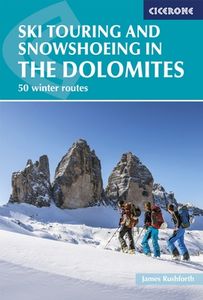
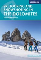
Sneeuwschoenwandelgids Ski Touring and Snowshoeing in the Dolomites -

0
Bijzondere gids van Cicerone: skitouren en sneeuwschoenwandelingen in de Dolomieten. Redelijk kaartmateriaal, goede beschrijvingen. Veel keuze in mogelijkheden van redlijke eenvoudige tot zware tochten.   Guidebook to 50 ski touring and snowshoeing routes in the Dolomites. The routes, which carry an Alpine (and when appropriate, a Volo/Toponeige) g...

Webshops met dit product

Webshop
Bezorging
Prijs

Anderen bekeken ook

Sneeuwschoenwandelgids Ski Touring and Snowshoeing in the Dolomites -
Bijzondere gids van Cicerone: skitouren en sneeuwschoenwandelingen in de Dolomieten. Redelijk kaartmateriaal, goede beschrijvingen. Veel keuze in mogelijkheden van redlijke eenvoudige tot zware tochten.   Guidebook to 50 ski touring and snowshoeing routes in the Dolomites. The routes, which carry an Alpine (and when appropriate, a Volo/Toponeige) grading, range from 5km to 18km, taking between 2 and 7 hours to complete. The routes are based in and around areas such as Canazei, Arabba, Corvara and San Martino, taking in stunning scenery, quaint villages and enchanting mountain vistas.   Clear route descriptions are accompanied by 1:50K mapping and photo topos, together with information such as total ascent and descent (as well as aspect), expected duration of route and equipment required. Also provided is invaluable practical advice on things such as mountain safety and navigation, equipment, transport options to, from and around the Dolomites, ski passes, accommodation and more.   Rega…
26,50
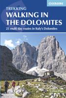
Wandelgids Walking in the Dolomites - Dolomieten | Cicerone
Uitstekende wandelgids van een gerenommeerde Engelse uitgever. De tochten zijn met zorg beschreven en voorzien van allerhande nuttige informatie. Guidebook to 25 multi day walks in the Dolomites mountains of northeast of Italy. The walks are mostly circular and 2 to 4 days long, and take in the Marmarole, Marmolada, Civet, Sella and Cortina Dolomites among others. Includes notes on accommodation, wildlife, transport, equipment, a glossary and other practical information. This guidebook describes 25 hut-to-hut treks in the Dolomites of northern Italy, covering 15 regions including Cortina, Sella, Sesto, Marmolada and Latemar. Ranging from 11.3km to 40.8km and from two to four days, the graded routes are suitable for walkers with a reasonable level of fitness and experience of mountain terrain, and some feature exposed sections which demand a good head for heights. They take advantage of the region's network of mountain refuges and efficient public transport system, with the majority of …
23,95
Wandelgids Walking The Munros Vol 1 Southern, Central and Western High
Uitstekende wandelgids van het zuiden, midden en westen van de Schotse Hooglanden. Goed beschreven met veel praktische informatie om de route te kunnen lopen, inclusief redelijke kaarten. Guidebook to walking the Munros in southern, central and western Highlands. Describes 69 challenging routes across 139 of the iconic 3000ft+ mountains covering areas such as Glencoe, Bridge of Orchy and Mull. Includes routes up Ben More, Ben Alder, Ben Lomond and Ben Nevis, the highest mountain in the British Isles. Volume 1 of two guidebooks.   Seasons The guide is intended for summer hillwalkers (usually April/May to October in Scotland). In winter conditions the routes become more serious mountaineering expeditions requiring appropriate skills, equipment and experience.   Centres Arrochar, Crianlarich, Killin, Pitlochry, Tyndrum, Glencoe, Fort William, Spean Bridge, Dalwhinnie, Braemar, Glenshee   Difficulty Most of the Munros are straightforward walks but some involve ridge walking, scr…
20,95
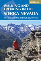
Wandelgids Walking and trekking in the Sierra Nevada | Cicerone
Uitstekende wandelgids voor de Sierra Nevada. Goed beschreven met veel praktische informatie om de route te kunnen lopen, inclusief redelijke kaarten. Aanbevolen wandelkaarten Wandelkaart NP Sierra Nevada met Alpujarras | Editorial Penibetica 1:40.000 of Wandelkaart Sierra Nevada en Alpujarras | Editorial Alpina - 1:40.000 Wandelkaart Sierra Nevada - la integral de los 3000 | Editorial Piolet 1:25.000   This guidebook presents 33 graded walks and 5 high mountain scrambles in the striking Sierra Nevada, the highest mountain range in mainland Spain and in western Europe outside the Alps. Easily accessible from Granada and Málaga, it is a world of soaring, snow-clad peaks and deep valleys, far removed from the crowded beaches of the Costa del Sol just two hours away. The routes are spread across the national park, with attractive towns and villages such as Trevélez, Lanjarón, Hoya de la Mora and Cumbres Verdes serving as potential bases for a walking holiday.   The walks have been careful…
20,95
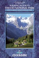
Wandelgids Walking in Italy's Stelvio National Park | Cicerone
Wandelgids voor de Stelvio Nationaal Park in de Rätische Alpen ( Alpi Retiche ) ten zuiden van de Splügenpas op de grens met het Zwitserse Graubünden. Engelstalige beschrijving van 38 dagwandelingen.   Aanbevolen wandelkaarten 1:25.000 voor deze gids Wandelkaart 008 Ortles - Cevedale - Ortlergebiet | Tabacco Editrice   Wandelkaart 045 Latsch - Martell - Schlanders- Laces - Val Martello - Silandro | Tabacco Editrice   Wandelkaart 048 Val di Peio - Val di Rabbi - Val di Sole | Tabacco Editrice   The wide range of 38 summer day walks in this guide explore the renowned Stelvio National Park in the Italian Rhaetian Alps. Bordering the Dolomites to the east, and Switzerland to the west, the Stelvio is one of the largest protected areas in all of the Alps. Its unspoilt landscape ranges from valley farmland to forested hillsides and alpine meadows, and up to a wilderness of rugged glaciated summits and ridges, the highest of which is Ortler, at 3905m.   The walks, a selection of routes from ea…
20,95
Wandelgids Peru - Hiking and Biking Peru's Inca Trails | Cicerone
The eastern slope of the Peruvian Andes is one of the most dramatic and diverse places on the planet, dropping from over 6000m (20,000ft) to just 200m above sea level. This dramatic drop in elevation produces a wide range of constantly changing climactic and vegetative zones – it is often possible to hike from the base of a glacier down to the jungle in just a day or two. Combined with the countless Inca sites and ubiquitous Inca roads, this makes the Sacred Valley one of the best trekking and mountain biking destinations in the world.    Machu Picchu is well known as one of the Seven Wonders of the World, and the Inca Trail trek that leads there is nearly as famous. What is less known, however, is the vast choice of other epic adventure trips that exist in the region – treks through soaring Andean glaciers and Incan ruins, bike rides through stunning alpine and jungle scenery. Nearly every route in this book uses an Inca road or visits an Inca ruin – and most do both. The majority of …
22,95
Wandelgids Trekking in the Stubaier Alps | Cicerone
Uitstekende wandelgids van Cicerone over de Stubaier Alpen, waarbij de nadruk ligt op een tweetal meerdaagse routes: Huttentochten voor een gemiddelde en wat meer gevorderde wandelaar. Goede praktische informatie, kaartmateriaal beperkt. Aanbevolen wandelkaarten bij deze gids Schaal 1:25.000 Wandelkaart 31/1 Alpenvereinskarte Stubaier Alpen - Hochstubai Wandelkaart 31/2 Alpenvereinskarte Stubaier Alpen - Sellrain Of schaal 1:50.000 Wandelkaart 83 Stubaier Alpen Kompass Of all the many Alpine areas, few can match the Stubai in the Austrian Tyrol as a venue for a first Alpine season. Shapely peaks, good paths and some of the best huts in the Alps make it ideal for the novice who wants to extend their experience beyond Britain. Of all the many Alpine areas, few can match the Stubai in the Austrian Tyrol as a venue for a first Alpine season. Shapely peaks, good paths and some of the best huts in the Alps make it ideal for the novice who wants to extend their experience beyond Britain. This…
21,95

Klanten-reviews van Sneeuwschoenwandelgids Ski Touring and Snowshoeing in the Dolomites -

Er zijn nog geen beoordelingen voor dit productBen jij de eerste die een review plaatst?

Meer over Sneeuwschoenwandelgids Ski Touring and Snowshoeing in the Dolomites -

Productomschrijving

Bijzondere gids van Cicerone: skitouren en sneeuwschoenwandelingen in de Dolomieten. Redelijk kaartmateriaal, goede beschrijvingen. Veel keuze in mogelijkheden van redlijke eenvoudige tot zware tochten.   Guidebook to 50 ski touring and snowshoeing routes in the Dolomites. The routes, which carry an Alpine (and when appropriate, a Volo/Toponeige) grading, range from 5km to 18km, taking between 2 and 7 hours to complete. The routes are based in and around areas such as Canazei, Arabba, Corvara and San Martino, taking in stunning scenery, quaint villages and enchanting mountain vistas.   Clear route descriptions are accompanied by 1:50K mapping and photo topos, together with information such as total ascent and descent (as well as aspect), expected duration of route and equipment required. Also provided is invaluable practical advice on things such as mountain safety and navigation, equipment, transport options to, from and around the Dolomites, ski passes, accommodation and more.   Regarded as one of the most beautiful mountain ranges in the world, the Dolomites offer endless winter escapades. Those who venture off the beaten track and into the backcountry (whether by ski or by shoe) will discover a veritable winter wonderland.

Productspecificaties

Artikelnummer(s)
Brand
Cicerone

Verken gerelateerde categorieën

Webshop.nl maakt gebruik van cookies. Ga je verder op onze website, ga dan akkoord met het plaatsen van cookies en de verwerking van deze data door ons en vermelde partners.