webshop.nl
Categorieën
  Sluiten

Meer Ordnance Survey
Meer Ordnance Survey in Elektra

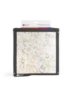
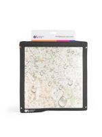
Kaartentas Waterproof Map Case | Ordnance Survey

0
Our map cases are the perfect companion for your maps and other navigation aids. The case is made from a durable nylon fabric with a double sided touch friendly window, making viewing and protecting your maps & paperwork a doddle.   It’s waterproof up to 10 metres for 30 minutes, meaning it easily prevents water, sand, and dirt from getting in. Ins...

Webshops met dit product

Webshop
Bezorging
Prijs

Anderen bekeken ook

Kaartentas Waterproof Map Case | Ordnance Survey
Our map cases are the perfect companion for your maps and other navigation aids. The case is made from a durable nylon fabric with a double sided touch friendly window, making viewing and protecting your maps & paperwork a doddle.   It’s waterproof up to 10 metres for 30 minutes, meaning it easily prevents water, sand, and dirt from getting in. Insert your belongings into the case and have peace of mind knowing that they’re safe and secure. The four lash points mean it can be easily worn around your neck with a lanyard or secured to your gear.   Inside the border dimensions are 28x28cm / 11x11 inches. Total product dimensions 33x33cm.   Waterproof fabric with welded seems Zip lock plus hoop and double closure seal Waterproof up to 10 metres for 30 minutes Crystal clear touch friendly window, can easily be used with a tablet Ideal for OS maps prints, tickets and other valuables
39,95
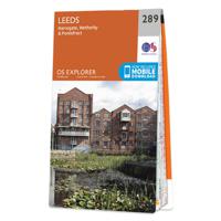
Wandelkaart - Topografische kaart 289 OS Explorer Map Leeds | Ordnance
Met zijn 4cm voor 1 km (2 ½ cm voor 1 mijl) schaal, is de OS Explorer kaartenserie de ideale en meest gedetailleerde kaartenreeks voor mensen die graag outdoor-activiteiten zoals fietsen, wandelen, paardrijden, klimmen en watersporten. Deze kaart is nog gedetailleerder dan de 'gewone' Landranger maps. Voor- en achterzijde bedrukt! Zeker op de moors en andere natuurgebieden van onschatbare waarden met echt alle aspecten van het landschap op de kaart ingetekend. Zeer goede detailkaart met topografische ondergrond. Hierop zijn toeristische symbolen van bezienswaardigheden ingetekend, daarnaast staan bijvoorbeeld campings en jeugdherbergen vermeld en - voor wandelaars het belangrijkst - alle right of way paden en Lange afstands Wandelpaden zijn er op te vinden. De ideale kaart voor het wandelen in Engeland, Wales of Schotland.   These highly detailed maps show all the administrative boundaries, settlements as small as isolated farms, the road network down to unfenced roads and country trac…
19,50
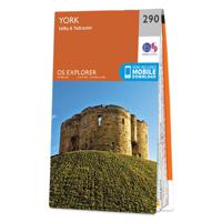
Wandelkaart - Topografische kaart 290 OS Explorer Map York | Ordnance
Met zijn 4cm voor 1 km (2 ½ cm voor 1 mijl) schaal, is de OS Explorer kaartenserie de ideale en meest gedetailleerde kaartenreeks voor mensen die graag outdoor-activiteiten zoals fietsen, wandelen, paardrijden, klimmen en watersporten. Deze kaart is nog gedetailleerder dan de 'gewone' Landranger maps. Voor- en achterzijde bedrukt! Zeker op de moors en andere natuurgebieden van onschatbare waarden met echt alle aspecten van het landschap op de kaart ingetekend. Zeer goede detailkaart met topografische ondergrond. Hierop zijn toeristische symbolen van bezienswaardigheden ingetekend, daarnaast staan bijvoorbeeld campings en jeugdherbergen vermeld en - voor wandelaars het belangrijkst - alle right of way paden en Lange afstands Wandelpaden zijn er op te vinden. De ideale kaart voor het wandelen in Engeland, Wales of Schotland.   These highly detailed maps show all the administrative boundaries, settlements as small as isolated farms, the road network down to unfenced roads and country trac…
19,50
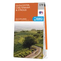
Wandelkaart - Topografische kaart 179 OS Explorer Map Gloucester, Chel
The essential map for outdoor activities in Gloucester, Cheltenham and Stroud. The OS Explorer Map is the Ordnance Survey's most detailed folding map and is recommended for anyone enjoying outdoor activities including walking, horse riding and off-road cycling. This map now comes with a digital version which you can download to your smartphone or tablet.Providing complete GB coverage, the OS Explorer map series details information essential in the great outdoors, including youth hostels, pubs and visitor information. Rights of way, fences, permissive paths and bridleways are clearly shown, ensuring you have the best information to get the most out of your time in the countryside. FeaturesCotswold Way Severn Way Gloucestershire Way Macmillan Way Wysis WayCotswold Way (National Trail) GloucesterCheltenhamGloucester Stroud1:25 000 scale (4 cm to 1 km - 2.5 inches to 1 mile) Met zijn 4cm voor 1 km (2 ½ cm voor 1 mijl) schaal, is de OS Explorer kaartenserie de ideale en meest gedetailleerde…
19,50
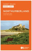
Wandelgids Northumberland | Ordnance Survey
Explore the castles and coast of Northumberland from Dunstanburgh to Hadrian’s Wall with ten walks suitable for all ages and abilities. Discover England’s most northerly county from the North Sea coast to the North Pennines on hand-picked, leisurely rambles for the whole family.   Northumberland Short Walks Made Easy include:   - Circle dramatic Bamburgh Castle, looking out to the Farne Islands from wildlife-rich dunes, and see the grave of lifeboat heroine Grace Darling - Enjoy the tranquility of secluded Wooler Common with its wealth of wildlife and ancient remains on the edge of the Cheviots - Start at picturesque Craster and follow the coast path to Dunstanburgh Castle, a rugged ruin perched on a rocky, wave-battered headland - Ramble the shores of Kielder Water, spot nesting ospreys and stumble upon the fascinating artworks in the forest - Follow Hadrian’s Wall from Cawfields near Haltwhistle to see the iconic Roman structure close up, with stunning views in both directions - Stro…
10,95
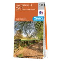
Wandelkaart - Topografische kaart 181 OS Explorer Map Chiltern Hills N
The essential map for outdoor activities in Chiltern Hills North. The OS Explorer Map is the Ordnance Survey's most detailed folding map and is recommended for anyone enjoying outdoor activities including walking, horse riding and off-road cycling. This map now comes with a digital version which you can download to your smartphone or tablet.Providing complete GB coverage, the OS Explorer map series details information essential in the great outdoors, including youth hostels, pubs and visitor information. Rights of way, fences, permissive paths and bridleways are clearly shown, ensuring you have the best information to get the most out of your time in the countryside. FeaturesIcknield Way RidgewayNorth Buckinghamshire Way Icknield Way PathSwan's Way Two Ridges Link Aylesbury RingSouth Bucks Way Chess Valley Walk Chiltern Link Thame Valley WalkGrand Union Canal Walk Midshires Way Bledlow Circular Ride Hertfordshire Way Chiltern WayRidgeway (National Trail) Bedfordshire Buckinghamshire He…
19,50

Klanten-reviews van Kaartentas Waterproof Map Case | Ordnance Survey

Er zijn nog geen beoordelingen voor dit productBen jij de eerste die een review plaatst?

Meer over Kaartentas Waterproof Map Case | Ordnance Survey

Productomschrijving

Our map cases are the perfect companion for your maps and other navigation aids. The case is made from a durable nylon fabric with a double sided touch friendly window, making viewing and protecting your maps & paperwork a doddle.   It’s waterproof up to 10 metres for 30 minutes, meaning it easily prevents water, sand, and dirt from getting in. Insert your belongings into the case and have peace of mind knowing that they’re safe and secure. The four lash points mean it can be easily worn around your neck with a lanyard or secured to your gear.   Inside the border dimensions are 28x28cm / 11x11 inches. Total product dimensions 33x33cm.   Waterproof fabric with welded seems Zip lock plus hoop and double closure seal Waterproof up to 10 metres for 30 minutes Crystal clear touch friendly window, can easily be used with a tablet Ideal for OS maps prints, tickets and other valuables

Productspecificaties

Artikelnummer(s)
Brand
Ordnance Survey

Verken gerelateerde categorieën

Webshop.nl maakt gebruik van cookies. Ga je verder op onze website, ga dan akkoord met het plaatsen van cookies en de verwerking van deze data door ons en vermelde partners.