webshop.nl
Categorieën
  Sluiten

Wandelgids The Cathar Way | Cicerone

Guidebook to the GR367 Cathar Way (Sentier Cathare) in the Languedoc region of southern France. The 260km waymarked trail from Port la Nouvelle on the Mediterranean to Foix traces the history of the Cathars through the Eastern foothills of the Pyrenees. Split into 13 stages and offering a northern variant, the route takes about 2 weeks to complete....
22,95

Webshops met dit product

Webshop
Bezorging
Prijs

Anderen bekeken ook

Wandelgids Walking in the Thames Valley | Cicerone
Walking in the Thames Valley offers 25 challenging circular walks around the River Thames and River Kennet in the south of England, taking in the Southern Chilterns, the Berkshire and North Hampshire Downs, Southern Oxfordshire and the eastern edge of Wiltshire. All routes are within easy reach of Reading, Newbury, Abingdon and London. While some walks visit Iron Age hill forts, others pass more modern features such as Wilton Windmill and the Kennet and Avon Canal. Some follow sections of the Ridgeway, while others meander along the banks of the Thames. What they all have in common is that they take the keen rambler to some of the best parts of the Thames Valley – a patchwork of open chalk grassland, broadleaved woodland and farmland and home to two Areas of Outstanding Natural Beauty. • walks from 10 to 18 miles, including one 2-day route • shorter, less strenuous alternatives for many of the walks • detailed route descriptions with information on local points of interest, OS mapping …
18,50
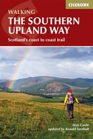
Wandelgids The Southern Upland Way | Cicerone
Uitstekende wandelgids van de Southern Upland Way, waarbij naast alle noodzakelijke informatie ook gebruik gemaakt wordt van de echte topografische kaart.   The Southern Upland Way is Scotland's coast-to-coast walk and the longest of the nation's Great Trails. 215 miles long, it links the pretty harbour village of Portpatrick on the west coast with Cockburnspath, a little south of Dunbar, in the east. The walk is at times a strenuous one, crossing the remote high moorland of the Galloway Hills, Carsphairn range, Lowthers, Ettrick Hills and Lammermuirs, calling for competence, fitness and self-reliance.    This guide presents advice on how best to plan and tackle this challenging but highly rewarding journey. The waymarked trail is presented in fourteen stages of 9–19 miles and suggestions for a rest day exploring Moffat and its environs are also included. It is possible either to backpack, taking advantage of five bothies and unlimited wild camping possibilities, or to stay in towns…
20,95
Wandelgids The Cotswold Way | Cicerone
Uitstekende wandelgids van de Cotswolds Way, waarbij naast alle noodzakelijke informatie ook gebruik gemaakt wordt van de echte topografische kaart. inclusief gidsje met routekaarten van 1:25000 (deze is hier ook los te bestellen) Guidebook to walking the 102 mile (163km) Cotswold Way National Trail between Chipping Campden and Bath, across the Cotswolds AONB. The guidebook - which includes both a guide to the route and a separate OS 1:25,000 map booklet - describes the route in both directions.   The route is described over 13 stages, each following the Cotswold escarpment, with dramatic and far-reaching views across the Severn Vale towards the Welsh hills, plunging down to visit honey-coloured villages, old market towns and the elegant and historic city of Bath. The longest of the 13 stages is 10 miles, the shortest 6 miles: these are dictated by the existence of overnight accommodation. For the determined, the trail can be walked in as little as five days.   The Cotswold Way offers …
23,50
Wandelgids Walking in the Auvergne | Cicerone
Uitgebreide wandelgids van de Auvergne: goede beschrijvingen, veel keuze, kaarten wat minder goed. This handy guidebook offers the finest day walks in five different areas of the Auvergne, an often-forgotten region in central France perfect for accessible day walking in a unique and spectacular landscape. Towns such as Vichy, Clermont-Ferrand and Puy-en-Velay also offer delightful places to base yourself for that perfect walking holiday. The ridges, rocky peaks and verdant valleys of the Cantal supervolcano dominate south-western Auvergne. The centre of the region hosts the unique chain of 'puys' with their pudding bowl forms and the pristine crater lakes of the Sancy massif. In the north, the Montagne Bourbonnaise preserves a pastoral way of life which is quintessentially French while the Haute Loire's rivers and medieval abbeys reward those venturing further off the beaten track. Notes on the geology and history of points of interest passed en route help you to get the most out of yo…
19,95
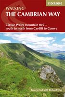
Wandelgids The Cambrian Way | Cicerone
Uitstekende wandelgids van de Cambrian Way, waarbij naast alle noodzakelijke informatie ook gebruik gemaakt wordt van de echte topografische kaart.  Dubbed 'the mountain connoisseurs' walk', the Cambrian Way stretches 479km between the mighty castles of Cardiff in the south and Conwy on the north coast. Traversing the heartland of Wales, the challenging route crosses the Brecon Beacons, the Cambrian Mountains and Snowdonia, passing through two national parks and visiting many of the country's iconic summits, including Pen y Fan, Pumlumon, Cadair Idris and Snowdon itself. It can be walked in three weeks (or in shorter sections) and is suitable for experienced hillwalkers with sound navigational skills.   The guide presents the route in 21 stages, offering comprehensive route description illustrated with OS 1:50,000 mapping and elevation profiles. Details of accommodation and facilities are provided, along with a helpful trek planner showing their distribution along the route: although t…
20,95
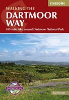
Wandelgids Walking the Dartmoor Way | Cicerone
This guidebook presents the Dartmoor Way, a 175km (109 mile) walk around Dartmoor National Park in Devon. Walked in 10 day-long stages between 12.75 and 20.5km (8 and 12.75 miles) in length, this waymarked route skirts the edge of England's largest granite moorland, passing through towns including Ivybridge, Ashburton, Okehampton and Tavistock. Also included is the 2-day High Moor Link, which crosses the moor's higher ground.   With 1:50,000 scale OS maps for each stage, the book includes notes on nature, history and local landmarks such as Haytor Rocks, the Teign gorge and Dewerstone crags. Taking in ancient paths, tracks and quiet lanes, the route is mostly at low level and is suitable for most walkers, although some stages involve short, steep climbs and descents. Accommodation, parking and public transport are covered, allowing walkers to choose whether to tackle the route in one go or as individual day walks.   Each stage includes low-level detours in case of bad weather, as well …
23,95
Wandelgids Walking in Provence - East | Cicerone
This guide offers 30 circular day walks in the eastern half of Provence, the large sun-kissed coastal region of south-east France. Spanning from the red rocks in the Ésterel on the Mediterranean to high mountains inland, the walks are set in the areas of the Alpes Maritimes, the Alpes de Haute-Provence and the Mercantour. Provence’s sunshine and Mediterranean charm attract many visitors to its coast, yet the area also has much more to offer the walker. The countryside inland boasts a range of scenery from remote mountaintops to spectacular gorges. History is everywhere, in medieval villages, arcaded streets, abbeys, churches and castles.    This guide covers the eastern regions, with its companion volume, Walking in Provence: West, covering the rest of this fascinating and historic landscape. The walking is incredibly diverse, and explores the country that hugs the Côte d'Azur and Italian border. The Alpes Maritimes rise craggy and wild above towns as unique as Grasse, Cannes and Monac…
21,95
Wandelgids The GR5 Trail Vosges and Jura | Cicerone
Uitstekende wandelgids van dit geweldige gebied. goed beschreven met veel praktische informatie om de route te kunnen lopen, inclusief redelijke kaarten. This guidebook describes a long-distance walking route through the delightful Vosges and Jura. Situated in France near the eastern border, the three regional parks of the Ballons des Vosges, Northern Vosges and Jura Mountains boast verdant forests, striking rock features and low rounded summits offering spectacular views. Yet, in spite of their extensive network of well-maintained paths, they are not high profile tourist destinations. This walk offers a chance to uncover the hidden secrets of this fascinating area, from its rich wildlife to ancient ruins. Starting in Wissembourg at the northeastern tip of France, the route follows the GR53 southwest to Schirmeck, before picking up the central section of the much-celebrated GR5 (which runs from the Hook of Holland to Nice) between Schirmeck and Nyon on Lake Geneva. The scenery is as va…
23,95
Wandelgids Walks and Scrambles in the Moroccan Anti-Atlas - Marokko | Cicerone
Uitstekende wandelgids van dit geweldige gebied. goed beschreven met veel praktische informatie om de route te kunnen lopen, inclusief redelijke kaarten. The walks and scrambles in this guidebook explore the wild and rugged landscapes of the Anti-Atlas mountains of southern Morocco, with Tafraout and the Ameln Valley as the main base. 41 adventurous routes of between 3 and 40km include Jebel el Kest, Adra Mkorn and Ait Mansour, with an outline of a 1 week long-distance trek across the north-west Anti-Atlas. Walks are mainly moderate to difficult, and scrambles are Grade 1 to Grade 3+, with ropes being required for some sections. Often remote and challenging, the routes are suitable for confident walkers and scramblers with good navigation skills. Each route description is accompanied by mapping, with some photo topos to aid route finding in tricky sections. The guidebook also gives background information on the people, culture and history of the region, as well as a wealth of advice o…
24,95
Wandelgids Snowdonia Way | Cicerone
Een beschrijving van de Snowdonia Way, goede beschrijving met gedetailleerd kaartmateriaal..Ook praktische informatie en hoogteprofielen per etappe.   This guidebook describes the Snowdonia Way in Wales, a long-distance route through Snowdonia National Park from Machynlleth to Conwy. A low-level route of 97 miles (in 6 stages of between 13 and 21 miles) passes through the heart of Snowdonia’s stunning mountain scenery and includes Pass of Aberglaslyn, Ogwen Valley and Aber Falls. It is suitable for walkers of average fitness and stamina, though days are long. An alternative mountain route covers 122 miles in 9 stages of 12–18 miles giving a spectacular journey over the most famous peaks such as Cadair Idris, Snowdon and Glyders. The high-level route is more physically challenging and requires good navigation skills. Full route descriptions for each stage are accompanied by OS maps and profiles. The guide also includes lists of accommodation and transport providers and a table of facili…
20,95

Klanten-reviews van Wandelgids The Cathar Way | Cicerone

Er zijn nog geen beoordelingen voor dit productBen jij de eerste die een review plaatst?

Meer over Wandelgids The Cathar Way | Cicerone

Productomschrijving

Guidebook to the GR367 Cathar Way (Sentier Cathare) in the Languedoc region of southern France. The 260km waymarked trail from Port la Nouvelle on the Mediterranean to Foix traces the history of the Cathars through the Eastern foothills of the Pyrenees. Split into 13 stages and offering a northern variant, the route takes about 2 weeks to complete. Two of the southernmost départements of France, the Pyrénées-Orientales and Ariège are inextricably linked with the history of the Cathars, a heretical Christian sect who were subjected to a crusade in the thirteenth century. Striking castles built on jagged rocky precipices are a highlight of the region and a reminder of those turbulent times. This guidebook describes the 260km Cathar Way (Sentier Cathare or GR367), a long-distance trail from Port-la-Nouvelle on the Mediterranean coast to Ariége's departmental capital Foix linking several of the impressive Cathar castles. The route follows ancient footpaths, jeep tracks and country lanes and calls for a moderate level of fitness as it sweeps from sea level to 1300m across the rugged hill ranges of the Corbières and Fenouillèdes.   The guide describes the main route in 13 stages and also includes the slightly more direct north variant, as well as suggestions for shorter itineraries. Summary statistics introduce each day's walking and are followed by step-by-step route description illustrated with clear mapping. There are also details of facilities available en route and accommodation listings. An introduction covers all the practicalities, with comprehensive advice for planning your trip - including when to go, how to get there and what to take - in addition to a wealth of information about the region's fascinating history and the intriguing Cathars themselves.   The trail traverses rocky hills and meanders through woodland, vineyards, ancient villages, gorges and plateaus. As well as the rich Cathar heritage, there are also historic wine-producing towns, sites associated with the French Resistance of WWII and mysterious places steeped in ancient legend. The guide is a perfect companion to discovering the Cathar Way and the captivating stories of this distinctive region.
Webshop.nl maakt gebruik van cookies. Ga je verder op onze website, ga dan akkoord met het plaatsen van cookies en de verwerking van deze data door ons en vermelde partners.